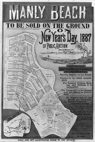
Image: StateLibQld 1 130843 Estate map of Manly Beach, Manly,1887

Size of this preview: 405 × 600 pixels. Other resolutions: 162 × 240 pixels | 675 × 1,000 pixels.
Original image (675 × 1,000 pixels, file size: 119 KB, MIME type: image/jpeg)
Description: Estate map of Manly Beach, Manly,1887. Map shows a plan of all blocks for sale in the Manly Estate, bounded by Gordon Parade, Mountjoy Terrace, The Espalande, Ernest Street and Spring Street. The auction was for New Year's Day 1887 and the auctioneers were Arthur Martin & Co. Many blocks front on to Moreton Bay and Waterloo Bay.
Title: StateLibQld 1 130843 Estate map of Manly Beach, Manly,1887
Credit: Item is held by John Oxley Library, State Library of Queensland.
Usage Terms: Public domain
License: Public domain
Attribution Required?: No
Image usage
The following page links to this image:

All content from Kiddle encyclopedia articles (including the article images and facts) can be freely used under Attribution-ShareAlike license, unless stated otherwise.
