
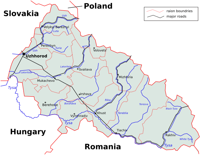
Image: Subcarpathia Ukraine districts en

Description: Map of the Subcarpathian Region (Zakarpatska oblast) with districts' borders, rivers and main roads. Based on different printed maps. The source code of this SVG is valid. This vector image was created with Inkscape, and then manually edited.
Title: Subcarpathia Ukraine districts en
Credit: Based off Image:Subcarpathia Ukraine districts.svg map.
Author: DDima, based off map by PM.
Permission: This work has been released into the public domain by its author, DDima. This applies worldwide. In some countries this may not be legally possible; if so: DDima grants anyone the right to use this work for any purpose, without any conditions, unless such conditions are required by law.
Usage Terms: Public domain
License: Public domain
Attribution Required?: No
Image usage
The following page links to this image:
