
Image: Sunda strait map v3
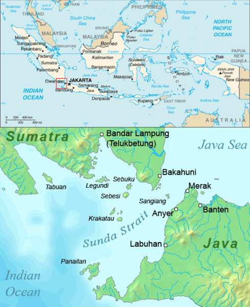
Description: Map of the Sunda Strait, Indonesia.
Title: Sunda strait map v3
Credit: Combination of CIA World Factbook map and Demis Map Server (http://www2.demis.nl/mapserver/mapper.asp) data with additional annotations and modifications by self.
Author: ChrisO
Permission: This image is in the public domain because it contains materials that originally came from the United States Central Intelligence Agency's World Factbook. Беларуская (тарашкевіца) | বাংলা | Čeština | Deutsch | Zazaki | English | Esperanto | Español | Eesti | Suomi | Français | Hrvatski | Italiano | 日本語 | ქართული | 한국어 | Македонски | മലയാളം | Nederlands | Norsk nynorsk | Polski | Português | Русский | Sicilianu | Slovenščina | Српски / srpski | தமிழ் | Türkçe | Українська | 中文 | 中文(简体) | 中文(繁體) | +/− This image is in the public domain because it came from the site http://www.demis.nl/home/pages/Gallery/examples.htm and was released by the copyright holder. Permission is granted to copy, distribute and/or modify this map since it is based on free of copyright images from: www.demis.nl. See also approval email on de.wp and its clarification. Deutsch | English | Nederlands | slovenščina | +/− This work has been released into the public domain by its author, www.demis.nl. This applies worldwide. In some countries this may not be legally possible; if so: www.demis.nl grants anyone the right to use this work for any purpose, without any conditions, unless such conditions are required by law.
Usage Terms: Public domain
License: Public domain
Attribution Required?: No
Image usage
The following page links to this image:
