
Image: TULSE HILL WARD - PARISH MAP, TULSE HILL
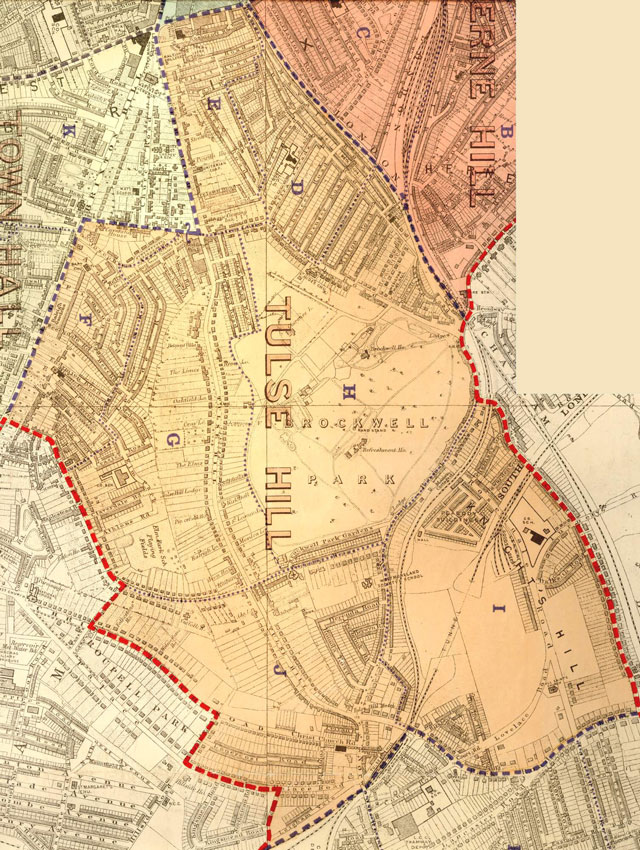
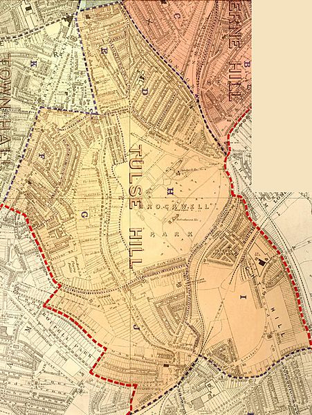
Description: At the centre of the Tulse Hill ward lies Brockwell Park which was purchased by the London County Council in 1891, and opened in June 1892. The two roads, Tulse Hill and Upper Tulse Hill, linked Brixton Hill with Norwood Road. They were developed as parish highways in 1822 , but the detached villas lining these roads are now replaced by large housing estates and hardly any of them have survived. Ribbon development along some of the other roads, like Norwood Road, remains almost unchanged. The Peabody Buildings on the right replaced Thompson's brickfields, one of the two large brickfields in the area. At the bottom left corner lies Roupell Park Estate, on land purchased and developed by John and Richard Palmer Roupell between 1810 and 1843. Extracts from the map of the Metropolitan Borough of Lambeth showing the wards, parliamentary divisions and subdivisions into poling districts, 1918.
Title: TULSE HILL WARD - PARISH MAP, TULSE HILL
Credit: https://boroughphotos.org/lambeth/tulse-hill-ward-parish-map-tulse-hill/
Author: Metropolitan Borough of Lambeth
Usage Terms: Public domain
License: Public domain
Attribution Required?: No
Image usage
The following page links to this image:
