
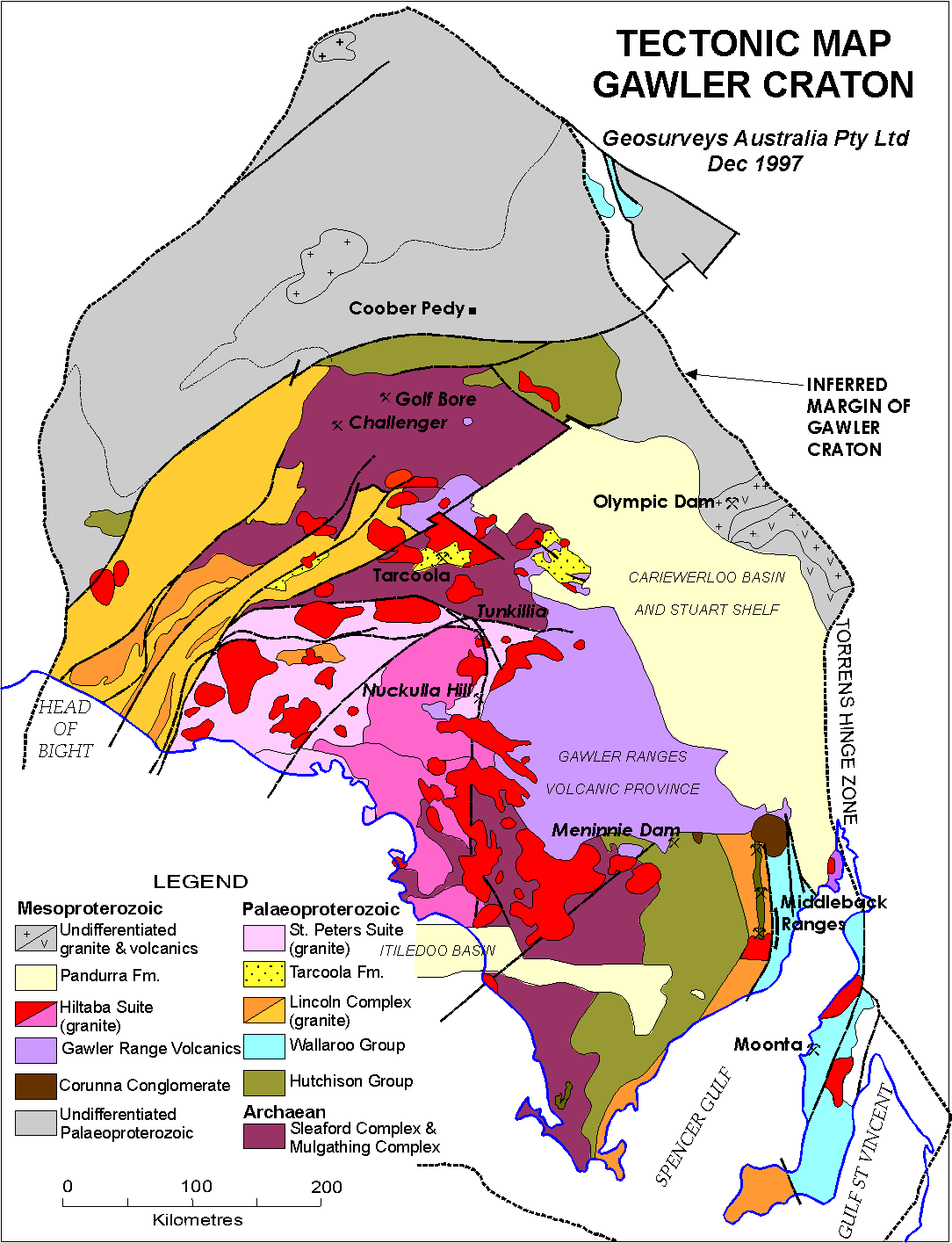
Image: Tectonic Map of Grawler Craton
Size of this preview: 459 × 599 pixels. Other resolutions: 184 × 240 pixels | 1,084 × 1,415 pixels.
Original image (1,084 × 1,415 pixels, file size: 70 KB, MIME type: image/gif)
Description: Tectonic Map of Gawler Craton
Title: Tectonic Map of Grawler Craton
Credit: http://www.users.on.net/~geosurveys/gawler3.htm Geosurveys Australia Pty Ltd
Author: Geosurveys Australia Pty Ltd
Permission: "Please feel free to copy and use this brief review of the Gawler Craton and the following map generated by Geosurveys Australia Pty Ltd."
Usage Terms: Copyrighted free use
License: Copyrighted free use
License Link: //commons.wikimedia.org/wiki/File:Tectonic_Map_of_Grawler_Craton.gif
Image usage
The following page links to this image:

All content from Kiddle encyclopedia articles (including the article images and facts) can be freely used under Attribution-ShareAlike license, unless stated otherwise.