
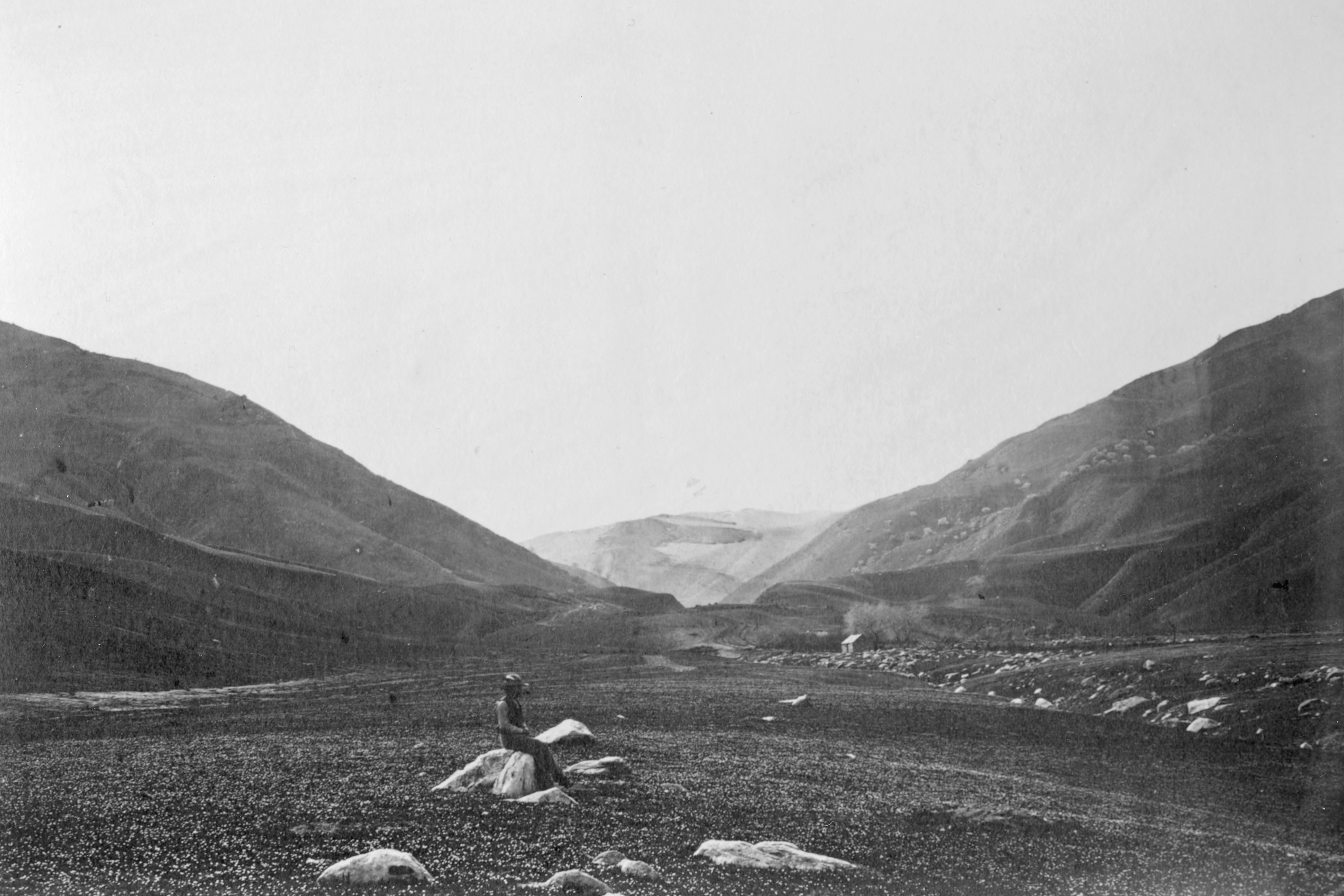
Image: Tejon Pass, 1868
Description: Canada de las Uvas, or Tejon Pass in Sierra Nevada, California, 1690 miles west of Missouri River. Image Description The Canada de las Uvas, or 'Canyon of the Grapes' - named after the canyon's native grapevines (Vitus californica). Location: At canyon landform between the Tehachapi Mountains (left—southeast) and San Emigdio Mountains (right—northwest), in Southern California, circa 1868. (Not in the in Sierra Nevada range, per 1868 title. ) View: To southwest, from the southwestern San Joaquin Valley floor towards Tejon Pass (on present day Interstate 5), and Fort Tejon. Gardner Series This is plate 106 - in a series of views by Alexander Gardner made in 1867 and 1868 starting in St. Louis, Missouri through Kansas, Colorado, New Mexico, and Arizona to San Francisco, California. Series made for the Union Pacific Railroad, Eastern Division later renamed the Kansas Pacific Railroad. Gardner accompanied the survey party seeking the best southern route for the railroad going through Kansas along the old Santa Fe Trail south to Albuquerque, then west along the 35th parallel to the Tehachapi Pass before heading north to San Francisco. The series is significant as the earliest comprehensive U.S. western landscape survey. Included are photographs of towns, buildings, soldiers, Native Americans, other people, forts, vegetation, geological formations, rivers, plains, mountain ranges, and railroad construction. Physical Description 1 photographic print: albumen; 15 x 20.3 cm. on 30.3 x 45.7 cm. mount
Title: Tejon Pass, 1868
Credit: DeGolyer Library, Southern Methodist University [1]
Author: Gardner, Alexander, 1821-1882
Usage Terms: Public domain
License: Public domain
Attribution Required?: No
Image usage
The following page links to this image:
