
Image: The Protestant Reformation

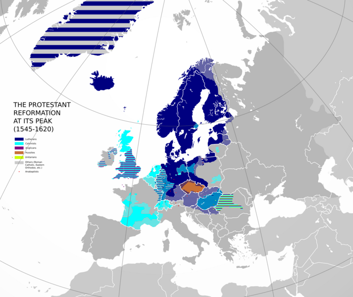
Description: This map was made to spread awareness of how complex the Protestant Reformation really was. This map shows the spread of Protestantism in its various forms at the high point of the Protestant Reformation. In 1545, it was first considered a serious threat to the Catholic Church and the Papacy at the Council of Trent, prompting counterreformational measures by Catholic religious hierarchy. In 1620, the Battle of White Mountain put an end to Protestantism in Bohemia (now the Czech Republic). The Thirty Years' War began in 1618 and brought a drastic territorial and demographic decline when the House of Habsburg introduced counterreformational measures throughout their vast possessions in Central Europe. This map is only appromixate and inaccuracies may occur, especially in Germany (where religious situation was so complex it is nearly impossible to put it on a map without a significant effort). It is based on various other religious maps depicting individual countries in Europe during 1545-1620. Superimposed on modern borders. Additional note: This map could be more detailed but it is not for good reasons. Arminianism, Baptists, Quakers and some other English dissenters that deviate much from Calvinism are excluded due to either problems with recognition (i.e. Arminianism is claimed by some to be only a soteriological diversification of Calvinism) or complicated distribution. Also, I decided to keep it the way it is to keep only the basic and necessary information and to avoid redundancy and overdetail.
Title: The Protestant Reformation
Credit: Own work
Author: Ernio48
Usage Terms: Creative Commons Attribution-Share Alike 4.0
License: CC BY-SA 4.0
License Link: https://creativecommons.org/licenses/by-sa/4.0
Attribution Required?: Yes
Image usage
The following page links to this image:
