
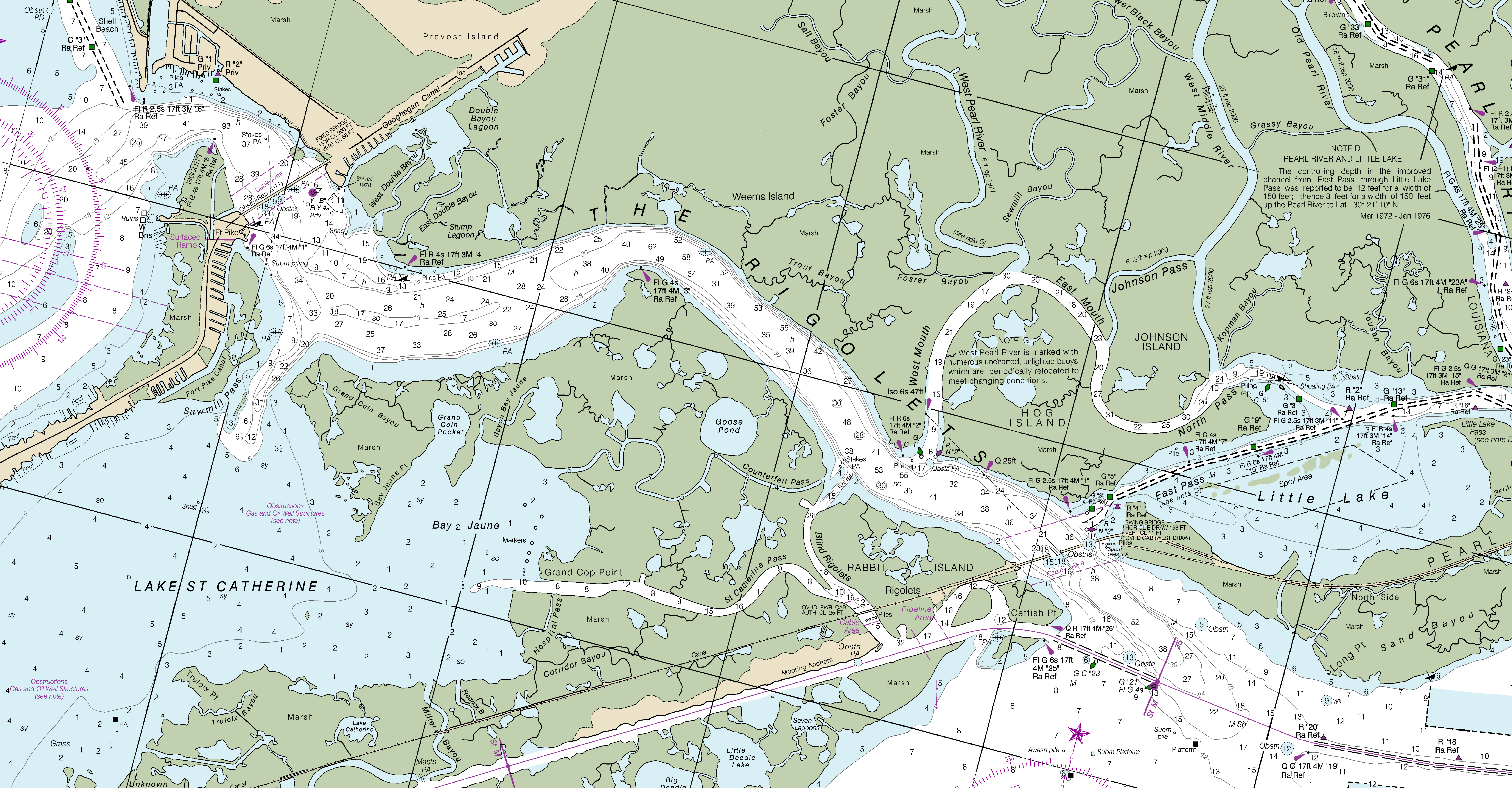
Image: The Rigolets (Louisiana) - 2016 NOAA nautical chart
Size of this preview: 800 × 417 pixels. Other resolutions: 320 × 167 pixels | 7,020 × 3,657 pixels.
Original image (7,020 × 3,657 pixels, file size: 1.21 MB, MIME type: image/png)
Description: NOAA nautical chart of the The Rigolets in Louisiana, which is strait connecting Lake Pontchartrain and Lake St. Catherine to Lake Borgne and the Gulf of Mexico.
Title: The Rigolets (Louisiana) - 2016 NOAA nautical chart
Credit: Charts at NOAA Office of Coast Survey (direct link)
Author: NOAA Office of Coast Survey
Usage Terms: Public domain
License: Public domain
Attribution Required?: No
Image usage
The following page links to this image:

All content from Kiddle encyclopedia articles (including the article images and facts) can be freely used under Attribution-ShareAlike license, unless stated otherwise.
_-_2016_NOAA_nautical_chart.png)