
Image: The Sur Empire at its height
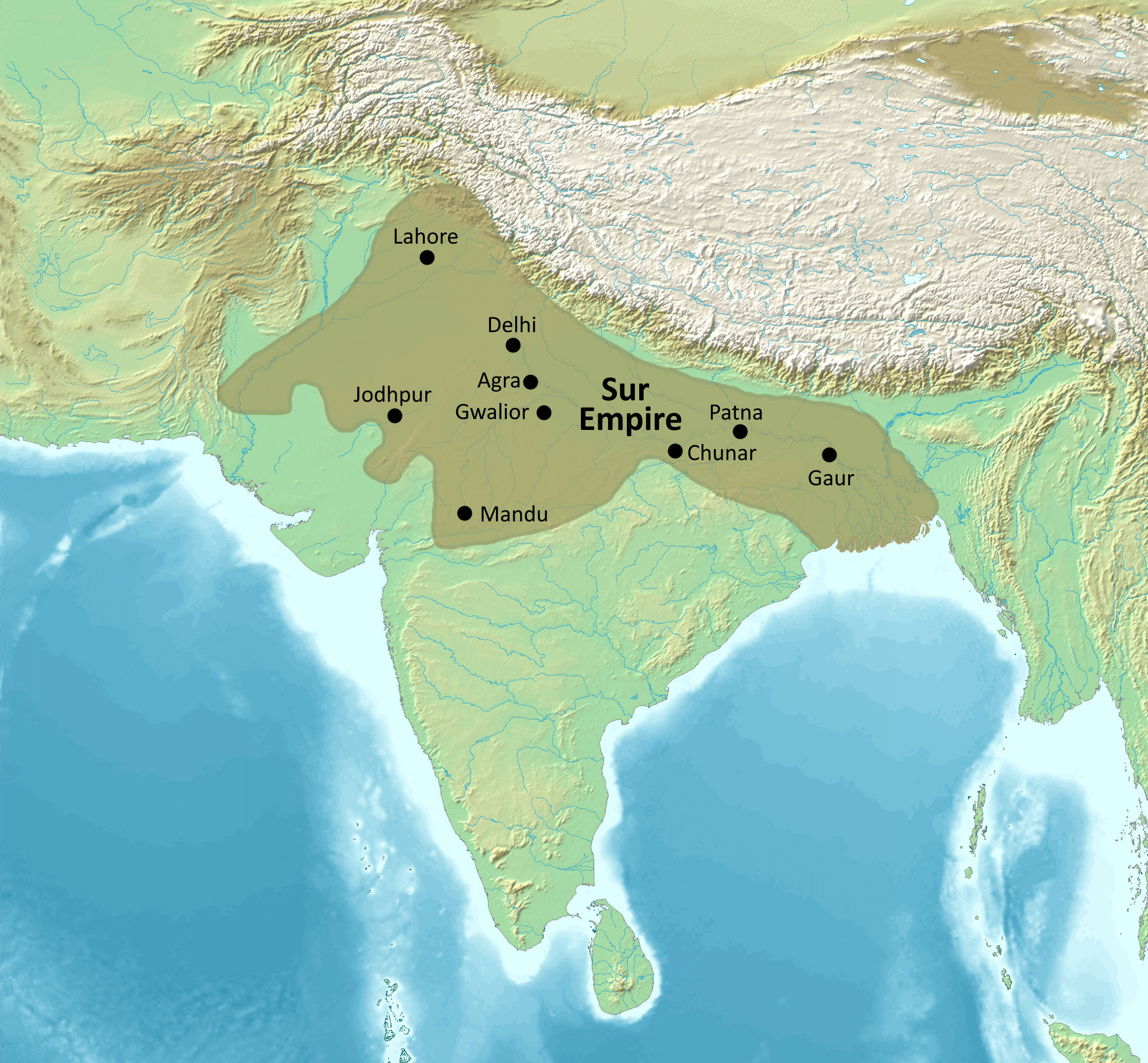
Description: Map of the Sur Empire at its height under the reign of Sher Shah Suri
Title: The Sur Empire at its height
Credit: Own work based on: South Asia non political, with rivers.jpg References: Mehta, J. L. (in English) Advanced Study in the History of Medieval India, Sterling Publishers Pvt. Ltd ISBN: 978-81-207-1015-3. Chandra, Satish (2005) Medieval India: From Sultanat to the Mughals - Part Two: Mughal Empire (1526–1748) (3rd ed.), Har-Anand Publications ISBN: 978-81-241-1066-9. Chandra, Satish (2007) (in English) History of Medieval India: 800-1700, Orient BlackSwan ISBN: 978-81-250-3226-7. Ali Khan, Zulfiqar (1925) Sher Shah Suri, Emperor of India, Lahore: Civil and Military Gazette Press
Author: Map created from DEMIS Mapserver, which are public domain. Koba-chan Borders by Noorullah21
Usage Terms: Creative Commons Attribution-Share Alike 4.0
License: CC BY-SA 4.0
License Link: https://creativecommons.org/licenses/by-sa/4.0
Attribution Required?: Yes
Image usage
The following 2 pages link to this image:
