
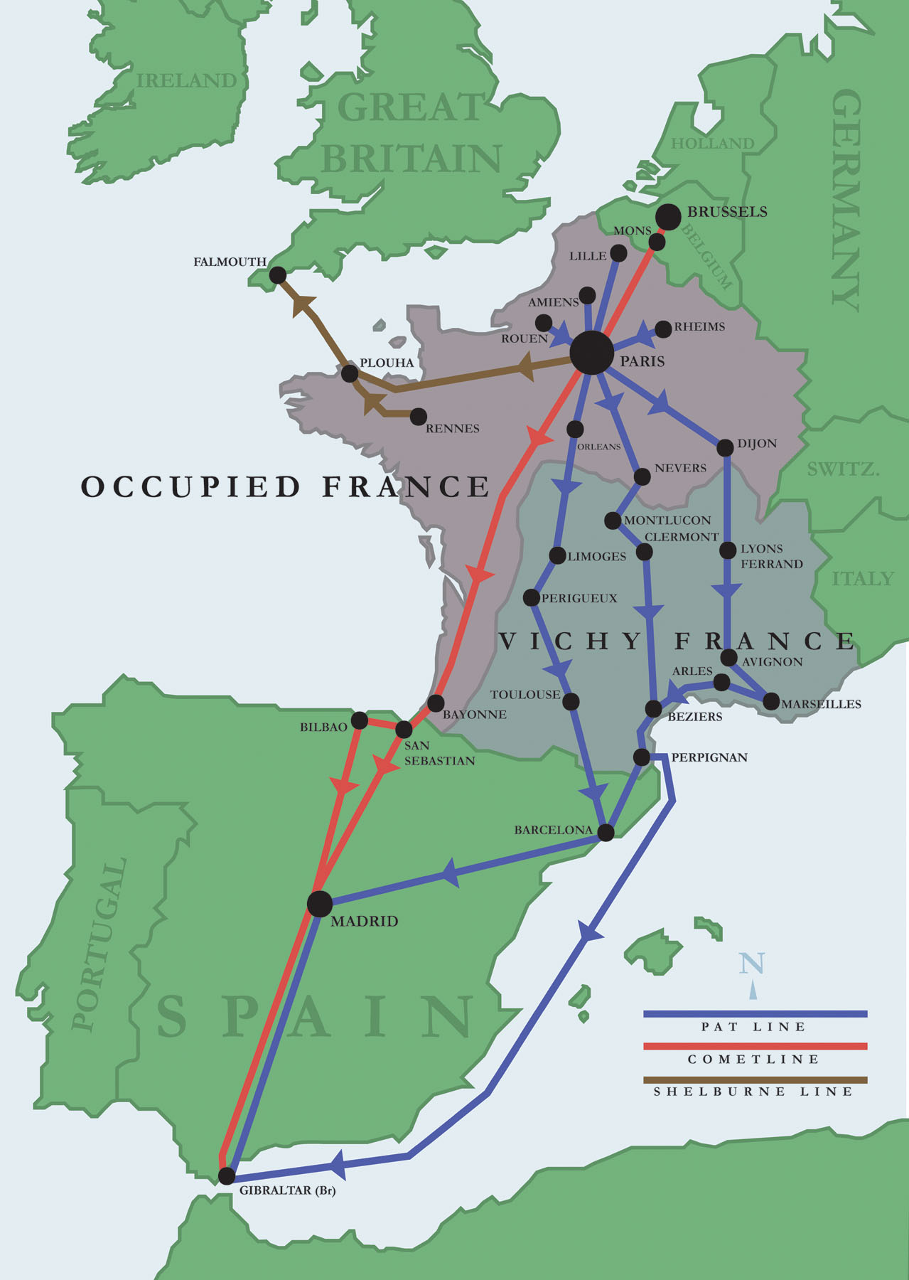
Image: The routes used by escape lines to help downed airmen escape Nazi-occupied Europe,
Size of this preview: 426 × 600 pixels. Other resolutions: 170 × 240 pixels | 1,279 × 1,800 pixels.
Original image (1,279 × 1,800 pixels, file size: 231 KB, MIME type: image/jpeg)
Description: A map of the routes used by the Comet Line, the Pat Line, and the Shelbourne escape lines to smuggle downed allied airmen out of Nazi-occupied Europe during World War II.
Title: The routes used by escape lines to help downed airmen escape Nazi-occupied Europe,
Credit: National Museum of the United States Air Force
Author: United States Air Force
Usage Terms: Public domain
License: Public domain
Attribution Required?: No
Image usage
The following 2 pages link to this image:

All content from Kiddle encyclopedia articles (including the article images and facts) can be freely used under Attribution-ShareAlike license, unless stated otherwise.