
Image: Tianjingshan fault
Size of this preview: 800 × 444 pixels. Other resolutions: 320 × 178 pixels | 3,221 × 1,789 pixels.
Original image (3,221 × 1,789 pixels, file size: 3.46 MB, MIME type: image/png)
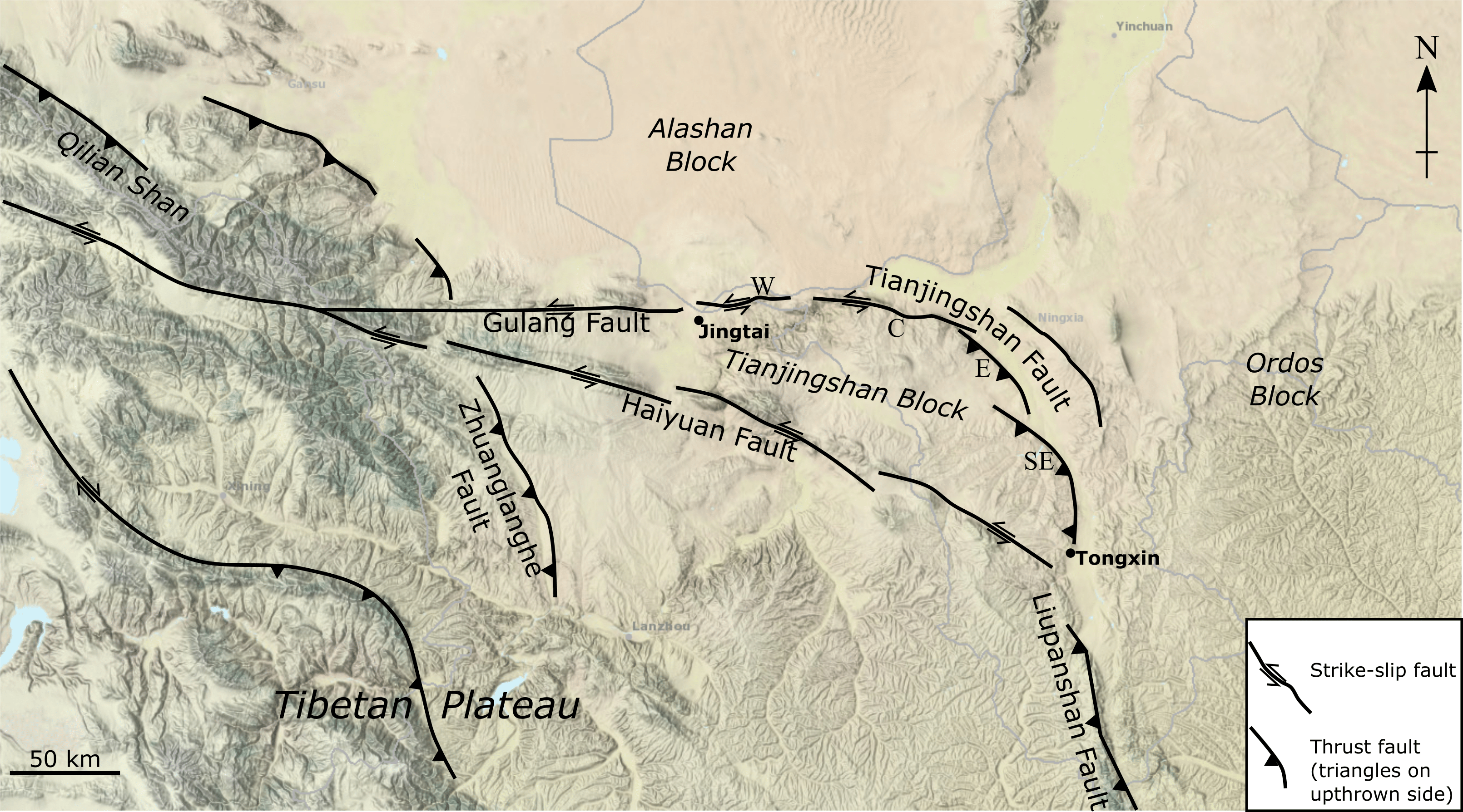
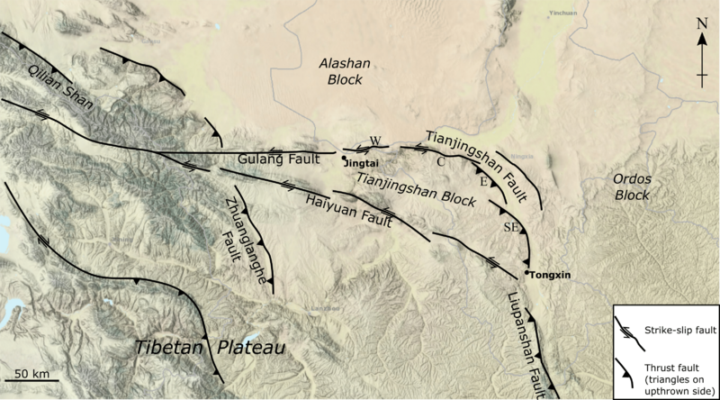
Description: Map of the Tianjingshan Fault and related structures. Base map comes from the NCEI Bathymetric Data Viewer. Faults are modified after Li et al. (2019) Figure 1.
Title: Tianjingshan fault
Credit: Own work
Author: Mikenorton
Usage Terms: Creative Commons Attribution-Share Alike 4.0
License: CC BY-SA 4.0
License Link: https://creativecommons.org/licenses/by-sa/4.0
Attribution Required?: Yes
Image usage
The following page links to this image:

All content from Kiddle encyclopedia articles (including the article images and facts) can be freely used under Attribution-ShareAlike license, unless stated otherwise.