
2023 Jishishan earthquake facts for kids

Damaged buildings in Jishishan after the earthquake
|
|


|
|
| UTC time | 2023-12-18 15:59:30 |
|---|---|
| ISC event | 636350642 |
| USGS-ANSS | ComCat |
| Local date | 18 December 2023 |
| Local time | 23:59:30 CST (UTC+08:00) |
| Magnitude | 6.2 Ms 6.1 Mw 5.9 Mww |
| Depth | 10 km (6 mi) |
| Epicenter | 35°44′35″N 102°49′37″E / 35.743°N 102.827°E |
| Type | Thrust |
| Areas affected | Gansu and Qinghai Provinces, China |
| Total damage | ¥14.4 billion (US$2 billion) |
| Max. intensity | CSIS VIII–CSIS IX IX (Violent) |
| Casualties | 151 fatalities, 982 injured |
On December 18, 2023, around 11:59 PM, a strong earthquake hit Jishishan County in Gansu Province, China. The earthquake had a magnitude between 5.9 and 6.2. It was a shallow earthquake, meaning it happened close to the Earth's surface. This type of earthquake is called a thrust faulting earthquake, where one block of the Earth's crust pushes over another.
The earthquake struck a busy area near the border of Gansu and Qinghai provinces. Sadly, 151 people died and 982 others were hurt. This made it the deadliest earthquake in China since the 2014 Ludian earthquake.
Contents
Why Earthquakes Happen Here

The Jishi Shan mountains are part of the Qilian Mountains in China. This area is at the edge of the Tibetan Plateau. The Tibetan Plateau is a huge, high landmass formed because the Indian Plate and the Eurasian Plate are slowly crashing into each other. Think of it like two giant puzzle pieces of the Earth's crust pushing together.
This constant pushing makes the land move north and spread out. This movement creates large cracks in the Earth's crust called faults. Some faults cause land to slide sideways, while others cause land to push upwards. The Jishi Shan mountains have faults on both sides that show both types of movement.
This region has a history of big earthquakes. For example, a powerful earthquake in 1927 had a magnitude of 7.7. It killed 40,000 people and caused huge damage and landslides. Another earthquake in 1920 killed 200,000 people, making it one of the deadliest of the 20th century. Even moderate earthquakes in China can cause a lot of damage because many people live in these areas, and some buildings are not strong enough to withstand the shaking.
The Jishishan Earthquake
.png)
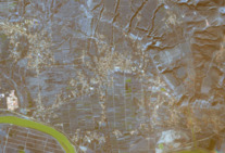
The China Earthquake Administration measured the earthquake at 6.2 magnitude. The United States Geological Survey measured it at 5.9 magnitude, happening about 10 kilometres (6.2 mi) deep. The center of the earthquake, called the epicenter, was near Liugou Township, about 8 kilometers from Jishishan.
People reported feeling the ground shake for nearly 20 seconds. The shaking was felt as far away as Xi'an, which is 570 kilometres (350 mi) away. After the main earthquake, there were many smaller quakes called aftershocks. By December 21, over 512 aftershocks had been recorded.
This earthquake happened because of a "reverse fault" at a shallow depth. This means that one part of the Earth's crust moved up and over another part. The earthquake's movement happened about 5 kilometres (3.1 mi) to 15 kilometres (9.3 mi) below the surface. This shows it was a "buried rupture," meaning the ground did not break open on the surface.
What Happened After the Earthquake
The earthquake caused a lot of damage and sadness.
- Casualties: At least 151 people died, and 982 were injured. Most deaths were in Gansu province, but 34 people also died in Qinghai province.
- Homes: About 15,000 houses completely fell down, and 207,000 others were damaged. Many homes in the area were old and made of clay, which made them more likely to collapse.
- Services: In some villages, communication lines, roads, electricity, and water services were cut off.
- Landslides: A dangerous mudslide happened in Jintian village in Qinghai. The mudslide buried the village under 2.5 metres (8 ft 2 in) to 3 metres (9.8 ft) of mud. This destroyed 51 homes and killed at least 20 people. The mud was caused by "soil liquefaction," where the ground becomes like liquid due to strong shaking, especially if there's a lot of water underground.
- Roads: Parts of the Qingshui-Dahejia Highway were blocked by falling rocks.
- Economic Impact: Officials in Gansu estimated that the earthquake caused about 532 million yuan (about $74.6 million US dollars) in damage to farms and fishing businesses.
Experts said that the earthquake caused so many deaths and so much damage because it happened at night, was shallow, and involved strong upward ground movement. Also, the quality of building materials in the area played a role.
World Reacts
Many leaders from around the world sent their condolences and offered help after the earthquake.
- António Guterres, the head of the United Nations, showed his support for the Chinese people.
- Taiwanese president Tsai Ing-wen offered help.
- The prime ministers of Pakistan and Russia also expressed their sadness.
- The Ministry of Foreign Affairs of Turkey sent condolences.
- Overall, leaders from 20 countries expressed their sympathy for the victims.
See also
- List of earthquakes in 2023
- List of earthquakes in China
