
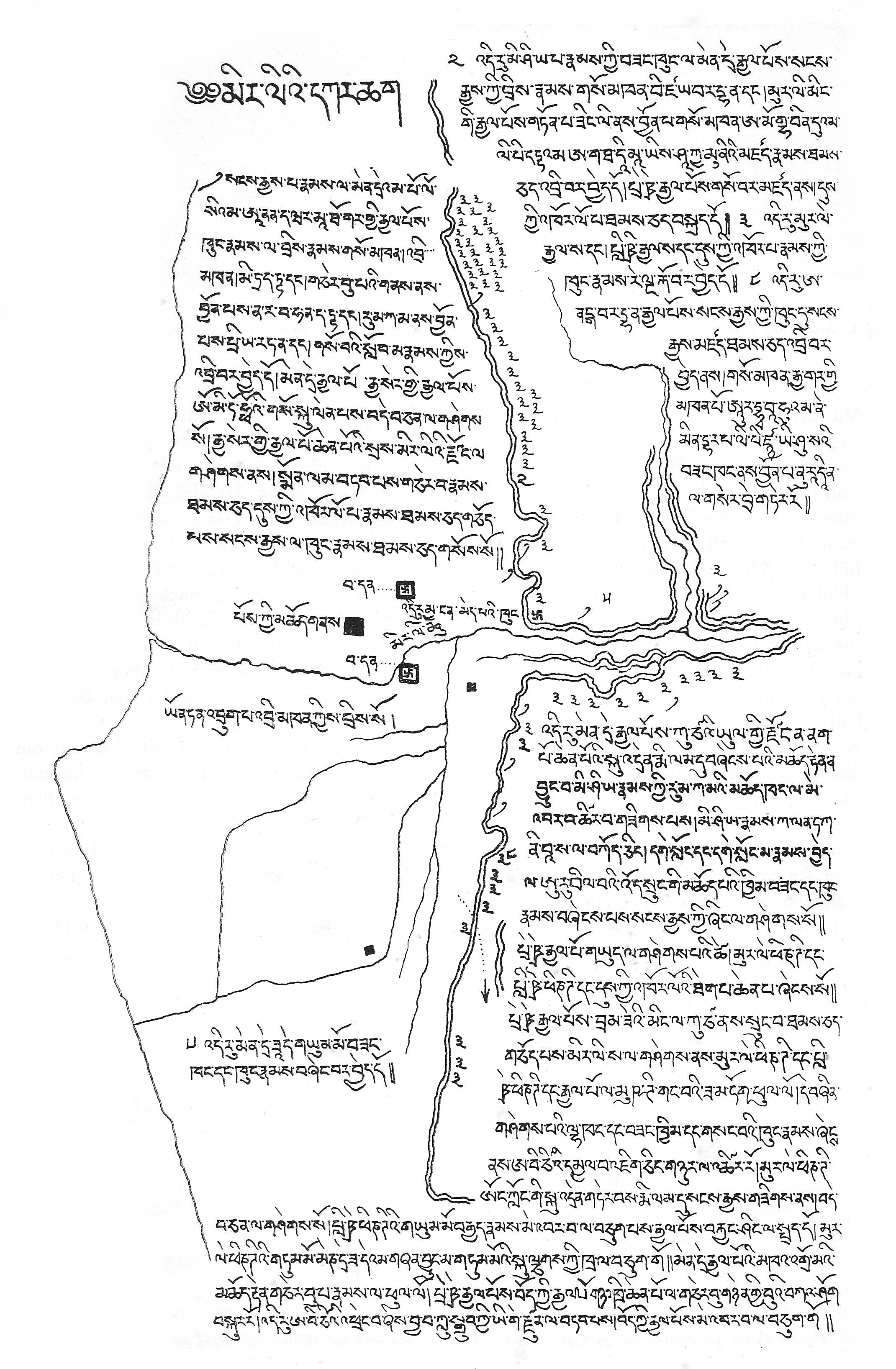
Image: Tibetan map of the Kizil Caves (13th entury CE)
Size of this preview: 392 × 599 pixels. Other resolutions: 157 × 240 pixels | 2,141 × 3,272 pixels.
Original image (2,141 × 3,272 pixels, file size: 3.09 MB, MIME type: image/jpeg)
Description: Tibetan map of the Kizil Caves (13th entury CE)
Title: Tibetan map of the Kizil Caves (13th entury CE)
Credit: Alt-Kutscha archäologische und religionsgeschichtliche Forschungen an Tempera-Gemälden aus buddhistischen Höhlen der ersten acht Jahrhunderte nach Christi Geburt. Published in 1920
Author: Albert Grünwedel (July 31, 1856 – October 28, 1935)
Usage Terms: Public domain
License: Public domain
Attribution Required?: No
Image usage
The following page links to this image:

All content from Kiddle encyclopedia articles (including the article images and facts) can be freely used under Attribution-ShareAlike license, unless stated otherwise.
.jpg)