
Image: Tobruk2Sollum1941 en

Size of this PNG preview of this SVG file: 757 × 454 pixels. Other resolution: 320 × 192 pixels.
Original image (SVG file, nominally 757 × 454 pixels, file size: 64 KB)
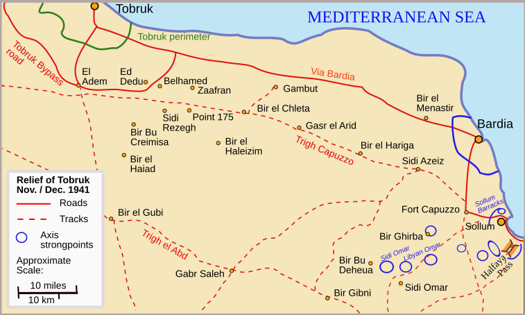
Description: Map of the battlefield during the relief of Tobruk Nov. / Dec. 1941
Title: Tobruk2Sollum1941 en
Credit: Own work based on Murphy, W. E. (1961) Fairbrother, Monty C. , ed. The Relief of Tobruk, The Official History of New Zealand in the Second World War 1939–1945 (New Zealand Electronic Text Collection ed.), Wellington, NZ: War History Branch, Department of Internal Affairs, p. 85 Retrieved on 21 September 2015.
Author: Kirrages
Usage Terms: Creative Commons Attribution-Share Alike 3.0
License: CC BY-SA 3.0
License Link: https://creativecommons.org/licenses/by-sa/3.0
Attribution Required?: Yes
Image usage
The following 2 pages link to this image:

All content from Kiddle encyclopedia articles (including the article images and facts) can be freely used under Attribution-ShareAlike license, unless stated otherwise.