
Image: Topo map Artsakh en
Size of this preview: 662 × 599 pixels. Other resolutions: 265 × 240 pixels | 2,999 × 2,715 pixels.
Original image (2,999 × 2,715 pixels, file size: 3.06 MB, MIME type: image/png)
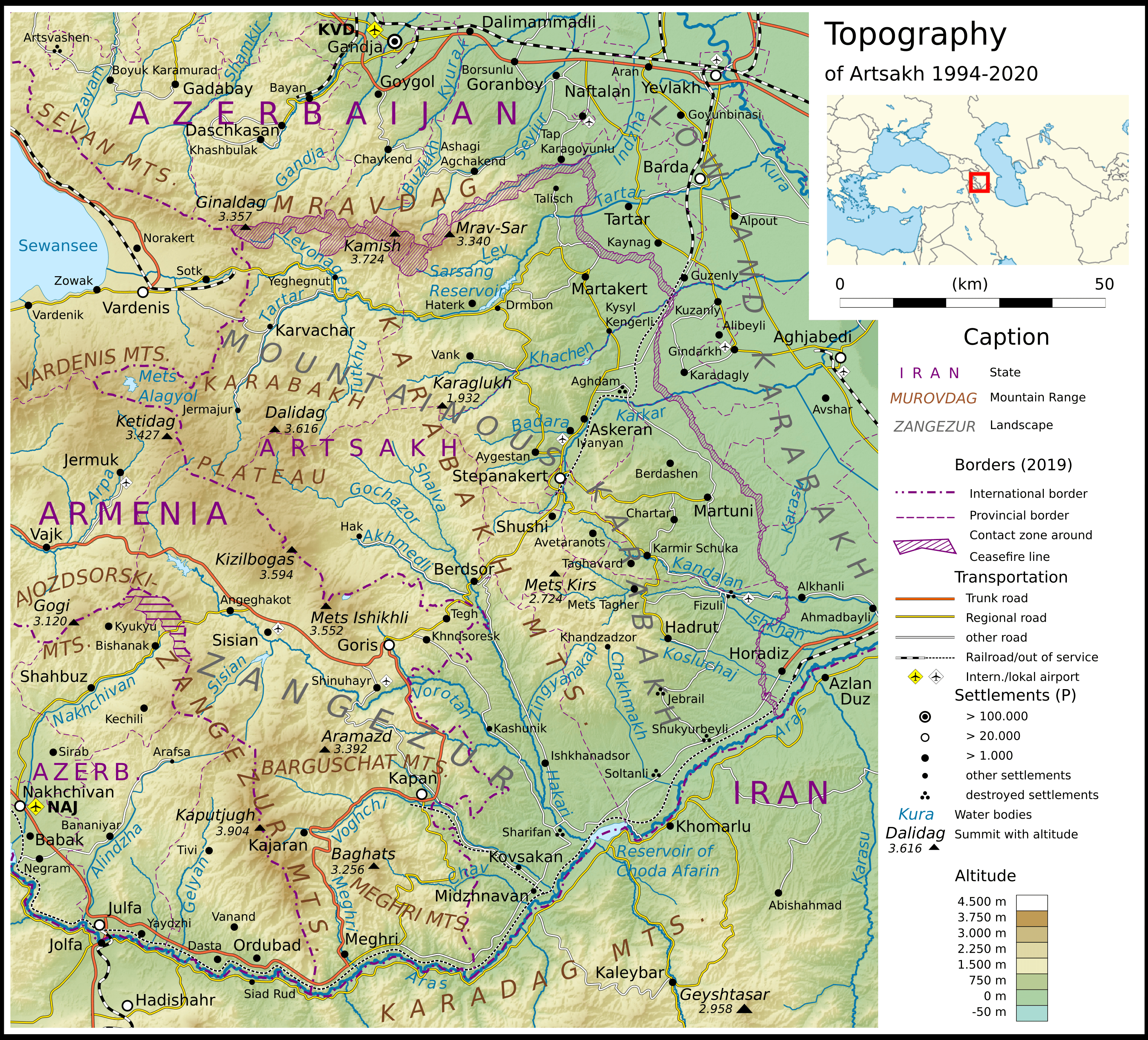
Description: topographic map of Artsakh 1994 to 2020. All names in English, for simplicity and readebility only the de-jure name variants were chosen.
Title: Topo map Artsakh en
Credit: Own work; topographic background: NASA Shuttle Radar Topography Mission (public domain). SRTM3 v.2. borders: Armenia adm location map.svg, Azerbaijan adm location map.svg; water bodies: OpenStreetMap
Author: Don-kun, sources: NordNordWest, OpenStreetMap Contributors
Usage Terms: Creative Commons Attribution-Share Alike 4.0
License: CC BY-SA 4.0
License Link: https://creativecommons.org/licenses/by-sa/4.0
Attribution Required?: Yes
Image usage
The following page links to this image:

All content from Kiddle encyclopedia articles (including the article images and facts) can be freely used under Attribution-ShareAlike license, unless stated otherwise.