
Image: Topographic Map of Gale Crater
Size of this preview: 561 × 599 pixels. Other resolutions: 225 × 240 pixels | 4,000 × 4,272 pixels.
Original image (4,000 × 4,272 pixels, file size: 1.22 MB, MIME type: image/jpeg)
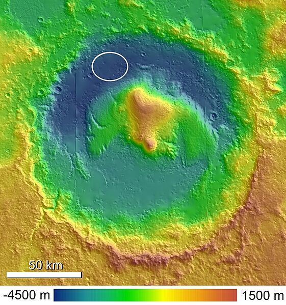
Description: A shaded and colorized topographic map of Gale Crater, Mars, based on publicly released High Resolution Stereo Camera (HRSC) data. The MSL landing ellipse is indicated in the northwestern crater floor.
Author: Ryan Anderson
Usage Terms: Creative Commons Attribution-Share Alike 3.0
License: CC-BY-SA-3.0
License Link: http://creativecommons.org/licenses/by-sa/3.0/
Attribution Required?: Yes
Image usage
The following page links to this image:

All content from Kiddle encyclopedia articles (including the article images and facts) can be freely used under Attribution-ShareAlike license, unless stated otherwise.