
Image: Topographic Map of Ilam Province
Size of this preview: 638 × 600 pixels. Other resolutions: 255 × 240 pixels | 6,391 × 6,009 pixels.
Original image (6,391 × 6,009 pixels, file size: 9.99 MB, MIME type: image/png)
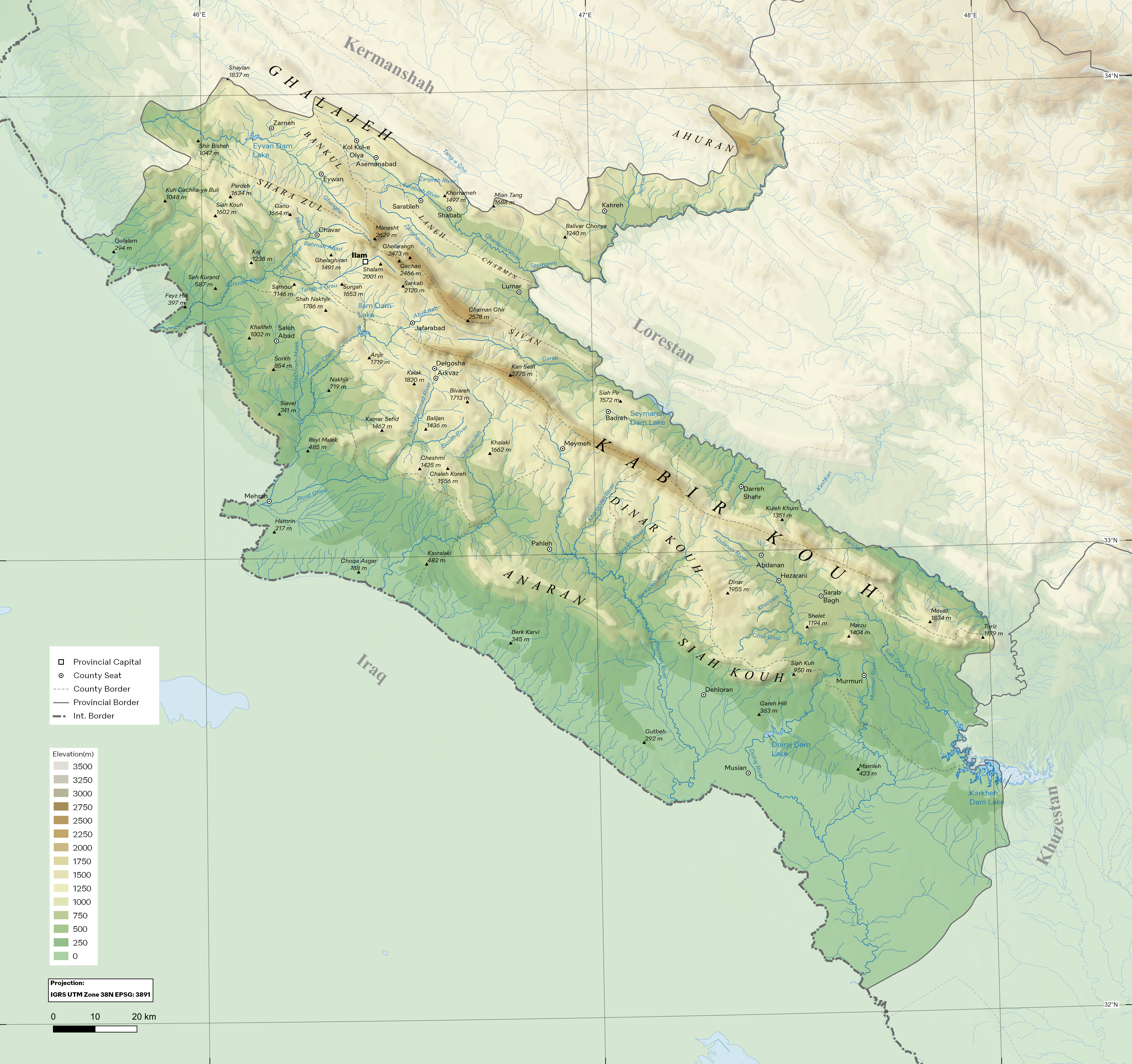
Description: Topographic Map of w:Ilam Province, Iran showing mountains, rivers and populated places. Projection system: IGRS / UTM zone 38N EPSG: 3891 Created by QGIS and GIMP. Data Sources: Vectors from OpenStreetMap Raster from NASADEM Merged DEM Global 1 Arc Second available at LP DAAC
Title: Topographic Map of Ilam Province
Credit: Own work
Author: Milad2017
Usage Terms: Creative Commons Attribution-Share Alike 4.0
License: CC BY-SA 4.0
License Link: https://creativecommons.org/licenses/by-sa/4.0
Attribution Required?: Yes
Image usage
The following 2 pages link to this image:

All content from Kiddle encyclopedia articles (including the article images and facts) can be freely used under Attribution-ShareAlike license, unless stated otherwise.