
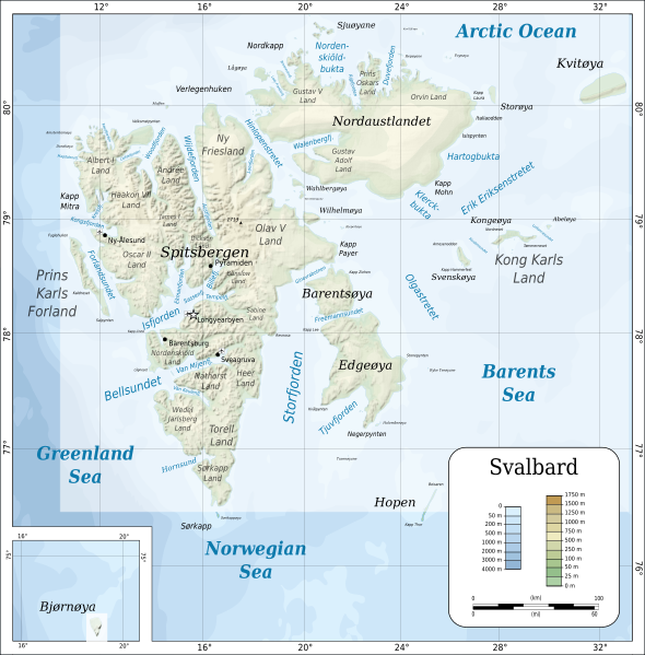
Image: Topographic map of Svalbard

Description: Topographic map of Svalbard.
Title: Topographic map of Svalbard
Credit: Self-made in Inkscape by Mysid. Coastline from a CIA map (Image:Sv-map.png) and topographic data (see below). Locations of place names based on the Russian-Norwegian Directory (http://www.russia.no/regional/svalbard/). Topographic data from MGG-GLOBE (http://www.ngdc.noaa.gov/mgg/topo/gltiles.html), automatically traced. Bathymetric data from MGG-IBCAO (http://www.ngdc.noaa.gov/mgg/bathymetry/arctic/arctic.html), manually traced into orthogonal projection. Big file size is because of the relief shading, which is an embedded PNG bitmap.
Author: Oona Räisänen (Mysid)
Usage Terms: Creative Commons Attribution-Share Alike 4.0
License: CC BY-SA 4.0
License Link: https://creativecommons.org/licenses/by-sa/4.0
Attribution Required?: Yes
Image usage
The following 5 pages link to this image:
