
Image: TorontoNewTownExtensionPlan1837
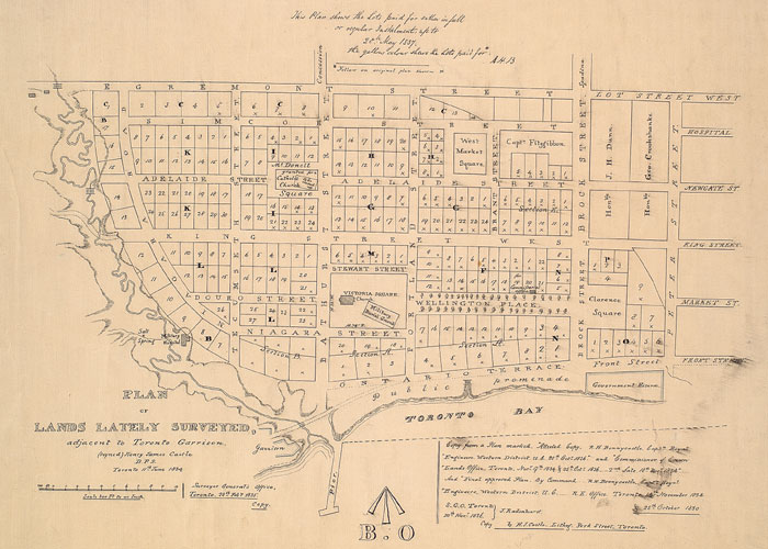
Description: 1837 Plan for Wellington Place (New Town Extension). The north-south streets are, from east to west: Peter Street (this segment is present-day Blue Jay Way), Brock Street (present-day Simcoe Street), Brant Street, Portland Street, Bathurst Street, and Tecumseh Street. The area to the west was once part of the harbour, but is now land after years of infill. The east-west routes, from south to north, are Front Street, King Street, Adelaide Street, Simcoe Street (present-day Richmond Street), and Lot Street (present-day Queen Street).
Title: TorontoNewTownExtensionPlan1837
Credit: This image is available from the Toronto Public Library
Author: Henry Castle
Permission: Public domain works must be out of copyright in both the United States and in the source country of the work in order to be hosted on the Commons. If the work is not a U.S. work, the file must have an additional copyright tag indicating the copyright status in the source country. Note: This tag should not be used for sound recordings.PD-1923Public domain in the United States//commons.wikimedia.org/wiki/File:TorontoNewTownExtensionPlan1837.jpg
Usage Terms: Public domain
License: Public domain
Attribution Required?: No
Image usage
The following page links to this image:
