History of neighbourhoods in Toronto facts for kids
Toronto has always been a city made up of many different areas and neighbourhoods. As the city grew bigger, new neighbourhoods appeared. These new areas were often built on what used to be countryside. Over time, even the older neighbourhoods changed and were rearranged.
Because Toronto has so many different kinds of neighbourhoods, people sometimes call it "the city of neighbourhoods."
Contents
- Early Toronto: Old Town and New Town
- How Wards Shaped the City
- Small Towns in the Countryside
- How Railways Created New Towns
- City Growth: From Crowded Areas to Streetcar Suburbs
- Postal Zones and Neighbourhood Names
- Suburbs and Downtown Changes
- Neighbourhoods Come Back to Life
- Modern Toronto: New Neighbourhoods
- See also
Early Toronto: Old Town and New Town
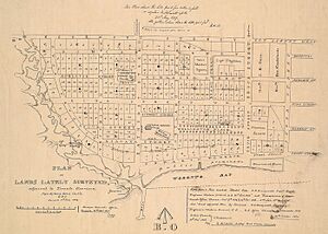
Before Toronto officially became a city in 1834, it was called York. For about 20 years after it started in 1793, most people lived in an area that is now between Jarvis and Parliament streets. This area was south of what is now Queen Street East and north of Front Street, which was right by the water back then.
By 1815, this first area became known as Old Town. This was because a new neighbourhood started to form just west of it. This new area, called New Town, stretched from Jarvis Street to Peter Street. It was also between Queen Street West and Front Street. New Town didn't have many people in 1815, but it grew very fast in the 1820s and 1830s. The Old Town and New Town even had a friendly rivalry, especially about where the main government buildings should be.
How Wards Shaped the City
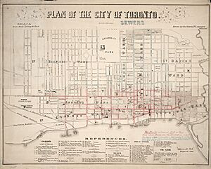
When Toronto became a city in 1834, it was divided into five main areas called municipal wards. These wards were named after the patron saints of the four parts of the British Isles: St. George, St. Andrew, St. Patrick, and St. David. The fifth ward was named after St. Lawrence, who is a patron saint of Canada.
Today, only the St. Lawrence name is still well-known as a neighbourhood. The other names are now used for landmarks like subway stations. As Toronto got bigger, more wards were created, still named after saints. For example, St. James Town neighbourhood keeps the name of St. James Ward. Also, the northern ward of St. Paul's is still used as a name for voting districts today.
Small Towns in the Countryside
In the early 1800s, Toronto was a small town with only a few thousand people. Most of the land that is now Toronto was farmland with small villages scattered around. Some villages, like Norway, have almost disappeared. But many others, such as Malvern and Wexford, have grown into well-known neighbourhoods in Toronto's suburbs.
Small inns and taverns often popped up along the main roads leaving the city. These were usually near toll booths, where people paid to use the early highways. These spots often grew into small towns. The three main roads out of the city were Kingston Road (going east), Yonge Street (going north), and Dundas Street (going west). Weston Road was another early route where communities developed.
Another type of town grew up to support the farms in the area. These towns usually formed where two concession roads crossed. They often had a post office or a small church at their centre.
Here are a few examples of these early villages:
- Agincourt: Started as a farming town with a post office in 1858.
- Davisville: Had a post office by the 1840s.
- Highland Creek: Settled in 1802, it was the first community in Scarborough.
- Leslieville: Grew around an inn in the 1850s.
- Todmorden Mills: Started around 1795 with a lumber mill that helped build York.
How Railways Created New Towns
In the second half of the 1800s, many railway lines were built across the Toronto area. This led to a new group of towns and neighbourhoods being formed. Railway lines and stations quickly became important spots for new communities to grow.
The most important railway was the Grand Trunk Railway line, which ran along the shore of Lake Ontario. The main Union Station in downtown Toronto was where many lines met. This helped industries grow in the area between Queen Street and the lake. East and west of downtown, major stations were built in Parkdale and Riverside South. These areas became busy centres with hotels like the Gladstone opening for travellers.
Railways also changed parts of town that used to be small rural communities into big industrial areas. For example, the small towns of Carleton and Davenport in the northwest became part of The Junction. This area then became home to many large factories and warehouses. To the east, the towns of Strangford and Mortlake became known as Scarborough Junction.
Further away from the city, railways also changed the landscape. New communities grew around railway yards and facilities to house the workers. The biggest of these was East Toronto, which developed east of the city near the Grand Trunk's main yards. In eastern Scarborough, Irish railway workers built the town of West Hill. The existing small town of Leaside also grew quickly after a railway maintenance yard was built nearby.
City Growth: From Crowded Areas to Streetcar Suburbs
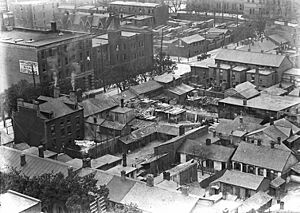
By the late 1800s, the centre of old Toronto had become mostly industrial and commercial. Some people, usually poorer citizens and new immigrants, still lived in these areas. These became some of Toronto's first neighbourhoods based on ethnic groups.
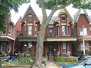
Working-class Irish people, who worked in many factories, lived mostly in the eastern part of the city. These neighbourhoods were named Cabbagetown and Corktown after them. Jewish immigrants also started arriving in large numbers around this time. They settled in an area known as The Ward, near Bay Street. In the early 1900s, Chinatown also grew into another important neighbourhood nearby.
Middle and upper-class residents moved out of the city centre into newer areas. This created many new neighbourhoods. Farmland around the city was turned into new places to live. These included The Annex, which was named because it was added to the city of Toronto, and the former village of Yorkville.
This moving process sped up a lot when streetcars were introduced. Streetcars made it easy for people living outside the main business area to travel to work. New areas, mostly for middle and upper-class families, grew along the streetcar lines. This created neighbourhoods like Riverdale, The Beaches, Birch Cliff, North Toronto, and Parkdale. Working-class streetcar suburbs also developed in New Toronto, Mimico, and Long Branch in what is now Etobicoke.
Postal Zones and Neighbourhood Names
By the 1920s, most of the neighbourhoods in old Toronto were already established. A writer for the Toronto Star in 1925 listed many of them, such as Rosedale, Riverdale, Parkdale, High Park, Junction, Danforth, Earlscourt, Wychwood, Willowvale, North Toronto, Beach, and Leaside. Most of these names are still used today. Willowvale is now known as Christie Pits, named after the park there.
In 1925, the Post Office divided Toronto into ten postal zones to help sort mail before postal codes existed. At first, people didn't use these zone numbers much. But after the Second World War, the zone numbers became very common. These postal districts became a main way to divide the city. People would often say they lived in Toronto 2 or Toronto 10. This system continued until 1971, with some changes as the city grew. By 1966, the city had 19 zones, and areas further out had single-letter codes, like R for Rexdale.
Suburbs and Downtown Changes
The years after the Second World War brought big changes to Toronto's neighbourhoods. Cars made it possible to live even further from the city centre. The "baby boom" also led to many new homes being built quickly. For the next 30 years, the areas around the city, which soon became known as Metro Toronto, grew very fast. Scarborough, North York, and Etobicoke changed from mostly farmland into huge areas of housing. Early developers didn't focus much on creating distinct neighbourhoods, but over time, many of these areas developed strong communities. Some suburbs kept the names of the small villages that used to be there. Others were given new names by developers to help sell the homes.
At the same time, downtown neighbourhoods also changed a lot. The Financial District grew northwards. Areas like The Ward and parts of old Chinatown were torn down to make way for new projects, such as Toronto City Hall. The Yorkville neighbourhood also changed from homes to hotels and stores.
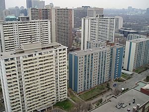
The government also tore down many areas they called "slums" (crowded, older areas). They replaced them with modern housing projects. The idea was that these new buildings would lead to better lives for the people living there. So, large parts of Cabbagetown and Corktown were cleared to build Regent Park and Moss Park. St. James Town was turned into many tall high-rise buildings. In the suburbs, governments also created new high-rise neighbourhoods like Flemingdon Park and Crescent Town.
These large housing projects stopped being built by the late 1970s. People realized that these projects often became areas with poverty and crime. Meanwhile, the parts of Cabbagetown that were not touched became very popular places to live. Under Mayor David Crombie, new ways of building social housing were tried, like in the St. Lawrence neighbourhood. These new projects have many people living in them but without the social problems of the earlier ones.
Neighbourhoods Come Back to Life
After the war, many traditional neighbourhood names were used less often. People used the postal district numbers more, and some older neighbourhoods became poorer. For example, the name Riverdale faded away as it became a poorer area. In 1964, a Toronto Star newspaper series called the entire area north of Gerrard Street "The Danforth." A real estate agent who worked in the area in the 1970s said he never heard it called Riverdale.
Residents and real estate agents soon found that giving neighbourhoods clear names and identities made them more appealing. So, in the 1970s, much of the city was divided into distinct neighbourhoods again. Older names like Riverdale were brought back. (Though real estate agents tried to rename part of it "Cabbagetown II" because Cabbagetown was becoming very popular.) Other areas that never had clear names were given them. Some, like Leslieville, took names from historic villages that used to be there. Others were named after nearby areas, like the Upper Beaches. Not all these naming attempts worked. For example, trying to call areas "Chester Village" or "South Annex" didn't catch on.
Modern Toronto: New Neighbourhoods
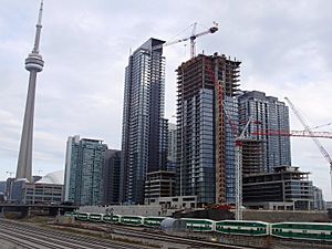
By the 1980s, almost all the open land within Metro Toronto had been built on. Most new growth happened in the areas around Toronto, often called "the 905" region. At the same time, central Toronto saw many factories and warehouses disappear, especially along the waterfront. This created large empty spaces for new developments and new neighbourhoods.
Many new communities have grown in these former industrial areas. The biggest is CityPlace, built on old railway lands. To the west and east, other residential and cultural areas have appeared, like Liberty Village and the Distillery District. Other parts of the waterfront, like the West Donlands and the Portlands, are still mostly empty and waiting to be redeveloped.
With less open space in the city of Toronto and the downtown area becoming popular again, many condominium buildings have been constructed. These have created new residential communities in areas that used to be only for businesses, like the Financial District and Yorkville. The suburbs have also become much denser. North York Centre has grown into a large group of condominiums and office buildings. A similar, though smaller, change is happening at Scarborough City Centre. Since the Sheppard subway line was finished in 2002, there has been a boom in condo construction along its route.
Today, the City of Toronto officially recognizes 158 neighbourhoods (as of 2022, 34 new ones were created from 16 older ones). There are also more than 240 official and unofficial neighbourhoods within the city limits.
See also
- History of Toronto
- List of neighbourhoods in Toronto
- Architecture of Toronto
 | James B. Knighten |
 | Azellia White |
 | Willa Brown |


