Yonge Street facts for kids
 |
|
|---|---|
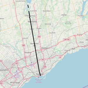
Yonge Street (Toronto/York section)
|
|
| Other name(s) | York Regional Roads 1 / 51 |
| Maintained by | City of Toronto York Region Town of East Gwillimbury |
| Location | Toronto Vaughan Markham Richmond Hill Aurora Newmarket East Gwillimbury |
| South end | Queens Quay in Toronto |
| Major junctions |
King Street Queen Street Dundas Street Bloor Street St. Clair Avenue Eglinton Avenue Lawrence Avenue Wilson Avenue / York Mills Road Sheppard Avenue Finch Avenue Steeles Avenue |
| North end | Holland River |
| Construction | |
| Inauguration | 1794 |
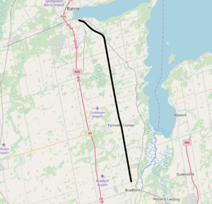
Yonge Street (Simcoe section)
|
|
| Other name(s) | Simcoe County Road 4 |
| Maintained by | Simcoe County City of Barrie |
| Length | 30 km (20 mi) |
| Location | Barrie Bradford West Gwillimbury Innisfil Simcoe |
| South end | 8th Line in Bradford (continues south as Barrie Street) |
| Major junctions |
|
| North end | Former Canadian National rail spur in Barrie (Continues as Burton Avenue) |
| Construction | |
| Inauguration | 1827 |
Yonge Street (pronounced YUNG) is a very important road in Ontario, Canada. It connects the shores of Lake Ontario in Toronto all the way to Lake Simcoe. Lake Simcoe is a gateway to the larger Great Lakes.
John Graves Simcoe, who was the first leader of Upper Canada (now Ontario), named the street. He named it after his friend, Sir George Yonge, who was an expert on old Roman roads.
Yonge Street was once the start of Ontario Highway 11, which linked Toronto to northern Ontario. Because of this, many people called it "Main Street Ontario." For a long time, the Guinness World Records mistakenly said Yonge Street was 1,896 kilometers (1,178 miles) long. This was because they confused Yonge Street with the entire length of Highway 11. In reality, Yonge Street, including its extension to Barrie, is only about 86 kilometers (53 miles) long. Today, no part of Yonge Street is officially a provincial highway.
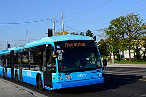
Building Yonge Street was a very important event in Canadian history. It was key to how western Upper Canada was planned and settled in the 1790s. In Toronto and York Region, Yonge Street is the main north-south line for numbering other streets. The Line 1 Yonge–University subway line runs along most of Yonge Street in Toronto. It's like the backbone of the Toronto subway system, connecting to other transit like the Viva Blue bus system. Yonge Street is a busy commercial area, not just a ceremonial road. It has popular shopping and entertainment spots like the Toronto Eaton Centre and Yonge–Dundas Square.
Contents
Exploring Yonge Street's Path
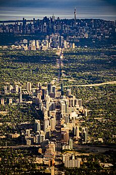
Yonge Street begins at Queens Quay on the northern shore of Toronto Bay. It starts as a four-lane road with a speed limit of 40 kilometers per hour (25 mph). The Harbourfront area, where the street begins, was once an industrial port. Now, it's a busy area with many homes and tall buildings. One of Canada's tallest buildings, SkyTower at Pinnacle One Yonge, is located at 1 Yonge Street.
The Gardiner Expressway and busy train tracks pass over Yonge Street. Near Front Street, the road goes up a bit, marking where the old shoreline used to be. Here, you can find the Dominion Public Building, the Meridian Hall, and the Hockey Hall of Fame. The Hockey Hall of Fame is in an old Bank of Montreal building. After Front Street, Yonge Street goes through the east side of the Financial District, which has many of Canada's tallest buildings.
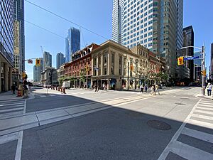
Between Front and Queen Streets, Yonge Street is lined with old and new commercial buildings. Many of these buildings serve the large number of people who work downtown. The Toronto Eaton Centre, a large indoor mall, takes up the entire west side of Yonge Street from Queen to Dundas Street. On the east side, there are two historic theaters: the Ed Mirvish Theatre and the Elgin and Winter Garden Theatres. Massey Hall is also nearby.
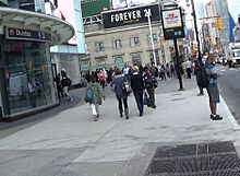
Across from the north end of the Eaton Centre is Yonge–Dundas Square. This area was redeveloped in the late 1990s and early 2000s. It has big video screens, shops, fountains, and places to sit. It's often called "Toronto's Times Square" and hosts many public events.
North of Dundas Street, Yonge Street continues to be busy with shops. The number of businesses becomes less dense north of Gerrard Street. Here, you'll see residential towers with some shops on the ground floor. The Art Deco College Park building, which was once a large shopping complex, is on the west side of the street from Gerrard to College Street. It was later turned into homes and businesses.
From College Street north to Bloor Street, Yonge Street has smaller, local shops. These are mostly in older, two- or three-story buildings. These shops serve the many people who live in the neighborhoods around Yonge Street.
Yonge and Bloor Intersection
The intersection of Yonge and Bloor streets is a major crossing in Toronto. Many people consider it the northern edge of downtown. The Line 2 Bloor–Danforth subway line crosses the Yonge line here, making Bloor–Yonge station the busiest subway station in the city. This intersection is a "scramble" crossing, meaning pedestrians can cross in any direction, even diagonally, when traffic stops.
North of Bloor Street
Just north of Bloor, Yonge Street goes through the old town of Yorkville. Today, Yorkville is a popular shopping area. North of Yorkville, the area becomes less busy, and the speed limit increases to 50 kilometers per hour (31 mph). Yonge Street becomes the main street of Summerhill, an area known for its fancy homes. Here, you can see the historic North Toronto station, which is now a large LCBO store.
From St. Clair Avenue to Yonge Boulevard, Yonge Street is the center of what was once the suburb of North Toronto, now called Midtown. This area has a mix of homes, shops, and businesses. The intersection at Eglinton Avenue is a very busy spot with many tall residential and office buildings, as well as a major transit hub. The historic Montgomery's Tavern, where an important event in the Upper Canada Rebellion happened, is also nearby.
North of Yonge Boulevard, Yonge Street crosses the deep valley of the West Don Valley at Hoggs Hollow. This was a difficult area to cross in the past. The Ontario Highway 401, Canada's busiest highway, crosses this valley on the Hogg's Hollow Bridge. After the valley, Yonge Street enters North York City Centre, which is the downtown area of the former city of North York. This area has many residential and office towers. The North York Civic Centre complex, with Mel Lastman Square, the North York Central Library, and the Toronto Centre for the Performing Arts, is located here. The street widens to six lanes in this area.
Beyond Toronto
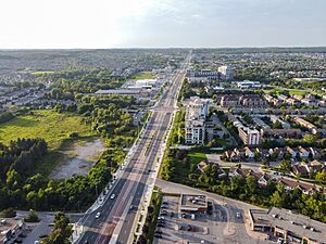
From Finch Avenue to Stouffville Road, Yonge Street becomes a suburban commercial area. It crosses Ontario Highway 407 north of Steeles Avenue, which is the border of Toronto and York Region. This part of Yonge Street is very busy and goes through towns like Thornhill and Richmond Hill. You'll see many residential high-rise buildings here.
The continuous urban area ends just south of Stouffville Road. The street then passes through some semi-rural areas between Richmond Hill, Aurora, Newmarket, and Holland Landing. It crosses the Oak Ridges Moraine, a large hill formed by glaciers. Yonge Street goes through the center of Aurora and serves as Newmarket's main suburban road. North of Green Lane, the main road (Regional Road 1) turns away from the original Yonge Street path. It goes around Cook's Bay and the Holland Marsh on its way to Bradford. This bypass was built in 1959.
Simcoe Road 4

Yonge Street continues northwest in Bradford (reached by Regional Road 1). It's first called Barrie Street in downtown Bradford before the name Yonge returns. This part of the road, called Simcoe Road 4, runs through the countryside of southeast Simcoe County, roughly parallel to Lake Simcoe. Yonge Street officially ends in Barrie at a train track, where its name changes to Burton Avenue. Burton Avenue then ends close to Kempenfelt Bay.
History of Yonge Street
How the Route Was Chosen
In 1793, there was a war between France and Great Britain. John Graves Simcoe, the leader of Upper Canada, was worried that the United States might join France and attack British lands. He was especially concerned about Newark (now Niagara-on-the-Lake), the first capital of Upper Canada, because it was close to the U.S. border.
Simcoe wanted to move the capital to a safer place and build roads to the upper Great Lakes. He chose York (which is now Toronto) as a good spot for a new capital because it had a safe harbor. To connect York to the upper lakes, he planned two roads. The first would go north from York to Lake Simcoe. The second would connect Lake Simcoe to Georgian Bay. These roads would allow goods and people to travel overland, avoiding areas controlled by the U.S. The road from Lake Ontario to Lake Simcoe is Yonge Street, and the second road to Georgian Bay was called the Penetanguishene Road.
Before Yonge Street was built, there was an old portage trail called the Toronto Carrying-Place Trail that connected Lake Ontario and Lake Simcoe. In 1793, Simcoe and a small group traveled along this trail. On his way back, he learned about a new path that avoided the marshy areas. Simcoe chose this new path for his road.
Building Yonge Street
In the spring of 1794, Simcoe asked Augustus Jones to mark the route for the road.
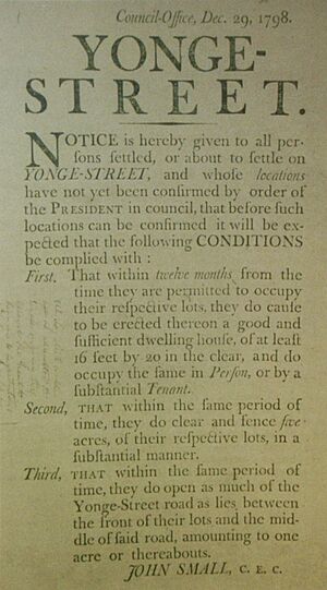
Simcoe started building the road by giving land to settlers. In return, these settlers had to clear a 33-foot wide path along the road in front of their land. The first settlers to do this were led by William Berczy in 1794. They cleared the route near Thornhill.
Work on the road continued in 1795 with the Queen's Rangers, a military group. They started at Eglinton Avenue and worked north. Farmers along the route also had to spend 12 days a year clearing logs from the road. The southern part of the road was in use by the early 1800s, and the entire road was passable by 1816.
The road was extended south from Eglinton to Bloor Street in 1796. The area south of Bloor Street was very swampy at first. Over time, the swamps were drained. In 1812, the road was extended from Queen Street to the harbor, and in 1828, the southern part was improved with gravel.
The town of Holland Landing grew up where Simcoe had hoped to build a town. Holland Landing was settled by Quakers who moved there after the American Revolution.
How Yonge Street Changed Over Time
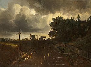
In the early days, bears were sometimes seen on Yonge Street! In 1809, a soldier named Lieutenant Fawcett even fought a bear on the street.
In 1824, work began to extend Yonge Street to Kempenfelt Bay near Barrie. This extension branched off the original Yonge Street in Holland Landing and went through Bradford before turning north towards Barrie. This part later became the only section of Highway 11, besides the original Yonge Street, to be named Yonge. The work was finished by 1827. In 1833, the government decided to improve parts of the dirt road with a method called "macadamizing" (using crushed stone).
In the past, the government asked private companies to build and maintain roads. These companies would then charge a fee, called a toll, to people using the road. This was common at the time. For example, a 13-kilometer (8-mile) stretch of Davenport Road had five tollbooths. In the 1830s, there was a tollbooth on Yonge Street near York Mills.
In 1850, James Beatty and his Toronto Road Company bought Yonge Street and other roads. But by 1863, the government took control again. In 1865, York County Council bought the road. In 1875, tolls ranged from 1 cent for a pig to 10 cents for a horse-drawn vehicle.
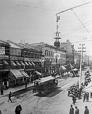
A horse-drawn streetcar line started on Yonge Street in Toronto in 1861. It ran from Scollard Street to King Street. By 1892, streetcar service in Toronto became electric.
The building of the Canadian Pacific Railway made Yonge Street less important for long-distance travel. By the 1870s, people realized that the extension of Yonge Street to Penetanguishene was no longer as crucial.
In the late 1800s, the Toronto and York Radial Railway used the side of Yonge Street to run trains all the way to Sutton, near Lake Simcoe. This railway became less popular when cars became more common. The last train ran in 1930. The space where the railway used to be was later used to make the road wider between Aurora and Newmarket.
Yonge Street Today
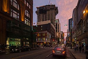
Yonge Street has changed a lot over the last 100 years. Today, it's seeing many new tall buildings that combine homes, offices, and shops. This mix of buildings and businesses brings people from all over the Greater Toronto Area together.
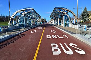
Yonge Street is a very important route for transportation and business. It is home to the Yonge-University Subway Line, which serves Toronto and Vaughan. The government is also working on extending the subway further north into Richmond Hill. North of Toronto, the Yonge Street Rapidway is a special bus lane system that helps buses move quickly. Yonge Street also has many other public transportation options, connecting people across more than 30 kilometers (18 miles).
Canada's First Subway
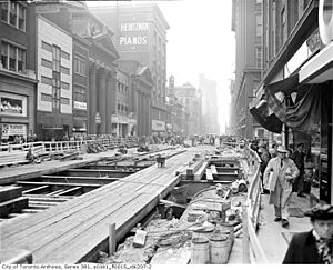
For many years, people wanted to build a subway on Yonge Street because so many people traveled north and south in downtown Toronto. After World War II, the Toronto Transit Commission (TTC) suggested building a subway line along Yonge Street from Union Station to Eglinton Avenue. Voters approved the plan in 1946, and construction began in 1949. The Yonge Subway opened in 1954 as Canada's first subway line. It cost $59 million.
The subway line has been extended several times since then. The most recent extension was to Vaughan in York Region in 2017. The line, now called Line 1 Yonge–University, is the busiest subway line in Canada.
The "Longest Street in the World" Myth
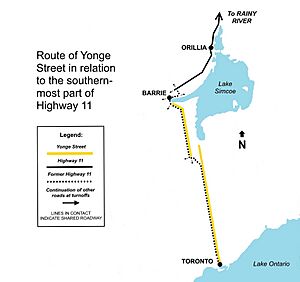
Yonge Street was once part of Ontario Highway 11. This led to the popular belief that Yonge Street was the longest street in the world. Highway 11 runs for over 1,896 kilometers (1,178 miles) through central and northern Ontario to the border with Minnesota. However, Yonge Street was never the same as the entire Highway 11.
The original Yonge Street path separates from the former Highway 11 (now York Regional 1) in East Gwillimbury. Yonge Street continues north through Holland Landing and ends near the Silver Lakes Golf and Country Club. The road that goes from Holland Landing to Bradford is not called Yonge Street. It's called Bradford Street and Holland Landing Road. The name Yonge Street only picks up again in Bradford, continuing through Innisfil until it becomes Burton Avenue in Barrie. No other part of Highway 11 further north has ever been called Yonge Street.
The Guinness World Records first listed Yonge Street as the longest street in the world in 1977. This was requested by a Toronto writer named Jay Myers. However, Guinness removed this claim in 1999, recognizing the Pan-American Highway as the world's longest road instead.
In the late 1990s, Yonge Street was officially separated from Highway 11. So, Highway 11 now starts several kilometers north of where Yonge Street ends.
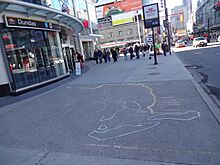
Even though Yonge Street is not the longest street, its fame as an urban myth was supported by an art installation. There was a map of its supposed long length laid out in bronze on the sidewalk at Yonge and Dundas Streets. However, this map has since been removed.
Interestingly, another street starting in Toronto, Dundas Street, might be the true longest named street in the world. It runs west from Toronto to London, Ontario, keeping the same name for most of its length.
Recent Events (2000s)
In 2008, Toronto's first pedestrian scramble (where pedestrians can cross in all directions at once) was opened at the intersection of Yonge and Dundas Streets.
On April 23, 2018, a driver intentionally hit many pedestrians on Yonge Street. This tragic event started near Finch Avenue and continued south along the sidewalks.
Yonge Street's Cultural Importance
As Toronto's main street, Yonge Street is often used for parades, street performances, and protests. After big sports victories, thousands of people gather on its downtown parts, especially near Yonge–Dundas Square, to celebrate. The street is often closed to cars during these times. This happened when the Toronto Blue Jays won the World Series in 1992 and 1993, when the Canada men's national ice hockey team won Olympic gold medals, and when the Toronto Raptors won the NBA championship in 2019.
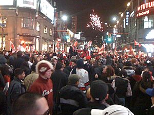
Parts of Yonge Street are also closed for other events, like an annual street festival. Famous musicians like Ricky Martin, R.E.M., Beyoncé, and John Mayer have held free concerts or autograph sessions on Yonge Street.
Five-pin bowling was invented and first played at the Toronto Bowling Club, located at Yonge and Temperance Streets.
Ken Westerfield and Jim Kenner helped introduce disc sports (like Frisbee) to Canada. They performed nightly Frisbee shows on the Yonge Street Mall between Gerrard and Dundas from 1971 to 1974.
Toronto's annual LGBTQ Pride, Orange Order, and Santa Claus parades also use Yonge Street for a large part of their routes.
Public Transportation on Yonge Street
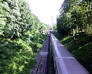
In Toronto, the eastern half of the Line 1 Yonge–University subway serves Yonge Street. It runs north from Union Station at Front Street to Finch Avenue. This subway line, which opened in 1954, is the busiest rapid transit route in Canada. There are also bus routes that run along Yonge Street, including an overnight "Blue Night" bus service when the subway is closed.
In York Region, the street is served by Viva Blue, a bus rapid transit route. This route connects to Finch station (the northern end of the subway) using the Yonge Street Rapidway. This rapidway has special bus lanes in the middle of the road. The subway is planned to be extended north to Highway 7. Viva Blue also has local bus routes that help people get around. In Holland Landing, there are also transit services. In Simcoe County, GO Transit runs a bus route along Yonge from Newmarket to Barrie. Barrie Transit also has bus routes that use parts of Yonge Street.
Yonge North Subway Extension (YNSE)
The Yonge North Subway Extension (YNSE) is a big project that will extend the TTC's Line 1 subway service. It will add about 8 kilometers (5 miles) of subway from Finch Station into York Region, reaching new downtown Richmond Hill. This extension will go through parts of Markham, Vaughan, and Richmond Hill.
Once finished, the YNSE will connect with local and GO transit services, making it easier to travel in the region. Construction for the project started in October 2022, with major work by Metrolinx beginning in Spring 2023. About 6.3 kilometers (3.9 miles) of the 8-kilometer extension will be underground tunnels. The Yonge North Subway Extension has been planned since 1994 and is a long-awaited improvement for the area.
The main public transit routes serving Yonge Street are:
Toronto (TTC):
| Route | Direction and Termini | ||||
|---|---|---|---|---|---|
| 1 | Yonge–University | SB | To Union Station (Front Street) Line continues northwest to Vaughan Metropolitan Centre station |
NB | To Finch Avenue |
| 97A | Yonge | SB | To Davisville station | NB | To York Mills station |
| 97B | Yonge | SB | To Queens Quay | NB | To York Mills station |
| 97F | Yonge | SB | To Davisville station | NB | To Steeles Avenue |
| 320 | Yonge (Blue Night) |
SB | To Queens Quay | NB | To Steeles Avenue |
York Region (YRT):
| Route | Direction and Termini | ||||
|---|---|---|---|---|---|
| Viva Blue | SB | To Finch Bus Terminal | NB | To Newmarket Bus Terminal (Davis Drive) | |
| 99 | Yonge South | SB | To Finch GO Bus Terminal | NB | To Bernard Terminal (north of Elgin Mills Road) |
| 98 | Yonge North | SB | To Bernard Terminal | NB | To Green Lane |
| 52 | Holland Landing | SB | To Newmarket Terminal | NB | To Queensville Sideroad Loops back south via other streets in Holland Landing to terminate back at the Newmarket Terminal |
Simcoe County (GO Transit):
| Route | Direction and Termini | ||||
|---|---|---|---|---|---|
| 68 | Barrie | SB | To Newmarket Terminal | NB | To Barrie Bus Terminal via Toll Gate Road |
Barrie (Barrie Transit):
| Route | Direction and Termini | ||||
|---|---|---|---|---|---|
| 8A | RVH/Yonge | SB | To Mapleview Drive Clockwise branch serves Yonge between Essa Rd. and Mapleview Dr. | NB | To Royal Victoria Hospital via off-Yonge St. routing |
| 8B | Crosstown/Essa | SB | To Mapleview Drive via off-Yonge St. routing | NB | To Royal Victoria Hospital Counterclockwise branch serves Yonge between Mapleview Dr. and Essa Rd. |
Main Road Connections
| City | Km | Mi | Road | Notes |
|---|---|---|---|---|
| Toronto | 0.0 | 0.0 | Queens Quay | |
| 0.3 | 0.1 | Road Gardiner | ||
| 0.6 | 0.4 | Front Street | ||
| 0.8 | 0.5 | King Street | ||
| 1.2 | 0.8 | Queen Street | ||
| 1.7 | 1.0 | Dundas Street | ||
| 3.3 | 2.1 | Bloor Street | ||
| 5.4 | 3.3 | St. Clair Avenue | ||
| 7.5 | 4.6 | Eglinton Avenue | ||
| 9.5 | 5.9 | Lawrence Avenue | ||
| 11.7 | 7.3 | Wilson Avenue / York Mills Road | ||
| 12.7 | 7.9 | Highway 401 exit 369 | ||
| 13.7 | 8.5 | Sheppard Avenue | ||
| 15.7 | 9.8 | Finch Avenue | ||
| Markham – Vaughan – Toronto tripoint | 17.8 | 11.1 | Steeles Avenue | |
| Vaughan – Markham boundary | 19.8 | 12.3 | Centre Street | |
| Markham – Vaughan – Richmond Hill tripoint | 21.9 | 13.6 | Road 407ETR | Highway 407 exit 77 |
| Richmond Hill | 22.1 | 13.7 | ||
| 24.0 | 14.9 | Regional Road 74 (Carrville Road / 16th Avenue) | ||
| 26.0 | 16.2 | |||
| 28.1 | 17.5 | Regional Road 49 (Elgin Mills Road) | ||
| 32.2 | 20.0 | Regional Road 14 (Stouffville Road) | ||
| 34.3 | 21.3 | |||
| Richmond Hill – Aurora boundary | 36.4 | 22.6 | Regional Road 40 (Bloomington Road) | |
| Aurora | 40.5 | 25.2 | Regional Road 15 (Wellington Street) | |
| Newmarket | 46.8 | 29.1 | ||
| East Gwillimbury | 49.88 | 31.0 | Former Highway 11 | |
| 55.3 | 34.4 | Regional Road 77 (Queensville Sideroad) | Continues north 0.2 km east along Queensville Sideroad | |
| 57.1 | 35.5 | Dead end |
See also
 In Spanish: Yonge Street para niños
- Penetanguishene Road
 | John T. Biggers |
 | Thomas Blackshear |
 | Mark Bradford |
 | Beverly Buchanan |


