Regional Municipality of York facts for kids
Quick facts for kids
York Region
|
|||
|---|---|---|---|
|
Regional municipality (upper-tier)
|
|||
| Regional Municipality of York | |||
|
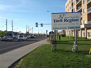
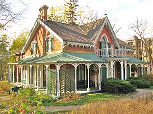
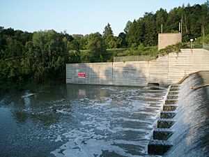
Clockwise from top left: Historic Aurora Cultural Centre, Sibbald Point Provincial Park, Vaughan Metro Centre, rural Nobleton, Markham Civic Centre, Canada's Wonderland
|
|||
|
|||
| Motto(s):
Ontario's Rising Star
|
|||
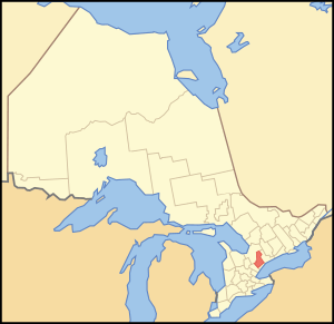
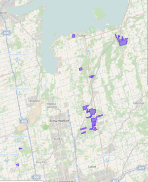
Map showing York Region's location in Ontario
|
|||
| Country | Canada | ||
| Province | Ontario | ||
| Established | 1792 (as York County) | ||
| Incorporated | 1971 (as a Regional municipality) | ||
| Seat | Newmarket | ||
| Government | |||
| • Type | Council-CEO | ||
| Area | |||
| • Total | 1,758.27 km2 (678.87 sq mi) | ||
| Population
(2021)
|
|||
| • Total | 1,173,334 | ||
| • Density | 667.3/km2 (1,728/sq mi) | ||
| Time zone | UTC-5 (Eastern (EST)) | ||
| • Summer (DST) | UTC-4 (Eastern (EDT)) | ||
| Website | www.york.ca | ||
York Region, officially known as the Regional Municipality of York, is a large area in Southern Ontario, Canada. It's located between Lake Simcoe and the city of Toronto. York Region was created in 1971, taking the place of what was once York County. It's an important part of the Greater Toronto Area and the Golden Horseshoe. The main office for the regional government is in Newmarket.
In 2021, York Region had a population of 1,173,334 people. This number grew by 5.7% since 2016. The government of Ontario expects the population to grow to over 1.5 million by 2031. The three biggest cities in York Region are Markham, Vaughan, and Richmond Hill.
Contents
History of York Region
In 1970, leaders from the towns in York County decided to create a new regional government. This new plan was introduced by Darcy McKeough, who was the Minister of Municipal Affairs for Ontario. It took about a year to figure out the new borders for the towns.
The Regional Municipality of York was officially created on January 1, 1971. This happened because of a special law passed by the Legislative Assembly of Ontario. When York Region was formed, the fourteen old towns and villages of York County were combined into nine new ones.
Here's how the new towns were created in 1971:
| New Town | What it was made from | Villages that were combined |
|---|---|---|
| Town of Aurora | Old Town of Aurora, plus parts of King and Whitchurch | |
| Town of East Gwillimbury | Part of the old Township of East Gwillimbury |
|
| Town of Georgina | Old Townships of Georgina and North Gwillimbury, and the Village of Sutton | |
| Township of King | Part of the old Township of King |
|
| City of Markham | Old Town of Markham, plus part of the Township of Markham |
|
| Town of Newmarket | Old Town of Newmarket, plus parts of East Gwillimbury, King, and Whitchurch | |
| City of Richmond Hill | Old City of Richmond Hill, plus parts of King, Markham, Vaughan, and Whitchurch | |
| City of Vaughan | Old Village of Woodbridge, plus parts of King and Vaughan |
|
| Town of Whitchurch–Stouffville | Old Village of Stouffville, plus parts of Markham and Whitchurch |
The towns of Aurora, Newmarket, and Richmond Hill were chosen to be the main "growth centres" for the new region. The idea was for York Region to be a greenbelt area. This would be a natural space between the busy cities of Toronto to the south and Barrie to the north.
Electricity and Police Services
When York Region was formed, the way electricity was provided changed. Different areas had different companies providing power. Over time, these services were combined to make things simpler.
The York Regional Police force was also created at this time. It brought together fourteen smaller police services from the towns and villages. This helped to provide better policing across the whole region.
Geography and Nature
York Region covers about 1,762 square kilometers. It stretches from Lake Simcoe in the north down to the city of Toronto in the south. To the east, it shares a border with Durham Region. To the west, it borders Peel Region, and Simcoe County is to the northwest.
The towns and cities you'll find in York Region are:
- Town of Aurora
- Town of East Gwillimbury
- Town of Georgina
- Township of King
- City of Markham
- Town of Newmarket
- City of Richmond Hill
- City of Vaughan
- Town of Whitchurch–Stouffville
There is also one First Nation community here. The Chippewas of Georgina Island First Nation live on Georgina Island, Fox Island, and Snake Island.
York Region has a mix of landscapes. You can find farmlands, wetlands, and kettle lakes. It also includes the Oak Ridges Moraine and over 2,070 hectares of regional forest. The highest point in the region is on the Oak Ridges Moraine, reaching about 360 meters (1,243 feet) above sea level.
Weather and Climate
York Region has a humid continental climate. This means it has warm summers and cold winters. There's usually a good amount of snowfall, especially in the northern parts. This snow often comes from "snowbelt streamer activity," which is wind-driven snow.
| Climate data for Markham (Buttonville at Toronto Buttonville Airport) WMO ID: 71639; coordinates 43°51′44″N 79°22′12″W / 43.86222°N 79.37000°W; elevation: 198.1 m (650 ft); 1981–2010 normals |
|||||||||||||
|---|---|---|---|---|---|---|---|---|---|---|---|---|---|
| Month | Jan | Feb | Mar | Apr | May | Jun | Jul | Aug | Sep | Oct | Nov | Dec | Year |
| Record high humidex | 16.0 | 14.4 | 29.2 | 35.7 | 41.0 | 44.6 | 50.9 | 47.4 | 43.6 | 37.8 | 24.9 | 20.6 | 50.9 |
| Record high °C (°F) | 14.9 (58.8) |
14.9 (58.8) |
26.0 (78.8) |
31.7 (89.1) |
34.6 (94.3) |
36.6 (97.9) |
37.2 (99.0) |
37.8 (100.0) |
34.4 (93.9) |
31.0 (87.8) |
22.1 (71.8) |
18.0 (64.4) |
37.8 (100.0) |
| Mean daily maximum °C (°F) | −1.5 (29.3) |
−0.9 (30.4) |
4.5 (40.1) |
12.1 (53.8) |
19.1 (66.4) |
24.6 (76.3) |
27.1 (80.8) |
26.0 (78.8) |
21.5 (70.7) |
14.1 (57.4) |
7.2 (45.0) |
0.9 (33.6) |
12.9 (55.2) |
| Daily mean °C (°F) | −5.8 (21.6) |
−5.6 (21.9) |
−0.4 (31.3) |
6.7 (44.1) |
13.0 (55.4) |
18.6 (65.5) |
21.2 (70.2) |
20.2 (68.4) |
15.7 (60.3) |
8.9 (48.0) |
3.1 (37.6) |
−2.9 (26.8) |
7.7 (45.9) |
| Mean daily minimum °C (°F) | −10.1 (13.8) |
−10.2 (13.6) |
−5.3 (22.5) |
1.2 (34.2) |
6.8 (44.2) |
12.6 (54.7) |
15.2 (59.4) |
14.3 (57.7) |
9.9 (49.8) |
3.6 (38.5) |
−1.1 (30.0) |
−6.8 (19.8) |
2.5 (36.5) |
| Record low °C (°F) | −35.2 (−31.4) |
−25.7 (−14.3) |
−25.6 (−14.1) |
−10.1 (13.8) |
−2.1 (28.2) |
1.9 (35.4) |
6.9 (44.4) |
4.2 (39.6) |
−2.0 (28.4) |
−7.4 (18.7) |
−15.0 (5.0) |
−26.0 (−14.8) |
−35.2 (−31.4) |
| Record low wind chill | −42.6 | −37.4 | −35.6 | −18.6 | −4.4 | 0.0 | 0.0 | 0.0 | −4.2 | −8.8 | −23.9 | −36.6 | −42.6 |
| Average precipitation mm (inches) | 62.1 (2.44) |
50.5 (1.99) |
53.2 (2.09) |
74.1 (2.92) |
79.6 (3.13) |
82.8 (3.26) |
79.0 (3.11) |
76.2 (3.00) |
81.8 (3.22) |
68.0 (2.68) |
80.0 (3.15) |
65.7 (2.59) |
852.9 (33.58) |
| Average rainfall mm (inches) | 26.0 (1.02) |
22.9 (0.90) |
33.6 (1.32) |
66.7 (2.63) |
79.5 (3.13) |
82.8 (3.26) |
78.8 (3.10) |
76.2 (3.00) |
81.8 (3.22) |
66.7 (2.63) |
68.3 (2.69) |
34.2 (1.35) |
717.4 (28.24) |
| Average snowfall cm (inches) | 38.9 (15.3) |
29.9 (11.8) |
19.3 (7.6) |
7.5 (3.0) |
0.1 (0.0) |
0.0 (0.0) |
0.0 (0.0) |
0.0 (0.0) |
0.0 (0.0) |
0.6 (0.2) |
12.1 (4.8) |
34.2 (13.5) |
142.6 (56.1) |
| Average precipitation days (≥ 0.2 mm) | 16.7 | 12.9 | 12.0 | 12.3 | 12.0 | 11.8 | 11.2 | 9.9 | 10.8 | 13.2 | 14.5 | 15.3 | 152.7 |
| Average rainy days (≥ 0.2 mm) | 5.8 | 3.8 | 6.7 | 10.8 | 12.0 | 11.8 | 11.2 | 9.9 | 10.8 | 13.0 | 11.3 | 6.6 | 113.7 |
| Average snowy days (≥ 0.2 cm) | 13.4 | 10.8 | 7.0 | 2.9 | 0.13 | 0.0 | 0.0 | 0.0 | 0.0 | 0.48 | 4.7 | 10.8 | 50.2 |
| Average relative humidity (%) (at 1500 LST) | 69.6 | 64.0 | 57.8 | 52.9 | 52.3 | 53.9 | 53.4 | 55.9 | 59.2 | 62.4 | 68.9 | 71.1 | 60.1 |
| Source: Environment and Climate Change Canada | |||||||||||||
| Climate data for Richmond Hill Climate ID: 6157012; coordinates 43°52′38″N 79°26′52″W / 43.87722°N 79.44778°W; elevation: 240 m (790 ft); 1981–2010 normals |
|||||||||||||
|---|---|---|---|---|---|---|---|---|---|---|---|---|---|
| Month | Jan | Feb | Mar | Apr | May | Jun | Jul | Aug | Sep | Oct | Nov | Dec | Year |
| Record high °C (°F) | 14.5 (58.1) |
14.5 (58.1) |
25.5 (77.9) |
31.0 (87.8) |
34.5 (94.1) |
35.0 (95.0) |
37.0 (98.6) |
37.0 (98.6) |
34.4 (93.9) |
29.4 (84.9) |
23.3 (73.9) |
20.0 (68.0) |
37.0 (98.6) |
| Mean daily maximum °C (°F) | −2.2 (28.0) |
−0.6 (30.9) |
4.4 (39.9) |
12.1 (53.8) |
19.0 (66.2) |
24.2 (75.6) |
26.8 (80.2) |
25.6 (78.1) |
20.9 (69.6) |
13.7 (56.7) |
6.7 (44.1) |
0.8 (33.4) |
12.6 (54.7) |
| Daily mean °C (°F) | −6.2 (20.8) |
−4.9 (23.2) |
−0.3 (31.5) |
6.9 (44.4) |
13.3 (55.9) |
18.7 (65.7) |
21.4 (70.5) |
20.3 (68.5) |
15.9 (60.6) |
9.1 (48.4) |
3.1 (37.6) |
−2.7 (27.1) |
7.9 (46.2) |
| Mean daily minimum °C (°F) | −10.2 (13.6) |
−9.1 (15.6) |
−5 (23) |
1.7 (35.1) |
7.7 (45.9) |
13.1 (55.6) |
15.9 (60.6) |
15.1 (59.2) |
10.8 (51.4) |
4.5 (40.1) |
−0.5 (31.1) |
−6.1 (21.0) |
3.2 (37.8) |
| Record low °C (°F) | −32.5 (−26.5) |
−29 (−20) |
−27 (−17) |
−15 (5) |
−5.6 (21.9) |
0.6 (33.1) |
4.4 (39.9) |
3.0 (37.4) |
−3.3 (26.1) |
−7.8 (18.0) |
−15.5 (4.1) |
−30 (−22) |
−32.5 (−26.5) |
| Average precipitation mm (inches) | 62.3 (2.45) |
58.0 (2.28) |
58.8 (2.31) |
70.1 (2.76) |
81.6 (3.21) |
80.2 (3.16) |
83.5 (3.29) |
89.2 (3.51) |
88.4 (3.48) |
69.1 (2.72) |
87.2 (3.43) |
66.8 (2.63) |
895.2 (35.24) |
| Average rainfall mm (inches) | 25.2 (0.99) |
26.3 (1.04) |
33.6 (1.32) |
62.5 (2.46) |
81.5 (3.21) |
80.2 (3.16) |
83.5 (3.29) |
89.2 (3.51) |
88.4 (3.48) |
67.6 (2.66) |
73.5 (2.89) |
33.1 (1.30) |
744.6 (29.31) |
| Average snowfall cm (inches) | 37.1 (14.6) |
31.7 (12.5) |
25.2 (9.9) |
7.6 (3.0) |
0.1 (0.0) |
0.0 (0.0) |
0.0 (0.0) |
0.0 (0.0) |
0.0 (0.0) |
1.5 (0.6) |
13.7 (5.4) |
33.7 (13.3) |
150.6 (59.3) |
| Average precipitation days (≥ 0.2 mm) | 18.3 | 13.9 | 14.4 | 13.6 | 13.6 | 11.9 | 11.3 | 11.2 | 12.4 | 13.4 | 15.2 | 16.2 | 165.2 |
| Average rainy days (≥ 0.2 mm) | 4.9 | 4.3 | 7.4 | 11.7 | 13.6 | 11.9 | 11.3 | 11.2 | 12.4 | 13.3 | 11.4 | 7.0 | 120.2 |
| Average snowy days (≥ 0.2 cm) | 15.3 | 11.3 | 9.0 | 3.2 | 0.12 | 0.0 | 0.0 | 0.0 | 0.0 | 0.62 | 5.3 | 11.6 | 56.5 |
| Source: Environment and Climate Change Canada | |||||||||||||
| Climate data for Stouffville 1971–2000 | |||||||||||||
|---|---|---|---|---|---|---|---|---|---|---|---|---|---|
| Month | Jan | Feb | Mar | Apr | May | Jun | Jul | Aug | Sep | Oct | Nov | Dec | Year |
| Record high °C (°F) | 11.0 (51.8) |
13.5 (56.3) |
23.0 (73.4) |
30.5 (86.9) |
32.0 (89.6) |
34.0 (93.2) |
35.5 (95.9) |
36.5 (97.7) |
32.8 (91.0) |
25.5 (77.9) |
22.8 (73.0) |
18.0 (64.4) |
36.5 (97.7) |
| Mean daily maximum °C (°F) | −3.2 (26.2) |
−2.4 (27.7) |
3.1 (37.6) |
11.1 (52.0) |
18.5 (65.3) |
23.1 (73.6) |
26.2 (79.2) |
24.7 (76.5) |
19.9 (67.8) |
12.8 (55.0) |
6.0 (42.8) |
−0.6 (30.9) |
11.6 (52.9) |
| Mean daily minimum °C (°F) | −11.6 (11.1) |
−10.9 (12.4) |
−5.7 (21.7) |
1.2 (34.2) |
7.4 (45.3) |
11.8 (53.2) |
14.8 (58.6) |
14 (57) |
9.6 (49.3) |
3.5 (38.3) |
−1.0 (30.2) |
−7.7 (18.1) |
2.1 (35.8) |
| Record low °C (°F) | −35.5 (−31.9) |
−28.3 (−18.9) |
−28.0 (−18.4) |
−17.0 (1.4) |
−3.3 (26.1) |
0.0 (32.0) |
7.0 (44.6) |
2.5 (36.5) |
−2.0 (28.4) |
−7.2 (19.0) |
−15.0 (5.0) |
−31.5 (−24.7) |
−35.5 (−31.9) |
| Average precipitation mm (inches) | 52.8 (2.08) |
53.5 (2.11) |
62.8 (2.47) |
65.5 (2.58) |
81.2 (3.20) |
73.3 (2.89) |
75.8 (2.98) |
99.3 (3.91) |
79.2 (3.12) |
81.2 (3.20) |
78.5 (3.09) |
65.6 (2.58) |
868.6 (34.20) |
| Average rainfall mm (inches) | 17.9 (0.70) |
23.3 (0.92) |
43.5 (1.71) |
60.5 (2.38) |
81.1 (3.19) |
73.3 (2.89) |
75.8 (2.98) |
99.3 (3.91) |
79.2 (3.12) |
80.6 (3.17) |
70.3 (2.77) |
33.0 (1.30) |
737.7 (29.04) |
| Average snowfall cm (inches) | 34.9 (13.7) |
30.2 (11.9) |
19.3 (7.6) |
5.0 (2.0) |
0.1 (0.0) |
0.0 (0.0) |
0.0 (0.0) |
0.0 (0.0) |
0.0 (0.0) |
0.6 (0.2) |
8.2 (3.2) |
32.7 (12.9) |
131.0 (51.6) |
| Average precipitation days (≥ 0.2 mm) | 11.0 | 10.3 | 10.1 | 10.8 | 11.0 | 10.7 | 9.2 | 10.8 | 10.4 | 13.0 | 12.6 | 12.3 | 131.9 |
| Average rainy days (≥ 0.2 mm) | 2.9 | 3.1 | 6.2 | 9.8 | 11.0 | 10.7 | 9.2 | 10.8 | 10.4 | 13.0 | 10.7 | 5.1 | 102.6 |
| Average snowy days (≥ 0.2 cm) | 8.4 | 7.7 | 4.7 | 1.2 | 0.1 | 0.0 | 0.0 | 0.0 | 0.0 | 0.2 | 2.6 | 8.3 | 33.1 |
| Source: Environment Canada | |||||||||||||
| Climate data for Vaughan 1981–2010 (Woodbridge) | |||||||||||||
|---|---|---|---|---|---|---|---|---|---|---|---|---|---|
| Month | Jan | Feb | Mar | Apr | May | Jun | Jul | Aug | Sep | Oct | Nov | Dec | Year |
| Record high °C (°F) | 17.0 (62.6) |
15.5 (59.9) |
26.5 (79.7) |
31.5 (88.7) |
33.0 (91.4) |
36.0 (96.8) |
39.0 (102.2) |
37.2 (99.0) |
36.1 (97.0) |
30.6 (87.1) |
25.0 (77.0) |
19.5 (67.1) |
39.0 (102.2) |
| Mean daily maximum °C (°F) | −2.5 (27.5) |
−0.5 (31.1) |
4.3 (39.7) |
12.0 (53.6) |
18.8 (65.8) |
24.1 (75.4) |
26.9 (80.4) |
25.4 (77.7) |
20.9 (69.6) |
13.9 (57.0) |
6.9 (44.4) |
0.8 (33.4) |
12.6 (54.7) |
| Daily mean °C (°F) | −6.6 (20.1) |
−4.8 (23.4) |
−0.4 (31.3) |
6.6 (43.9) |
12.9 (55.2) |
18.1 (64.6) |
20.8 (69.4) |
19.6 (67.3) |
15.4 (59.7) |
9.0 (48.2) |
3.1 (37.6) |
−2.8 (27.0) |
7.6 (45.7) |
| Mean daily minimum °C (°F) | −10.7 (12.7) |
−9.2 (15.4) |
−5.2 (22.6) |
1.2 (34.2) |
6.8 (44.2) |
12.0 (53.6) |
14.7 (58.5) |
13.8 (56.8) |
9.8 (49.6) |
4.0 (39.2) |
−0.8 (30.6) |
−6.4 (20.5) |
2.5 (36.5) |
| Record low °C (°F) | −34.5 (−30.1) |
−30.0 (−22.0) |
−29.4 (−20.9) |
−17.2 (1.0) |
−6.7 (19.9) |
−1.7 (28.9) |
2.8 (37.0) |
−0.6 (30.9) |
−5.0 (23.0) |
−11.7 (10.9) |
−18.3 (−0.9) |
−30.0 (−22.0) |
−34.5 (−30.1) |
| Average precipitation mm (inches) | 50.3 (1.98) |
44.2 (1.74) |
49.2 (1.94) |
63.3 (2.49) |
79.1 (3.11) |
76.3 (3.00) |
70.4 (2.77) |
80.4 (3.17) |
84.6 (3.33) |
66.5 (2.62) |
78.3 (3.08) |
57.4 (2.26) |
799.8 (31.49) |
| Average rainfall mm (inches) | 20.4 (0.80) |
23.2 (0.91) |
31.4 (1.24) |
59.6 (2.35) |
79.1 (3.11) |
76.3 (3.00) |
70.4 (2.77) |
80.4 (3.17) |
84.6 (3.33) |
66.0 (2.60) |
71.1 (2.80) |
34.6 (1.36) |
697.0 (27.44) |
| Average snowfall cm (inches) | 29.9 (11.8) |
21.1 (8.3) |
17.8 (7.0) |
3.7 (1.5) |
0.0 (0.0) |
0.0 (0.0) |
0.0 (0.0) |
0.0 (0.0) |
0.0 (0.0) |
0.45 (0.18) |
7.2 (2.8) |
22.8 (9.0) |
102.8 (40.5) |
| Average precipitation days (≥ 0.2 mm) | 13.5 | 10.3 | 10.7 | 11.8 | 12.0 | 10.8 | 9.5 | 9.6 | 10.6 | 12.7 | 13.1 | 12.8 | 137.4 |
| Average rainy days (≥ 0.2 mm) | 4.2 | 4.4 | 6.4 | 10.7 | 12.0 | 10.8 | 9.5 | 9.6 | 10.6 | 12.6 | 11.1 | 6.5 | 108.3 |
| Average snowy days (≥ 0.2 cm) | 10.2 | 6.8 | 5.1 | 1.5 | 0.0 | 0.0 | 0.0 | 0.0 | 0.0 | 0.23 | 3.0 | 7.5 | 34.3 |
| Source: Environment Canada | |||||||||||||
Economy and Shopping
York Region has a very varied economy. It includes everything from factories to high-tech companies and even farms. New buildings and businesses are always popping up, especially along the Yonge Street area. This area stretches from Vaughan and Richmond Hill in the south to Newmarket and Aurora in the north.
Sometimes, there are disagreements between people who want to protect nature and those who want to build new things. The biggest debate is often about how to use the land on the Oak Ridges Moraine.
Shopping Centers
York Region has many large shopping centers where you can find all sorts of stores:
- Aurora North Smart Centre (Aurora)
- Hillcrest Mall (Richmond Hill)
- Green Lane Centre (East Gwillimbury)
- King Square Shopping Mall (Markham)
- Markville Shopping Centre (Markham)
- Pacific Mall (Markham)
- The Promenade Shopping Centre (Vaughan)
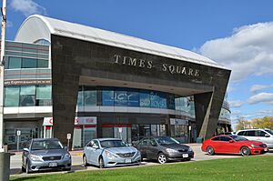
- Times Square (Richmond Hill)
- Langham Square (Markham)
- Upper Canada Mall (Newmarket)
- Woodside Mall (Markham)
- Vaughan Mills (Vaughan)
- First Markham Place (Markham)
People and Languages
In the 2021 Canadian census, about 45.5% of people in York Region said English was their first language. Other common first languages include Cantonese (9.7%), Mandarin (8.7%), Italian (4.0%), Persian (4.4%), and Russian (3.1%).
Ethnic Backgrounds
As of 2021, the most common ethnic groups in York Region are Chinese (22.6%), Italian (12.5%), and English (7.4%).
| Ethnic origin (2021) | Population | Percentage |
|---|---|---|
| Chinese | 263,900 | 22.6 |
| Italian | 145,695 | 12.5 |
| English | 86,435 | 7.4 |
| Canadian | 75,990 | 6.5 |
| Irish | 66,465 | 5.7 |
| Scottish | 65,430 | 5.6 |
| East Indian | 57,990 | 5.0 |
| Iranian | 43,545 | 3.7 |
| Jewish | 38,670 | 3.3 |
| Russian | 36,780 | 3.2 |
| German | 32,175 | 2.8 |
| Filipino | 28,590 | 2.5 |
| French | 27,845 | 2.4 |
| Polish | 24,470 | 2.1 |
| Ukrainian | 21,095 | 1.8 |
Religions in York Region
According to the 2021 census, the most common religion in York Region is Christianity (45.3%). Within Christianity, Catholicism is the largest group (25.2%). Other religions include Islam (7.8%), Judaism (5.2%), Hinduism (5.0%), Buddhism (2.6%), and Sikhism (1.0%). About 32.5% of the people in York Region do not identify with any particular religion.
Getting Around York Region
York Region has a network of main roads that mostly run north-south or east-west. These roads are called York Regional Roads and are maintained by the region. They have numbers to help you find your way.
Major highways in the region include:
- Highway 7 (east-west)
- Highway 9 (east-west)
- Highway 48 (north-south)
- Highway 400 (north-south)
- Highway 404 (north-south)
- Highway 407 (east-west)
- Highway 427 (north-south)
Airports and Flying
Most people flying to or from York Region use Toronto Pearson International Airport. This is Canada's largest airport and is located just outside York Region. There are also smaller airports in the region, like Markham Airport, which is private. Other small airports include Hare Field, Belhaven Airport, and Stouffville Aerodrome.
Buttonville Municipal Airport was a larger airport in Markham used for private and business planes. It closed in November 2023.
Public Transportation
You can get around York Region using several public transit services:
- York Region Transit (YRT): This includes the Viva bus network.
- GO Transit: Offers both bus and train services.
- Toronto Transit Commission (TTC): Some TTC bus routes cross into York Region from Toronto. The Line 1 Yonge-University subway line also reaches Central Vaughan. There are plans to extend the Yonge Street part of this line further into York Region.
Before 2001, each town in York Region had its own bus service, which made it hard to travel between towns. YRT was created to combine five of these services. This made it much easier for people to get around the entire region.
Water Supply
Water in southern York Region comes from Lake Ontario. It is supplied by Toronto Water and Peel Region. This water is moved through pumping stations and stored in reservoirs. Towns like Keswick and Sutton get their water from Lake Simcoe. Other parts of York Region get water from a mix of Lake Ontario and underground wells. Some wells are managed by the region, while others are private.
Water is sent out from 14 pumping stations and stored in 37 elevated tanks and reservoirs.
Education and Learning
York Region has four main public school boards. These boards run elementary and high schools.
- Conseil scolaire catholique MonAvenir (CSCM) and Conseil scolaire Viamonde (CSV) are French-language school boards.
- The York Catholic District School Board (YCDSB) and the York Region District School Board (YRDSB) are English-language school boards.
The YRDSB is the largest school board in the region. It has 175 elementary schools and 33 high schools. The YCDSB has 83 elementary schools and 15 high schools.
Besides public schools, there are also many private and religious schools in York Region. Some examples include:
- As-Sadiq Islamic School (Vaughan)
- Academy for Gifted Children (Richmond Hill)
- Country Day School (King)
- Holy Trinity School (Richmond Hill)
- Leo Baeck Day School (Vaughan)
- Pickering College (Newmarket)
- St. Andrew's College (Aurora)
- St. Thomas of Villanova College (King)
- Town Centre Montessori Private School (Markham)
For older students, York Region has post-secondary schools like Seneca Polytechnic. Seneca has two campuses in York Region, located in King and Markham. While there isn't a university yet, a new Markham campus for York University is currently being built.
News and Media
York Region has its own local news sources, including:
- York Region Media Group
- CKVR - CTV Two (from Barrie)
- CFU758 - 90.7 RAV FM (Vaughan)
- CKDX 88.5FM - Foxy 88-5 (Newmarket)
- CFMS-FM - 105.9 The Region (Markham)
- CIWS-FM - WhiStle Community Radio Whitchurch–Stouffville
People in York Region also get news from media outlets based in Toronto.
Fun Places to Visit
York Region has many interesting places to visit. These range from nature spots to old museums and even a modern amusement park.
In Vaughan, you can visit the McMichael Canadian Art Collection. This museum in Kleinburg shows art by Canadian artists, including Inuit and First Nations artists. Canada's Wonderland is also in Vaughan. It's a big amusement park with roller coasters, rides, concerts, and fireworks.
Here are some historical sites and museums in the region:
- Hillary House National Historic Site (Aurora)
- Historic Main Street Newmarket (Newmarket)
- Georgina Military Museum (Georgina)
- Georgina Village Museum (Georgina)
- King Township Museum (King)
- Markham Museum (Markham)
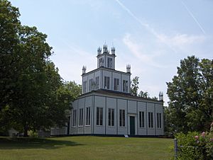
- Sharon Temple National Historic Site (East Gwillimbury)
- Whitchurch-Stouffville Museum (Whitchurch–Stouffville)
- York-Durham Heritage Railway (Whitchurch–Stouffville)
Other fun attractions in the area include:
- Applewood Farm Winery (Whitchurch–Stouffville)
- Canadian Heritage Humber River
- Fred Varley Art Gallery (Markham)
- Canada's Wonderland (Vaughan)
- Oak Ridges Trail
- Puck's Farm (King)
- Richmond Hill Centre for the Performing Arts
- Sutton-Zephyr Trail
- Willow Springs Winery (Whitchurch–Stouffville)
- Words Alive Literary Festival (East Gwillimbury)
- York Demonstration Forest (Whitchurch–Stouffville)
Protected Natural Areas
York Region has many protected natural areas where you can enjoy the outdoors:
- Baker Sugarbush Conservation Area
- Boyd Conservation Area
- Bruce's Mill Conservation Area
- Duclos Point Provincial Nature Reserve
- Gold Creek Conservation Area
- Holland Landing Prairie Provincial Nature Reserve
- Kortright Centre for Conservation
- Lake St. George Conservation Area
- Mabel Davis Conservation Area
- Milne Park
- Pickering Lands Preservation Site
- Rogers Reservoir Conservation Area
- Sheppards Bush Conservation Area
- Sibbald Point Provincial Park
- Thornton Bales King Conservation Area
- Wesley Brooks Memorial Conservation Area (also known as "Fairy Lake")
- Whitchurch Conservation Area
- Willow Beach Conservation Area
Sister City
York Region has a "Twinning Agreement" with the city of Omsk in Russia. This agreement was signed on August 28, 1997, after they had a "Friendship Agreement" a year before.
See also
 In Spanish: Municipio Regional de York para niños
 | James B. Knighten |
 | Azellia White |
 | Willa Brown |


