Whitchurch-Stouffville facts for kids
Quick facts for kids
Whitchurch-Stouffville
|
|||||
|---|---|---|---|---|---|
| Town of Whitchurch-Stouffville | |||||
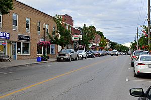
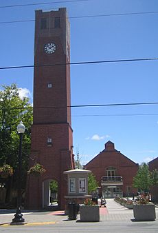
Main Street, Whitchurch–Stouffville
|
|||||
|
|||||
| Motto(s):
Country close to the city.
|
|||||
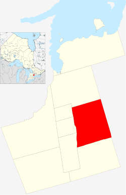
Location of Whitchurch–Stouffville within York Region
|
|||||
| Country | Canada | ||||
| Province | Ontario | ||||
| Regional municipality | York | ||||
| Incorporated | Township of Whitchurch 1792 | ||||
| Incorporated | Village of Stouffville 1877 | ||||
| Amalgamation | January 1, 1971 | ||||
| Government | |||||
| • Type | Municipality | ||||
| Area | |||||
| • Total | 206.42 km2 (79.70 sq mi) | ||||
| Elevation | 239 m (784 ft) | ||||
| Population
(2021)
|
|||||
| • Total | 49,864 | ||||
| • Density | 241.6/km2 (626/sq mi) | ||||
| • Growth | +8.8% (2,016–2,021) | ||||
| Time zone | UTC−05:00 (EST) | ||||
| • Summer (DST) | UTC−04:00 (EDT) | ||||
| Forward sortation area |
L0H (Gormley)
L4A (Stouffville, Vandorf) L0G (Cedar Valley) |
||||
| Area code(s) | 905, 289, and 365 | ||||
| Highways | Highway 48 Highway 404 |
||||
| Website | www.townofws.ca | ||||
Whitchurch-Stouffville is a town in Ontario, Canada. It's part of the Greater Toronto Area, about 50 kilometers (31 miles) north of downtown Toronto. The town covers about 206 square kilometers (80 square miles). It sits on the Oak Ridges Moraine, which is an important natural area. Since 1993, the town's motto has been "country close to the city."
The town's borders are Davis Drive to the north, York-Durham Line to the east, and Highway 404 to the west. The southern border is a bit uneven because some land from Markham Township was added in 1971.
Between 2011 and 2021, the town grew by 32.8%. The number of homes increased a lot, with an average of 3.0 people living in each home. The town expects to grow even more in the future. New laws like the Oak Ridges Moraine Conservation Act (2001) help protect the environment and stop too much building on sensitive land.
Contents
Communities in Whitchurch-Stouffville
The Town of Whitchurch-Stouffville is made up of several different communities and the countryside in between. The biggest urban area is Stouffville itself, with over 36,000 people in 2021.
Other communities in the town include:
- Ballantrae
- Bethesda
- Bloomington
- Cedar Valley
- Gormley
- Lemonville
- Lincolnville
- Musselman's Lake
- Pine Orchard
- Pleasantville
- Preston Lake
- Ringwood
- Vandorf
- Vivian
- Wesley Corners
History of Whitchurch-Stouffville
The oldest human items found in Whitchurch Township are from 1500 BC. They were discovered in the hamlet of Ringwood. Before Europeans arrived, two Native trails crossed this area. These trails were used by Indigenous people and early traders to travel through the dense forests from Lake Ontario to Lake Simcoe. Several Native villages were located here, including those of the Iroquoian peoples.
In 2003, a large Huron village from the 16th century was found in Stouffville during land development. About 2000 people lived there between 1578 and 1623. The village had a palisade (a fence of strong posts) protecting more than 70 longhouses. Tens of thousands of artifacts were found at this site, known as the Mantle Site.
In 2012, archaeologists found a European iron axehead at the site. It is believed to be from the Basque people. This is the earliest European iron piece ever found in the North American interior.
Early European Settlement
The British Crown bought the western part of Whitchurch and Markham townships from the Mississaugas of the New Credit First Nation in 1787. Whitchurch Township was created in 1792. It was named after a village in England where the family of Elizabeth Simcoe lived. She was the wife of Sir John Graves Simcoe, the first Lieutenant Governor of Upper Canada. The first European settlements in Whitchurch Township began in the 1790s.
Between 1800 and 1802, John Stegman surveyed the township. This created a system of land distribution to settlers. Each section had five 200-acre lots. This layout can still be seen today in the road network.
Early settlers included Quakers and Mennonites. These groups came from the United States looking for religious freedom. The government of Upper Canada wanted people with skills to help build new communities.
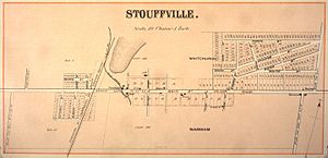
Many early settlements grew at road crossings or near streams where mills could be built. Stoufferville was one such place. It grew around the mills of Abraham Stouffer, a Mennonite who moved from Pennsylvania in 1804. He bought 600 acres of land. His sawmill started in 1817, and a gristmill (for grinding grain) opened by 1825.
In the early 1830s, the old Stouffville Road was built to connect York (now Toronto) with Brock Township. A post office opened in 1832, and the name Stouffville became official. Stouffville was known for its "Radical opinion" and was a place where William Lyon Mackenzie planned the Upper Canada Rebellion of 1837–38.
Stouffville grew quickly in the 1840s. By 1849, it had a doctor, stores, taverns, and various tradespeople. The population reached 866 by 1881. Other hamlets like Ballantrae, Bloomington, Gormley, Lemonville, and Ringwood also grew.
Growth and Challenges
In 1877, Stouffville became an official village. Its growth was helped by the Toronto and Nipissing Railway, built in 1871. This railway connected Stouffville and Uxbridge with Toronto. Soon, "Stouffville Junction" had thirty trains a day. This brought prosperity, and businesses like R.J. Daley built a music hall and a curling rink. By 1911, Stouffville had a public library, banks, and newspapers.
Intensive forestry (cutting down trees) in Whitchurch Township led to a lot of deforestation. By 1910, only 7% of the township was wooded. This caused erosion and other environmental problems. Efforts to plant new trees (reforestation) began, and the Reforestation Act (1911) helped restore these areas. Vivian Forest, a large conservation area, was created in 1924 for this purpose. This helped restore the soil's ability to hold water and reduce floods and droughts. Today, the town has over 62 square kilometers (24 square miles) of protected forest.
After the forest industry declined, growth in the hamlets slowed. However, the population started to grow again in the 1970s as people moved from Metropolitan Toronto. This led to changes in how local governments were run. On January 1, 1971, Whitchurch Township and the Village of Stouffville merged to form the Town of Whitchurch-Stouffville. The combined population was 11,487.
Whitchurch-Stouffville adopted its coat of arms in 1973. The dove of peace represents the early Quaker and Mennonite settlers. The British Union banner honors the United Empire Loyalists. The white church symbolizes Whitchurch, and the star and chalice come from the Stouffer family's coat of arms.
In the 1980s, there were concerns about waste disposal sites affecting the town's water supply. Local groups worked hard to get these sites closed, and the main site was ordered to close in 1983. This led to a greater focus on protecting the environment and water quality.
With new commuter train service in the 1990s and improved water systems, Whitchurch-Stouffville began to change significantly. Protecting land and water, and welcoming new residents, are important goals for the town's future.
A big challenge for Whitchurch-Stouffville is the possible development of an international airport south-east of the town. This could affect local communities with planes flying overhead. Studies are ongoing to determine the best way forward.
In late 2019, the Town decided to use "Town of Stouffville" on signs for "branding" reasons, but the official name remains Whitchurch-Stouffville.
Geography and Environment
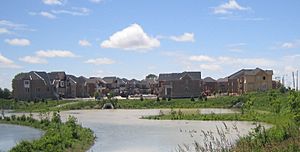
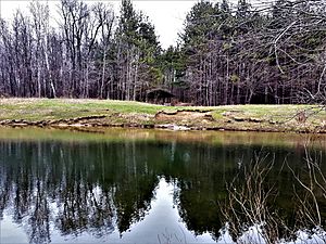
Most of Whitchurch-Stouffville is located on the Oak Ridges Moraine. This moraine is made of hills formed by glacial debris (sand and gravel) left behind by melting glaciers thousands of years ago. Some deep, water-filled holes called kettle lakes were also formed when buried ice blocks melted. Preston Lake, Van Nostrand Lake, and Musselman Lake are examples of these.
The town has a watershed divide. Streams in the northern part of the moraine flow north into Lake Simcoe. Streams in the southern parts (south of Bloomington Road) form the beginnings of the Rouge River and Duffins Creek, which flow into Lake Ontario. Protecting these headwaters and planting more trees is important for the environment. The heavily wooded Vivian Infiltration Area helps groundwater enter the Oak Ridges aquifer (underground water source).
The northwestern part of Whitchurch-Stouffville is outside the moraine. It's a flat area with good farmland. The southernmost part of the town, west of Highway 48, is a clay-loam plain.
Local Trees and Water
Many types of trees grow naturally in Whitchurch-Stouffville, including:
- American Mountain Ash
- Balsam Fir
- Bitternut Hickory
- Black Cherry
- Black Spruce
- Bur Oak
- Eastern Hemlock
- Eastern White Cedar
- Peachleaf Willow
- Pin Cherry
- Red Oak
- Red Maple
- Red Pine
- Shagbark Hickory
- Silver Maple
- Sugar Maple
- Tamarack
- Trembling Aspen
- White Birch
- White Oak
- White Pine
- White Spruce
In 2012, about 28.9% of Whitchurch-Stouffville was covered by forest.
The town's water comes from both underground wells (aquifers) and from Lake Ontario. The well water is treated to make it safe to drink. Protecting these water sources is very important.
Climate and Air Quality
Whitchurch-Stouffville has a continental climate, meaning it has warm, humid summers and cold winters. The Oak Ridges Moraine can affect rainfall, as air masses rise over the higher ground, causing precipitation.
| Climate data for Stouffville 1971–2000 | |||||||||||||
|---|---|---|---|---|---|---|---|---|---|---|---|---|---|
| Month | Jan | Feb | Mar | Apr | May | Jun | Jul | Aug | Sep | Oct | Nov | Dec | Year |
| Record high °C (°F) | 11.0 (51.8) |
13.5 (56.3) |
23.0 (73.4) |
30.5 (86.9) |
32.0 (89.6) |
34.0 (93.2) |
35.5 (95.9) |
36.5 (97.7) |
32.8 (91.0) |
25.5 (77.9) |
22.8 (73.0) |
18.0 (64.4) |
36.5 (97.7) |
| Mean daily maximum °C (°F) | −3.2 (26.2) |
−2.4 (27.7) |
3.1 (37.6) |
11.1 (52.0) |
18.5 (65.3) |
23.1 (73.6) |
26.2 (79.2) |
24.7 (76.5) |
19.9 (67.8) |
12.8 (55.0) |
6.0 (42.8) |
−0.6 (30.9) |
11.6 (52.9) |
| Mean daily minimum °C (°F) | −11.6 (11.1) |
−10.9 (12.4) |
−5.7 (21.7) |
1.2 (34.2) |
7.4 (45.3) |
11.8 (53.2) |
14.8 (58.6) |
14 (57) |
9.6 (49.3) |
3.5 (38.3) |
−1.0 (30.2) |
−7.7 (18.1) |
2.1 (35.8) |
| Record low °C (°F) | −35.5 (−31.9) |
−28.3 (−18.9) |
−28.0 (−18.4) |
−17.0 (1.4) |
−3.3 (26.1) |
0.0 (32.0) |
7.0 (44.6) |
2.5 (36.5) |
−2.0 (28.4) |
−7.2 (19.0) |
−15.0 (5.0) |
−31.5 (−24.7) |
−35.5 (−31.9) |
| Average precipitation mm (inches) | 52.8 (2.08) |
53.5 (2.11) |
62.8 (2.47) |
65.5 (2.58) |
81.2 (3.20) |
73.3 (2.89) |
75.8 (2.98) |
99.3 (3.91) |
79.2 (3.12) |
81.2 (3.20) |
78.5 (3.09) |
65.6 (2.58) |
868.6 (34.20) |
| Average rainfall mm (inches) | 17.9 (0.70) |
23.3 (0.92) |
43.5 (1.71) |
60.5 (2.38) |
81.1 (3.19) |
73.3 (2.89) |
75.8 (2.98) |
99.3 (3.91) |
79.2 (3.12) |
80.6 (3.17) |
70.3 (2.77) |
33.0 (1.30) |
737.7 (29.04) |
| Average snowfall cm (inches) | 34.9 (13.7) |
30.2 (11.9) |
19.3 (7.6) |
5.0 (2.0) |
0.1 (0.0) |
0.0 (0.0) |
0.0 (0.0) |
0.0 (0.0) |
0.0 (0.0) |
0.6 (0.2) |
8.2 (3.2) |
32.7 (12.9) |
131.0 (51.6) |
| Average precipitation days (≥ 0.2 mm) | 11.0 | 10.3 | 10.1 | 10.8 | 11.0 | 10.7 | 9.2 | 10.8 | 10.4 | 13.0 | 12.6 | 12.3 | 131.9 |
| Average rainy days (≥ 0.2 mm) | 2.9 | 3.1 | 6.2 | 9.8 | 11.0 | 10.7 | 9.2 | 10.8 | 10.4 | 13.0 | 10.7 | 5.1 | 102.6 |
| Average snowy days (≥ 0.2 cm) | 8.4 | 7.7 | 4.7 | 1.2 | 0.1 | 0.0 | 0.0 | 0.0 | 0.0 | 0.2 | 2.6 | 8.3 | 33.1 |
| Source: Environment Canada | |||||||||||||
Climate change predictions suggest slightly warmer temperatures in the future. Ground-level ozone, which causes smog, is a problem in the entire Greater Toronto Area. Smog alerts are issued when air quality is poor.
Demographics
| Historical population | ||
|---|---|---|
| Year | Pop. | ±% |
| 1851 | 350 | — |
| 1866 | 600 | +71.4% |
| 1881 | 866 | +44.3% |
| 1901 | 1,223 | +41.2% |
| 1911 | 1,034 | −15.5% |
| 1971 | 11,487 | +1010.9% |
| 1976 | 13,129 | +14.3% |
| 1981 | 13,882 | +5.7% |
| 1986 | 15,725 | +13.3% |
| 1991 | 19,036 | +21.1% |
| 1996 | 20,485 | +7.6% |
| 2001 | 22,859 | +11.6% |
| 2006 | 24,390 | +6.7% |
| 2011 | 37,628 | +54.3% |
| 2016 | 45,837 | +21.8% |
| 2021 | 49,864 | +8.8% |
| Figures for 1851 to 1911 are for the Village of Stouffville alone. Beginning in 1971, figures are for the consolidated Town of Whitchurch-Stouffville. Sources: 1804–1866 (cf. "History" above); 1901; 1911; 1971–2006; 2011 2016; | ||
In 2021, Whitchurch-Stouffville had a population of 49,864 people. This was an 8.8% increase from 2016. The town is growing steadily.
| Religion | Population (2021) | Per cent |
|---|---|---|
| Total | 49,864 | |
| Christian (total) | 26,220 | 52.6% |
| Roman Catholic (subtotal of Christian) | 12,290 | 24.6% |
| Christian Orthodox (subtotal of Christian) | 2,360 | 4.7% |
| Hindu | 3,510 | 7.0% |
| Muslim | 2,660 | 2.4% |
| Buddhist | 1,040 | 2.0% |
| Jewish | 435 | 0.9% |
| Sikh | 410 | 0.8% |
| No religious affiliation | 15,035 | 23% |
| Visible Minority Population |
Population 2021 |
Per cent |
|---|---|---|
| Total | 22,860 | 45.8% |
| Chinese | 9,250 | 18.5% |
| South Asians | 6,830 | 13.7% |
| Black | 1,385 | 2.8% |
| Filipino | 1,350 | 2.7% |
In 2021, about 35% of residents were immigrants. The number of visible minorities has grown a lot, reaching 45.8% in 2021. This trend is expected to continue. Many children in the community are bilingual, meaning they speak two languages.
English is the main language spoken at home for 61.4% of residents. Other common languages include Cantonese, Mandarin, and Tamil.
The most common non-European ethnic groups in Whitchurch-Stouffville are Chinese, Indian, Sri Lankan, Filipino, and Tamil.
Infrastructure
Transportation in Whitchurch-Stouffville
Major roads include Highway 48, Highway 407, and Highway 404. These are supported by a network of regional roads.
Whitchurch-Stouffville has two railway lines. One is a main freight route for Canadian National Railway. The other is owned by GO Transit and offers passenger service to and from Toronto on the Stouffville line. There are two GO Transit stations in town: the Stouffville GO Station and Old Elm GO Station. The York-Durham Heritage Railway also runs historical trains on summer weekends.
York Region Transit (YRT) operates bus routes in Stouffville, connecting to the Markham-Stouffville Hospital and other areas. GO Transit also has bus services that go south to Markham and Toronto, and north to Uxbridge.
Even with good public transit, most working residents still drive to their jobs. Improving public transportation options is important as the town continues to grow.
Other Amenities
The Markham Stouffville Hospital serves about 400,000 people in Markham, Uxbridge, and Whitchurch-Stouffville. The main hospital is in Markham, about 10 kilometers (6 miles) south of Stouffville. It was expanded in 2014 and employs many staff and doctors. Residents in northern Whitchurch-Stouffville are also close to the Southlake Regional Health Centre in Newmarket.
The York-Durham Aphasia Centre helps people with aphasia (a language disorder) and is located in Stouffville.
The York Regional Police (YRP) police the town. A new community sub-station opened in 2014. In 2010, the crime rate was down, making it one of Canada's safest communities.
Downtown Stouffville has many casual eateries, cafes, pubs, and unique shops. There's also a large shopping center with stores like Walmart and Canadian Tire. While there isn't a regular movie theater, films are shown at The Lebovic Centre for Arts & Entertainment – Nineteen on the Park.
Outside of urban Stouffville, the town has community centers in Ballantrae, Lemonville, and Vandorf.
Education
The first schoolhouse in Stouffville was on Church Street. Today, Whitchurch-Stouffville has several public, Catholic, and private schools.
The York Region District School Board has one public high school, Stouffville District Secondary School. It also has eight public elementary schools:
- Ballantrae Public School
- Glad Park Public School
- Summitview Public School
- Whitchurch Highlands Public School
- Harry Bowes Public School
- Oscar Peterson Public School
- Wendat Village Public School
- Barbara Reid Public School
The York Catholic District School Board has three Catholic elementary schools:
- Saint Mark's Catholic Elementary
- Saint Brigid Catholic Elementary
- Saint Brendan Catholic Elementary
A Catholic French school for Kindergarten to Grade 12 opened in 2015. Catholic students often go to high school in Markham or attend the public high school in Stouffville.
Stouffville also has five private schools:
- The Progressive Montessori Academy
- Stouffville Christian School
- Maxfield Academy
- Mindtech Montessori School
- Willowgrove Primary School
As the town grows, new schools are being planned to welcome more children. Many children in Stouffville are bilingual.
More and more adults in Whitchurch-Stouffville are getting higher education. About 31% of adults aged 25 to 64 have a university degree. However, there are no university or college campuses directly in Whitchurch-Stouffville. The Whitchurch-Stouffville Public Library started as a Mechanics' Institute in 1877.
Economy
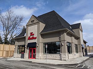
Stouffville's economy grew a lot after the railway arrived in 1871. Its location at important road junctions also helped.
Employment in Whitchurch-Stouffville
In 2013, Whitchurch-Stouffville had about 11,249 jobs. Most were full-time. While manufacturing used to be the biggest job sector, by 2012, retail and personal services had the most jobs.
The total number of local jobs increased from 10,300 in 2009 to 13,700 in 2013.
Most employed residents travel to Toronto and nearby areas for work. In 2011, the average commute time was 30 minutes. The unemployment rate in Whitchurch-Stouffville was 6.3% in 2011, which was lower than the Ontario average.
| Industry | People employed |
|---|---|
| Agriculture and other resource-based industries | 325 |
| Construction | 1,880 |
| Manufacturing | 1,400 |
| Wholesale trade | 1,510 |
| Retail trade | 2,225 |
| Finance, insurance, real estate | 2,210 |
| Health and Social Services | 1,405 |
| Educational Services | 1,765 |
| Professional, scientific, technical | 1,925 |
Some of the top private employers in 2009 included:
- Teva Canada (pharmaceuticals)
- Parkview Services for Seniors
- Strategic Information Technology (computer and communications)
- K-Line Group (electrical power)
- Ontario SPCA
- Hanson (concrete pipe)
- King Cole Ducks Processing
- Stock Transportation Ltd. (bus services)
- Tam-Kal (sheet-metal)
- Walmart Supercentre
Whitchurch-Stouffville has large areas for mineral aggregate (gravel and sand) extraction. These sites are carefully managed under the Oak Ridges Moraine Conservation Act.
In 2001, over 8,258 hectares (20,406 acres) of land were used for farming. Many farms focused on animal production (like horses) and growing plants in greenhouses.
Since 2009, the town has focused on attracting knowledge-based industries, agricultural services, and non-profit organizations. It is home to several international non-governmental service organizations like Emmanuel International Canada and Christian Blind Mission – Canada.
Housing and Social Services
In 2013, the town had 14,334 homes. More homes are planned to accommodate the growing population.
The value of homes in Whitchurch-Stouffville is higher than the provincial average. Most homes are owned rather than rented. The town has some public social housing and not-for-profit units for seniors.
Social services in Whitchurch-Stouffville include the Whitchurch-Stouffville Food Bank and the Care and Share Thrift Store. The YMCA also has an employment resource center.
Sports and Recreation
The first organized sport in Stouffville was curling in 1890. Lacrosse and hockey also became popular early on.
The main sports facilities in Whitchurch-Stouffville are:
- Soccer City: a large indoor soccer complex.
- Stouffville Clippers Sports Complex: with two ice pads for hockey and skating.
- Stouffville Arena: also with two ice pads.
- Whitchurch-Stouffville Leisure Centre: with a pool, hot tub, and gym.
- Bethesda Park: with ball diamonds and soccer fields.
Whitchurch-Stouffville has many golf courses, including Emerald Hills, Rolling Hills, and Spring Lakes.
Organized Sports Teams
The town has a Junior "A" ice hockey team called the Stouffville Spirit. There are also many local hockey leagues and skating clubs for all ages.
The Whitchurch-Stouffville Soccer Club started in 1977 and had 1,250 members in 2010. They use various fields and the indoor Soccer City facility.
The Whitchurch-Stouffville Softball Association is a volunteer-run league that uses several ball diamonds in town and nearby villages.
Trails and Water Recreation
More than half of the York Region Forest tracts are within Whitchurch-Stouffville.
- The Whitchurch Conservation Area has trails and connects to the Oak Ridges Trail Association trails.
- The Pangman Springs Conservation Area also connects to the Oak Ridges Trail.
- Bruce's Mill Conservation Area is the northern entrance to Rouge Park and has its own trail system.
An extensive trail system is being developed within urban Stouffville. The most important trail follows the Stouffville Creek through a forest around the Stouffville Reservoir. In 2012, Whitchurch-Stouffville had 32 kilometers (20 miles) of trails.
The town also has several kettle lakes, which are great for outdoor water activities. These lakes are privately owned, so public access can be limited. However, there is growing interest in creating more public access to these natural areas.
Arts, Culture, and Media
Whitchurch-Stouffville is working to improve its cultural services.
Arts and Entertainment Centre
The former Stouffville Town Hall, built in 1896, was renovated to create The Lebovic Centre for Arts & Entertainment – Nineteen on the Park. It opened in 2009 as a center for arts, culture, and entertainment in downtown Stouffville.
Art Gallery and Visual Art
Latcham Art Centre (formerly The Latcham Gallery) is a public art gallery established in 1979. It was named after Arthur Latcham, who donated money for the original building. The art center hosts several exhibitions each year, featuring contemporary art by provincial artists and community exhibitions. They also offer educational programs, workshops, and tours. Admission is free. In 2018, the Latcham Art Centre moved to the Whitchurch-Stouffville Leisure Centre.
Since 2000, local artists have organized the Whitchurch-Stouffville Studio Tour. This event features many artists in different locations across the town.
Library
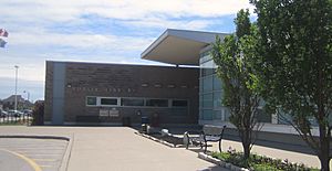
The Whitchurch-Stouffville Public Library is located in the Whitchurch-Stouffville Leisure Centre. The number of people using the library and the number of books borrowed have increased significantly. The library is an important community resource.
Festivals and Fairs
- The Stouffville Strawberry Festival is a traditional community fair held on the Canada Day weekend. It celebrates the town's farming history.
- The annual Stouffville Country Ribfest is held every August in Memorial Park. It's the largest event of the year, with food, merchants, and entertainment.
- The town also hosts other events like Victoria Day Fireworks, Symphony Under the Stars, and the Stouffville Santa Claus Parade.
- The Markham Fair is one of Canada's oldest and largest fairs, held just south of Stouffville.
- Bruce's Mill Conservation Area hosts an annual Sugarbush Maple Syrup Festival in March and April.
- The Musselman Lake community hosts an annual Winter Carnival in February.
- York Region's Spring Forest Festival is held annually in April.
- The annual Wine and Food Festival is organized by the Ballantrae Golf and Country Club in June.
- The GTA Toronto Mennonite Festival and Quilt Auction is held every September at Willowgrove Farm.
Museum
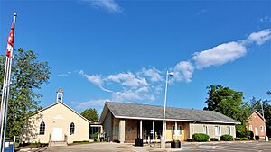
The Whitchurch-Stouffville Museum opened in 1971 in the hamlet of Vandorf. The museum site includes five historic buildings from the former Township of Whitchurch:
- The Bogarttown Schoolhouse (1857)
- A pioneer log cabin (around 1850)
- A Victorian Farmhouse (1857)
- A barn (around 1830)
- Vandorf Public School (1870)
In 2012, a Community Centre was added, connecting the two schoolhouses. The new facility has a Research Room, Exhibition Gallery, and Discovery Room.
Media
The town has two local community newspapers: the Stouffville Free Press and the Stouffville Sun-Tribune. SNAP Stouffville/Uxbridge is a photo-based publication. Stouffville Connects is an online news source. A community radio station, WhiStle Radio (CIWS-FM), started in 2008.
Film and Television
Many movies and TV shows have been filmed in the community of Stouffville, including:
- The Russell Girl (2008)
- Stir of Echoes: The Homecoming (2007)
- Who Killed Atlanta's Children? (2000)
- On Hostile Ground (2000)
- Strike! (1998)
- The Sweet Hereafter (1997)
- Bad Day on the Block (1997)
- Martin's Day (1984)
- The Dead Zone (1983)
Television shows filmed in Stouffville include episodes from:
- Warehouse 13 (2010)
- The West Wing
- Degrassi: The Next Generation
- Nikita
- Schitt's Creek (2015)
- Curse of the Axe (a documentary about the Wendat-Huron village)
Films and TV series filmed at Shadow Lake Centre near Musselman Lake include:
- 1-800-Missing
- Tarzan & Jane (2002)
- The Crossing (2000)
- Run the Wild Fields
- Ice Men (2005)
- Top Cops
- The Loretta Claiborne Story
- True Romance (1993)
- Ready or Not
- The White Dog Sacrifice
- The Littlest Hobo
Attractions
- Applewood Farm Winery
- Bruce's Mill Conservation Area, with trails and a Community Safety Village.
- Burd's Family Fishing
- Downtown Stouffville Farmers' Market (Thursdays, May–October)
- Latcham Art Centre
- Lionel's Farm (Petting zoo, pony farm, horse center)
- Magic Hill Farms
- Oak Ridges Trail and York Demonstration Forest
- RHLS Narrow Gauge Railway
- Ringwood Fish Culture Station
- Timber Creek Mini Golf & Family Fun Centre
- Whitchurch-Stouffville Museum
- Willow Springs Winery
- York-Durham Heritage Railway
- Churchill Chimes Equestrian Centre
Notable People
- Keith Acton – Former National Hockey League player and Stanley Cup winner.
- John W. Bowser – Construction Superintendent for famous buildings like the Empire State Building.
- Roy Brown – Royal Air Force officer and World War I flying ace, known for downing the Red Baron.
- Karen Cockburn – Olympic medalist in trampoline gymnastics.
- Earl Cook – Major League Baseball player for the Detroit Tigers.
- Michael Del Zotto – National Hockey League player.
- Nicole Dollanganger - Singer/songwriter.
- Mike Harris – Olympic medalist in curling.
- Bob Hassard – National Hockey League player and Stanley Cup winner.
- Liz Knox – Canadian Women's Hockey League player and founding board member of the Professional Women's Hockey Players Association.
- H.R. MacMillan – Forester, industrialist, and philanthropist.
- Jeff Marek – Hockey Analyst for Sportsnet.
- Brad May – National Hockey League player.
- Jason "Human Kebab" Parsons – Member of the band Ubiquitous Synergy Seeker.
- Sean Pierson – Professional mixed martial arts fighter.
- B. W. Powe – Author.
- Raffi Torres – National Hockey League player.
- Frank Underhill – Founder of the Co-operative Commonwealth Federation (CCF) Party and Officer of the Order of Canada.
- Jim Veltman – National Lacrosse League Hall of Fame player.
- Ethan Werek – Professional ice hockey player.
Sister City
 Igoma, Tanzania (Stouffville-Igoma Partnership).
 | Aaron Henry |
 | T. R. M. Howard |
 | Jesse Jackson |


