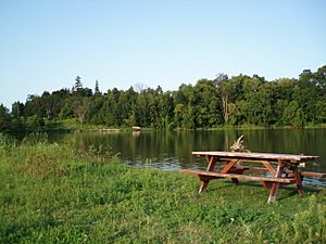
Rouge River (Ontario) facts for kids
Quick facts for kids Rouge River |
|
|---|---|
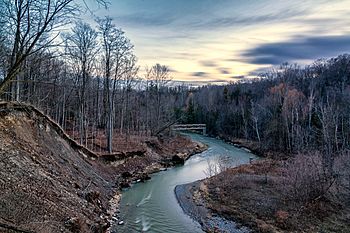
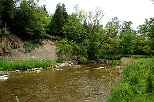
The Rouge River and Valley viewed from the Finch Meander Trail
|
|
|
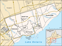
Location of the mouth of the Rouge River in Toronto
|
|
| Native name | Katabokokonk |
| Country | Canada |
| Province | Ontario |
| Region | Greater Toronto Area |
| Municipalities | |
| Physical characteristics | |
| Main source | Richmond Hill 286 m (938 ft) 43°56′21″N 79°24′56″W / 43.93917°N 79.41556°W |
| River mouth | Lake Ontario West Rouge, Toronto 74 m (243 ft) 43°47′41″N 79°06′55″W / 43.79472°N 79.11528°W |
| Basin features | |
| River system | Great Lakes Basin |
| Basin size | 336 km2 (130 sq mi) |
| Tributaries |
|
The Rouge River is a beautiful river in Ontario, Canada. It flows through several cities like Markham, Pickering, Richmond Hill, and Toronto. The river starts in the Oak Ridges Moraine and ends in Lake Ontario.
The Rouge River is special because it's home to Rouge National Urban Park. This is the only national park in Canada that is located inside a city! At its southern end, the Rouge River forms the border between Toronto and Pickering.
Contents
History of the Rouge River
The Rouge River area is part of the Carolinian life zone. This type of forest is found in Southern Ontario. Long ago, Indigenous peoples lived here. The Senecas from New York tried to expand their fur trade. They built a village called Gandechiagaiagon at the mouth of the Rouge River. This name meant "sand-cut."
In 1796, an English surveyor named Augustus Jones recorded the Mississauga name for the river. It was Gichi-ziibiinh, which means "large creek." The name "Rouge River" likely comes from French. It means "red river." This name was probably given by French explorer Louis Jolliet.
In the early 1800s, settlers could catch many large salmon. These fish swam far north into the river's smaller streams. Today, much of the river system in Toronto is still parkland or farmland. In the York Region, the southern part of the river flows through neighborhoods. It has many small parks along its banks.
Today, you can still find old farmlands and historic houses in the area. Some of these houses are still lived in. Toronto's website lists over 20 historic buildings here. One example is Hillside PS, which was Scarborough's first schoolhouse.
Geography of the Rouge River
Where the River Starts and Flows
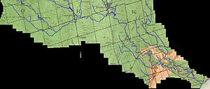
The Rouge River begins in the Oak Ridges Moraine in Richmond Hill. It then flows through Markham, and along the eastern edge of Scarborough. The river's watershed covers a large area. This includes parts of Richmond Hill, Markham, Pickering, and Toronto.
Smaller streams that feed the Rouge River also reach into Aurora and Whitchurch-Stouffville. The total area of the watershed is 336 square kilometres (130 sq mi). About 40% of this land is farms, 35% is urban areas, and 24% is forests or wetlands.
The water for the Rouge River comes from the high ground of the Oak Ridges Moraine. It flows downhill to Lake Ontario. The river meets Lake Ontario at Rouge Beach. North of Rouge Beach is the Rouge Marsh. This marsh holds more than half of the remaining wetlands in the Greater Toronto Area.
The Rouge River area is one of the few wilderness spots left in South-Central Ontario. It has remained mostly untouched by buildings. While some fancy homes are nearby, the area is mostly surrounded by farms. It has many walking and bike paths. Unlike other rivers in Toronto, the Rouge River is allowed to flood its flood plain naturally. This helps the environment. Parts of its watershed include the Toronto Zoo and the Beare Road Landfill.
Rouge River Tributaries
Smaller streams that flow into a larger river are called tributaries. The Rouge River has several important tributaries:
- Little Rouge Creek (left side) - This creek flows northeast through places like Cedar Grove and Bloomington.
- Katabokokonk Creek - This short creek is in northeast Markham. Its name is the original First Nations name for the Rouge River.
- Morningside Creek (right side) - This creek flows from near Dennison Avenue to the southwest of the Toronto Zoo.
- Exhibition Creek - This creek runs from north of 16th Avenue to Markham.
- Robinson Creek (left side) - This creek starts north of Elgin Mills and flows into the east end of Milne Park.
- Eckardt Creek (left side) - This creek starts from storm management ponds.
- Bruce Creek (left side) - This creek begins in Aurora and flows through Bruce's Mill Conservation Area into Markham. It passes through Angus Glen Golf Club and into Toogood Pond in Unionville.
- Berczy Creek - This creek flows into Bruce Creek near Toogood Pond.
- Carleton Creek - This creek flows into Berczy Creek.
- Berczy Creek - This creek flows into Bruce Creek near Toogood Pond.
- Beaver Creek (right side) - This creek flows from Richmond Hill to the future Downtown Markham area.
- Apple Creek - A small creek that branches off Beaver Creek.
Parks Along the Rouge River
Rouge National Urban Park
Rouge National Urban Park is a special urban park managed by Parks Canada. It is the largest urban park in North America. A big part of the Rouge River flows through this park. The idea for this national park came from the Canadian government.
Local Parks and Conservation Areas
Many local parks are found around the Rouge River. These parks are managed by the cities of Markham, Pickering, Richmond Hill, and Toronto. The Toronto and Region Conservation Authority also looks after several parks and conservation areas. Some of these parks include:
- Bob Hunter Memorial Park
- Littles Road Park
- Morningview Ravine Park
- Woodlands Park
- Glen Rouge Park
- Rouge Valley Park, Markham
- Milne Park, Markham
- Apple Creek Park
- Cedar Valley Park
- Mount Joy Lake Park
- Springdale Park
- Monarch Park
- Ashton Meadows Park
- Artisan Park - Beaver Creek
- Beaver Greenway - Beaver Creek
- Bruce Creek Park
- Berczy Creek Park
- Boyton Woods Park
- Elgin Mills Cemetery
- Headwaters Park
Golf Courses Near the Rouge River
Several golf courses are located near the Rouge River. Some of these were built on former farmlands.
- Parkview Golf Course
- Markham Green Golf Course
- Cedar Brae Golf & Country Club
- York Downs Golf and Country Club
- Angus Glen Golf Club
- Markham Golf Club
- Buttonville Fairways Golf Centre
An 18-hole golf course called Unionville Golf Centre used to operate along the Rouge River. It closed in 2007. Now, the Bill Crothers Secondary School stands on that site. The areas where the golf greens used to be have been restored to natural habitats.
Images for kids
 | Precious Adams |
 | Lauren Anderson |
 | Janet Collins |


