Holland Marsh facts for kids

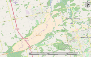
The Holland Marsh is a special wetland and farming area in Ontario, Canada. It's about 50 kilometers (30 miles) north of Toronto. This area sits in the Holland River valley, stretching from near Schomberg all the way to Cook's Bay in Lake Simcoe.
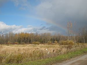
The whole marsh is about 21,000 acres (8,500 hectares). It's split into two main parts. One part, about 7,200 acres, is south-west of Bradford and has been drained for farming. This area is shared between King Township and the town of Bradford West Gwillimbury. The other part, about 13,800 acres, is north and east of Bradford, closer to Cook's Bay. Some of this area is also farmed, while other parts are used for recreation or are still natural wetlands.
Contents
Farming in the Holland Marsh
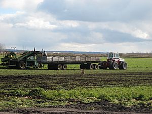
The flat areas of the Holland Marsh that have been drained are perfect for growing certain crops. The soil here is very rich and dark, called organic soil. This type of soil is great for growing "market garden" vegetables like onions, leafy greens, celery, and carrots. Organic soil is made from living plant parts and tiny organisms. It helps the soil stay healthy and holds water and nutrients for plants. Farmers need to be careful with this soil to stop strong winds from blowing it away.
Crops and Markets
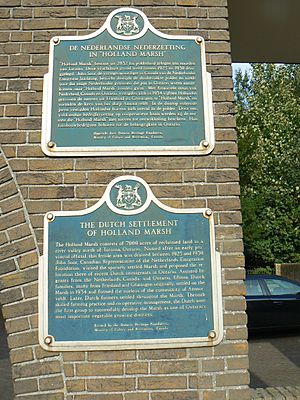
The main crops grown in the Holland Marsh are vegetables. These crops often show the different groups of immigrants who have come to Canada over the years. Many immigrant families traditionally grew these vegetables for their own communities in the Greater Toronto Area and for selling to other countries.
In the past, farms were often small, about 5 acres each. Farmers would take their produce to local markets. In the 1920s, popular crops included yellow onions, potatoes, carrots, and lettuce, reflecting European tastes. From the 1950s to the 1980s, Italian greens like dandelion and endive became common. By the 1990s, people started growing Asian greens, such as bok choy.
When Highway 400 opened in the 1950s, farmers could easily get their crops to the Ontario Food Terminal in Toronto. This greatly expanded their market. However, in the 1990s, new rules about food imports and the growth of large grocery store chains made it harder for small family farms to survive. Today, some small family farms still exist, but many have joined together to form larger farms. These bigger farms mostly grow onions and carrots for grocery stores, export, and food processing companies. The Greenbelt family farmers market, started by the Ontario government, has helped some smaller farms.
Researching Farm Practices
At the nearby Muck Crops Research Station, scientists study how different farming methods affect the crops. This research helps farmers in the Holland Marsh grow their vegetables better and more sustainably.
Geography of the Marsh
The Holland Marsh is considered a special soil region by the Ontario government. The southernmost drained area, which is about 7,200 acres, is the lowest and flattest part of the region. This area is shaped like an oval, about 15 kilometers (9 miles) long and 4 kilometers (2.5 miles) wide. The main part of the Holland River meets the canals of this drained area near Bradford.
History of the Holland Marsh
Before it became a farming area, the Holland Marsh was a huge wetland. It was part of the Toronto Carrying-Place Trail, a historic route used for travel.
Early Uses of the Swamp
In the 1880s, people harvested reeds from the marsh to stuff mattresses. They used scythes (hand tools) and later horse-drawn mowers. Horses had to wear special large boards on their hooves to avoid sinking into the soft, wet ground.
Big Storms and the Marsh
The Holland Marsh has faced some big challenges from weather.
Hurricane Hazel (1954)
In October 1954, Hurricane Hazel brought extremely heavy rains. The marsh's drainage system couldn't handle all the water, and the protective walls (dykes) broke. Within six hours, the entire farming area was flooded. Even Highway 400 was five feet underwater! Luckily, residents were warned by their neighbors using "party phone lines" (where many homes shared one phone line). People with single-story homes went to neighbors with two-story houses, and many used their boats or canoes to get around. Many families stayed with neighbors in Bradford during the winter.
Tornado (1985)
On May 31, 1985, a tornado touched down in the marsh area west of Highway 400. It ripped the roof off one house and knocked down power lines and trees. The damage on one street, Fraser Street, was so bad that it was renamed Tornado Road. The strong winds also ruined many acres of crops. This storm was part of a larger tornado outbreak that also hit Barrie, causing serious damage and injuries.
Reclaiming the Land
Professor William Day led the project to drain and reclaim the large southernmost part of the Holland Marsh. This huge effort was finished in 1930. The system of canals that helps drain the marsh was designed by engineer Alexander Baird.
Weather in the Marsh
During very long dry periods, the Holland Marsh can have dust storms. This usually only happens in the spring before crops grow or in the fall after they are harvested. This kind of event has been rare, happening only once in the last 10 years.
 | John T. Biggers |
 | Thomas Blackshear |
 | Mark Bradford |
 | Beverly Buchanan |


