
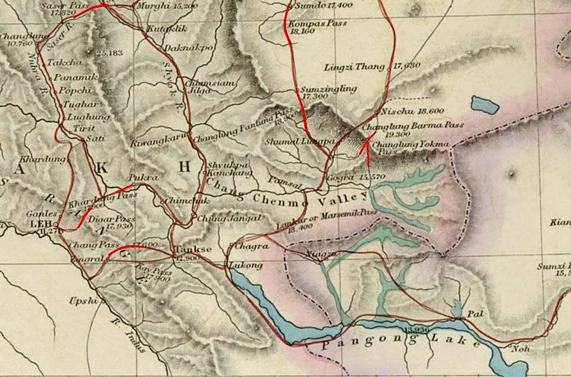
Image: Trade-routes-via-Pangong-and-Changchenmo-Douglas-Forsythe-1878

Description: Image of map of the Baltistan, Aksai Chin, Chinese Turkestan in maps of Central Asia. The international border between the British Indian Empire (including the Kashmir region) and Chinese Turkestan is shown two-toned purple and pink. From the article, "On the Geographical Results of the Mission to Kashghar, under Sir T. Douglas Forsyth in 1873-74" by H. Trotter Journal of the Royal Geographical Society of London, Vol. 48. (1878), pp. 173-234. Downloaded, resized to 33% of original size and annotated by Fowler&fowler«Talk» 23:52, 8 July 2007 (UTC)
Title: Trade-routes-via-Pangong-and-Changchenmo-Douglas-Forsythe-1878
Credit: Article= "On the Geographical Results of the Mission to Kashghar, under Sir T. Douglas Forsyth in 1873-74" by H. Trotter, Journal of the Royal Geographical Society of London, Vol. 48. (1878), pp. 173-234.
Author: H. Trotter
Usage Terms: Public domain
License: Public domain
Attribution Required?: No
Image usage
The following page links to this image:
