
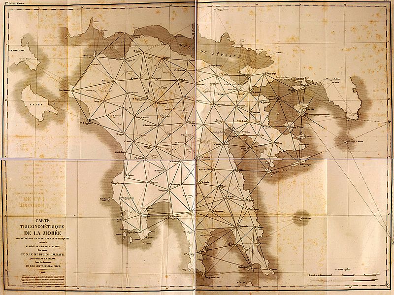
Image: Trigonometric Map of Greece - Peytier Eugène - 1832

Size of this preview: 800 × 599 pixels. Other resolutions: 320 × 239 pixels | 1,228 × 919 pixels.
Original image (1,228 × 919 pixels, file size: 1.26 MB, MIME type: image/jpeg)
Description: Carte Trigonométrique de la Morée, par MM. Peytier, Puillon Boblaye et Servier (1832)
Title: Trigonometric Map of Greece - Peytier Eugène - 1832
Credit: Expédition scientifique de Morée, Section des sciences physiques, Atlas (1835). https://gallica.bnf.fr/ark:/12148/bpt6k1519194v
Author: Jean-Baptiste Bory de Saint-Vincent, Pierre Peytier, Émile Puillon Boblaye, Aristide-Camille Servier
Usage Terms: Public domain
License: Public domain
Attribution Required?: No
Image usage
The following page links to this image:

All content from Kiddle encyclopedia articles (including the article images and facts) can be freely used under Attribution-ShareAlike license, unless stated otherwise.