
Image: Tunisia Antica
Size of this preview: 399 × 600 pixels. Other resolutions: 159 × 240 pixels | 479 × 720 pixels.
Original image (479 × 720 pixels, file size: 67 KB, MIME type: image/jpeg)
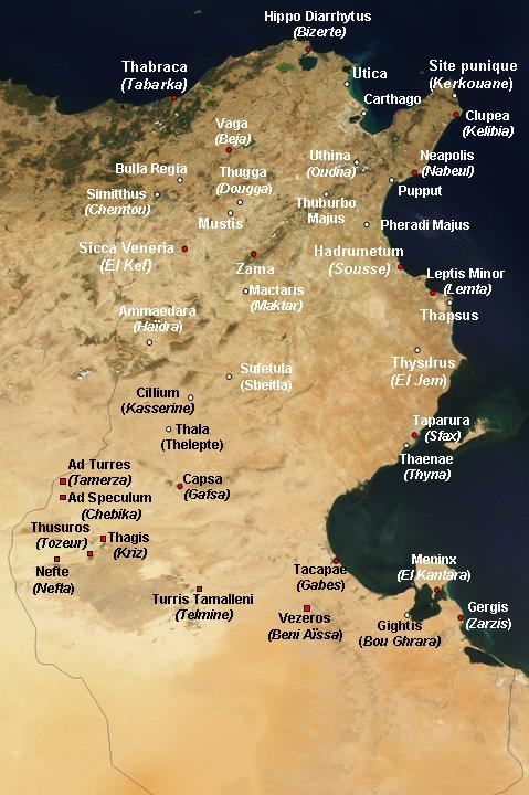
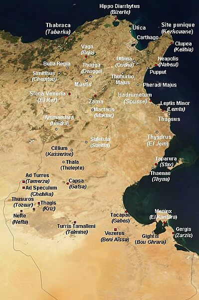
Description: Satellite map of Tunisia, with ancient Punic and Roman archeological sites. White dot : important archeological sites. Red dot : other antic site. Personal work.
Title: Tunisia Antica
Credit: Image:Satellite image of Tunisia in August 2001.jpg [1]
Author: NASA's Visible Earth, derivative work by Ursus
Permission: Sattelite image: PD-USGov-NASA, derivative work: PD-self
Usage Terms: Public domain
License: Public domain
Attribution Required?: No
Image usage
The following page links to this image:

All content from Kiddle encyclopedia articles (including the article images and facts) can be freely used under Attribution-ShareAlike license, unless stated otherwise.