
Image: Typhoon Tip and Typhoon Sarah (1997)
Size of this preview: 731 × 600 pixels. Other resolutions: 293 × 240 pixels | 773 × 634 pixels.
Original image (773 × 634 pixels, file size: 836 KB, MIME type: image/png)
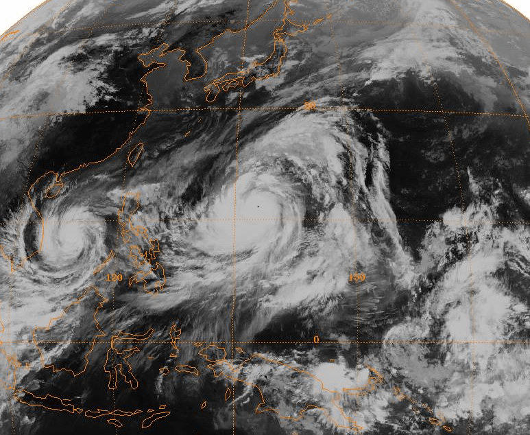
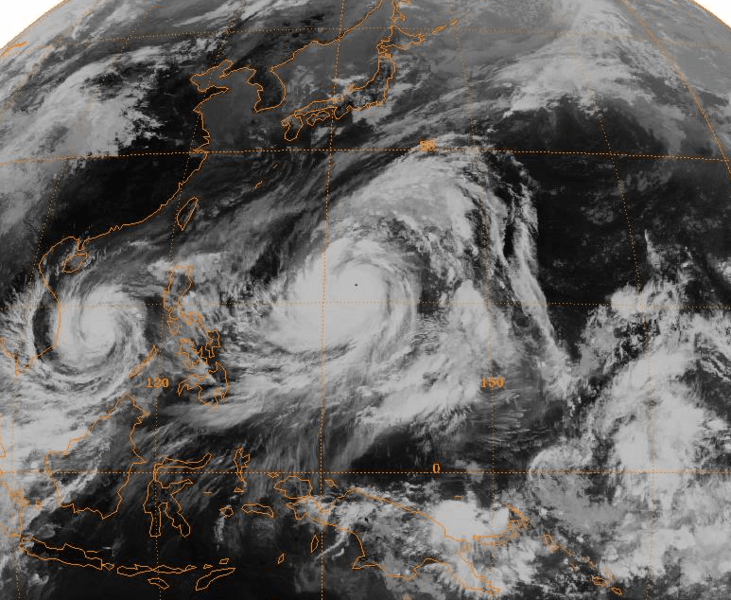
Description: Full-disc satellite image of Typhoon Tip near its worldwide record peak intensity, located in the western Pacific Ocean. Typhoon Sarah is located to its west in the South China Sea.
Title: Typhoon Tip and Typhoon Sarah (1997)
Credit: http://www.ncdc.noaa.gov/gibbs/
Author: GMS-1 Satellite
Permission: This image is in the public domain because it contains materials that originally came from the U.S. National Oceanic and Atmospheric Administration, taken or made as part of an employee's official duties.
Usage Terms: Public domain
License: Public domain
Attribution Required?: No
Image usage
The following image is a duplicate of this image (more details):
The following page links to this image:

All content from Kiddle encyclopedia articles (including the article images and facts) can be freely used under Attribution-ShareAlike license, unless stated otherwise.
.png)