
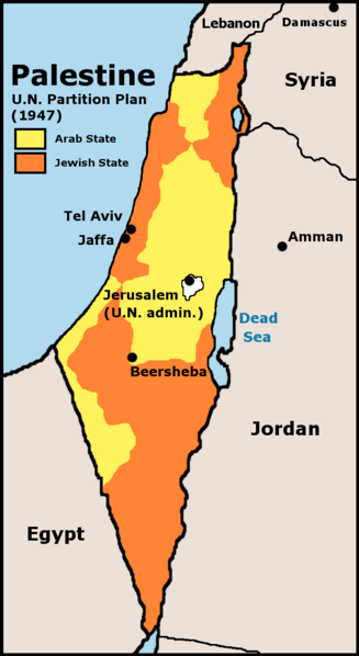
Image: UN Partition Plan For Palestine 1947

Size of this preview: 327 × 598 pixels. Other resolutions: 131 × 240 pixels | 627 × 1,147 pixels.
Original image (627 × 1,147 pixels, file size: 65 KB, MIME type: image/png)
Description: UN 1947 partition plan for Palestine
Title: UN Partition Plan For Palestine 1947
Credit: Crop and edit of http://www.lib.utexas.edu/maps/historical/israel_hist_1973.jpg, Scan from “Issues in the Middle East”, Atlas, U.S. Central Intelligence Agency, 1973.
Author: U.S. Central Intelligence Agency
Permission: According to lib.utexas.edu here and here, the map is “produced by the U.S. Central Intelligence Agency, unless otherwise indicated.” There is no such mark with this map, so it is presumed the map is PD-US-GOV.
Usage Terms: Public domain
License: Public domain
Attribution Required?: No
Image usage
The following 3 pages link to this image:

All content from Kiddle encyclopedia articles (including the article images and facts) can be freely used under Attribution-ShareAlike license, unless stated otherwise.