
Image: USACE Coffeeville Lock and Dam Tombigbee

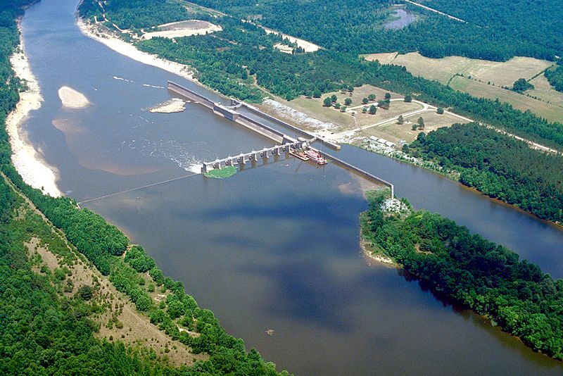
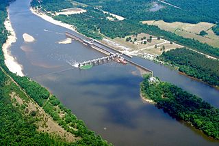
Description: Aerial view of Coffeeville Lock and Dam on the Tombigbee River, spanning the border between Choctaw and Clarke Counties near Coffeeville, Alabama, USA. View is downriver to the east. The U.S. Army Corps of Engineers constructed the dam and lock on the river to provide a nine-foot navigation channel. Coffeeville Lock and Dam is the last lock and dam down the Tombigbee River (or the first, if travelling up the Tombigbee or Black Warrior River). There are no locks and dams between Coffeeville and the Gulf of Mexico.
Title: USACE Coffeeville Lock and Dam Tombigbee
Credit: U.S. Army Corps of Engineers Digital Visual Library Image page Image description page Digital Visual Library home page
Author: U.S. Army Corps of Engineers, photographer not specified or unknown
Permission: This image or file is a work of a U.S. Army Corps of Engineers soldier or employee, taken or made as part of that person's official duties. As a work of the U.S. federal government, the image is in the public domain.
Usage Terms: Public domain
License: Public domain
Attribution Required?: No
Image usage
The following 2 pages link to this image:
