
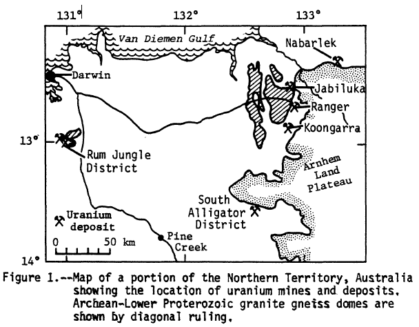
Image: USGS Map of Northern Territory Uranium Mines
No higher resolution available.
USGS_Map_of_Northern_Territory_Uranium_Mines.png (608 × 474 pixels, file size: 58 KB, MIME type: image/png)
Description: USGS Map of Northern Territory Uranium Mines
Title: USGS Map of Northern Territory Uranium Mines
Credit: Chemical Data and Statistical Interpretations for Rocks and Ores from the Ranger Uranium Mine N.T., Australia, USGS Open-File Report 83-239
Author: J. Thomas Nash and David Frishman
Usage Terms: Public domain
License: Public domain
Attribution Required?: No
Image usage
The following 3 pages link to this image:

All content from Kiddle encyclopedia articles (including the article images and facts) can be freely used under Attribution-ShareAlike license, unless stated otherwise.