
Image: USGS Oatman 1921 rfl01262
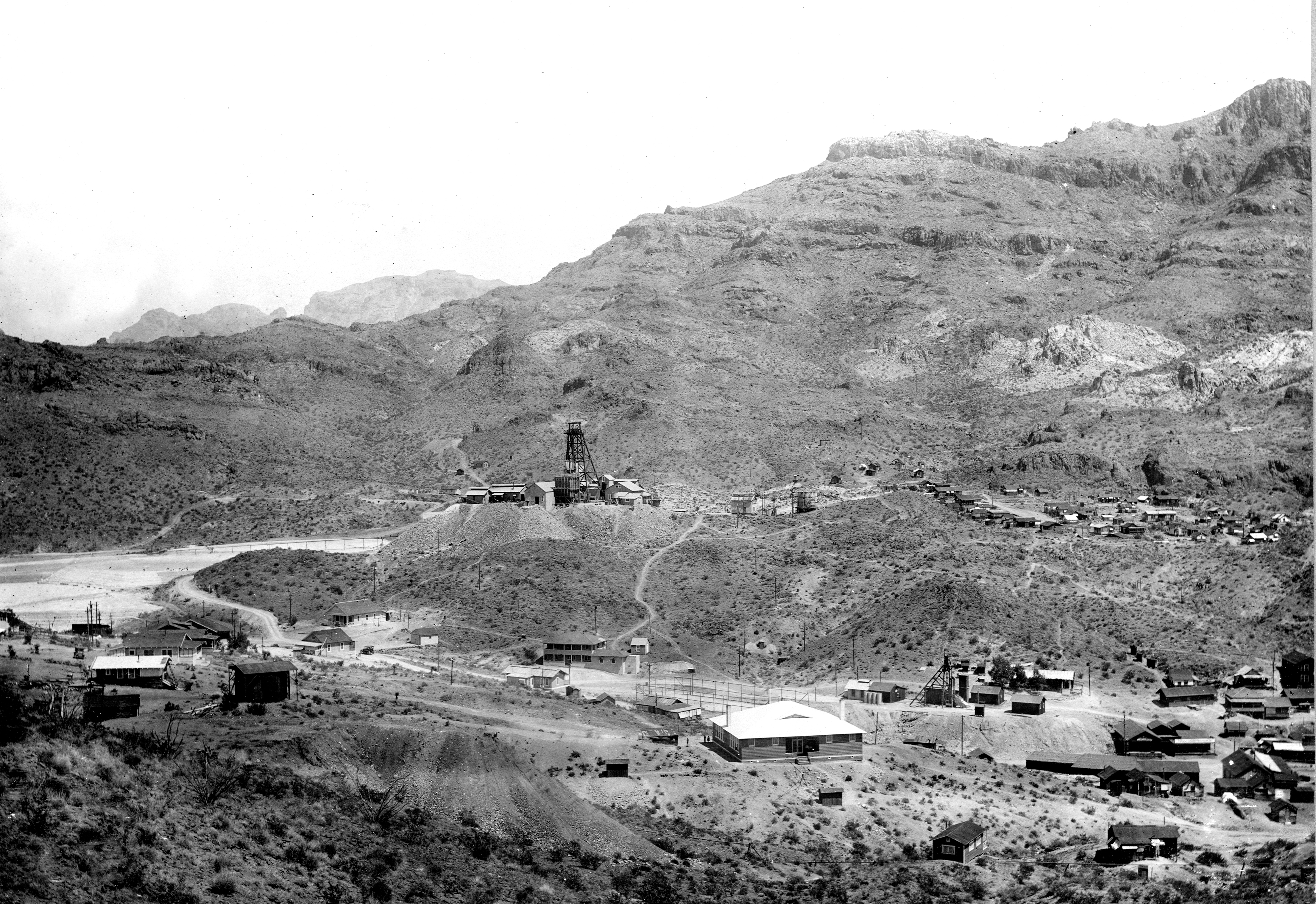
Description: Topography of the en:Black Mountains (Arizona): Western front, looking northeast from a point near Oatman. The original or No. 1 shaft of the United Eastern mine appears in the right foreground, at the north end of town. The present main or No. 2 shaft, in the left center, is in the hanging wall of the vein. The dump in the left foreground is that of the Olla Oatman shaft, on the southwest branch of the Tom Reed vein. The flows whose edges appear along the mountain side are part of the Gold Road latite. The lighter colored irregular areas are intrusive rhyolite. Mohave County, Arizona. 1921.
Title: USGS Oatman 1921 rfl01262
Credit: http://libraryphoto.cr.usgs.gov/cgi-bin/show_picture.cgi?ID=ID.%20Ransome,%20F.L.%201262
Author: USGS
Permission: This image is in the public domain in the United States because it only contains materials that originally came from the United States Geological Survey, an agency of the United States Department of the Interior. For more information, see the official USGS copyright policy.
Usage Terms: Public domain
License: Public domain
Attribution Required?: No
Image usage
The following page links to this image:
