
Image: US Secession map 1863 (BlankMap derived)
Size of this preview: 800 × 488 pixels. Other resolutions: 320 × 195 pixels | 841 × 513 pixels.
Original image (841 × 513 pixels, file size: 24 KB, MIME type: image/png)
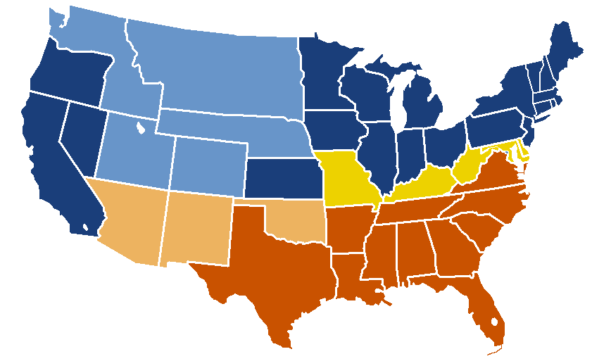
Description: United States map of 1863, show affiliation of states and territories regarding the Secession War (Civil War.) Union states Union territories not permitting slavery Border Union states, permitting slavery Confederate states Union territories permitting slavery (claimed by Confederacy)
Title: US Secession map 1863 (BlankMap derived)
Credit: Map: Image:BlankMap-USA-states.PNG Information: Image:US_Secession_map_1865.svg
Author: w:en:Porsche997SBS (talk | contribs)
Usage Terms: Public domain
License: Public domain
Attribution Required?: No
Image usage
The following 2 pages link to this image:

All content from Kiddle encyclopedia articles (including the article images and facts) can be freely used under Attribution-ShareAlike license, unless stated otherwise.
.png)