
Image: Ukraine famine map
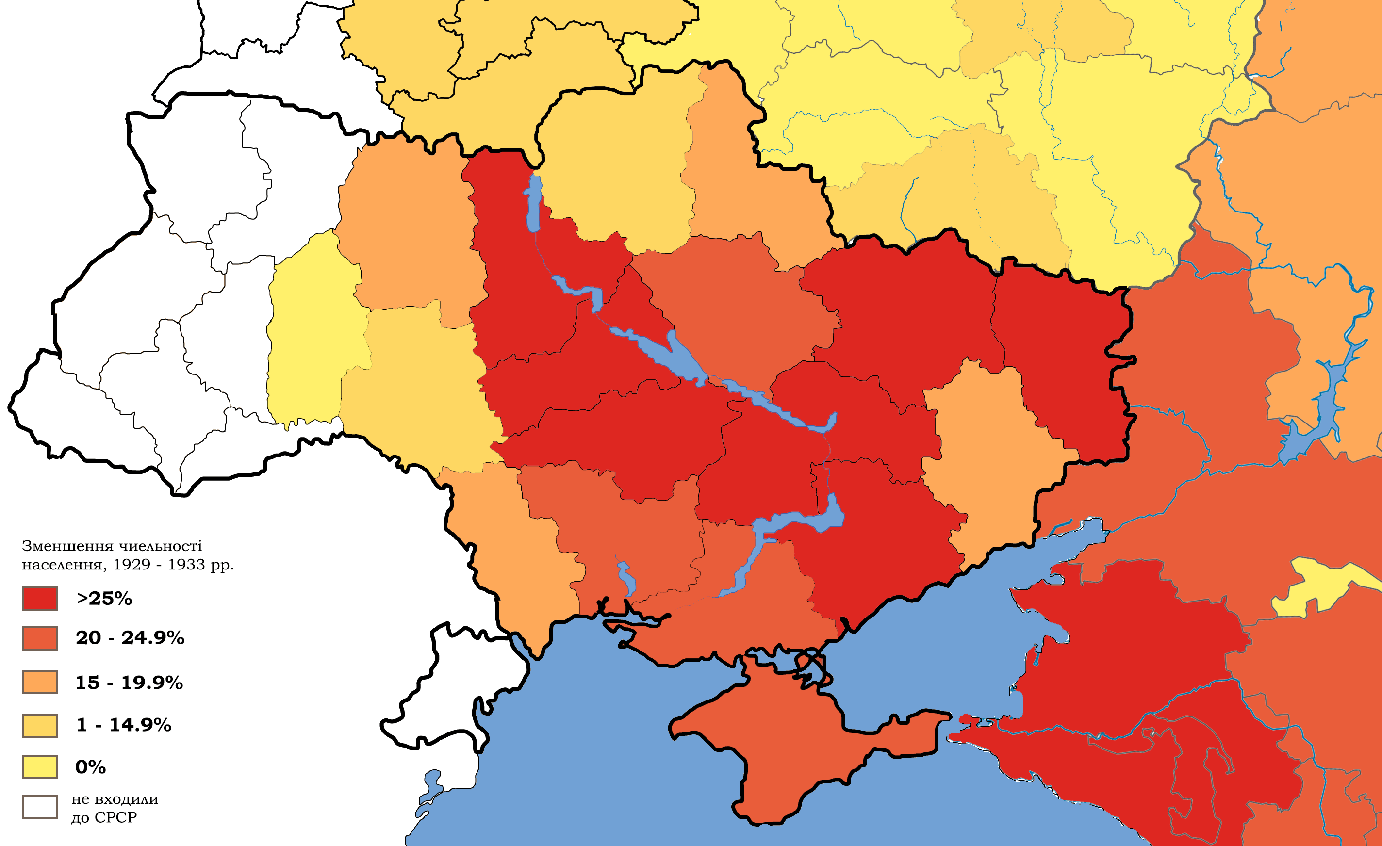
Description: Depopulation in Ukraine and southern Russia, 1929 – 1933. White regions were not part of the USSR at that time.
Title: Ukraine famine map
Credit: Own work, based on: File:Map_of_Ukraine_political_simple_blank.png, File:Belarus_provinces_blank.png, File:Outline_Map_of_Central_Russia.svg, File:Ouline_Map_of_Southern_Federal_District.svg, statistics from "The Foreign Office and the famine : British documents on Ukraine and the Great Famine of 1932-1933" / edited by Marco Carynnyk, Lubomyr Y. Luciuk and Bohdan S. Kordan ; with a foreword by Michael R. Marrus. Kingston, Ont. ; Vestal, N.Y. : Limestone Press, 1988. lxi, 493 p. ; 24 p. ISBN 0919642314
Author: Sergento
Usage Terms: Creative Commons Attribution-Share Alike 4.0
License: CC BY-SA 4.0
License Link: https://creativecommons.org/licenses/by-sa/4.0
Attribution Required?: Yes
Image usage
The following 2 pages link to this image:
