
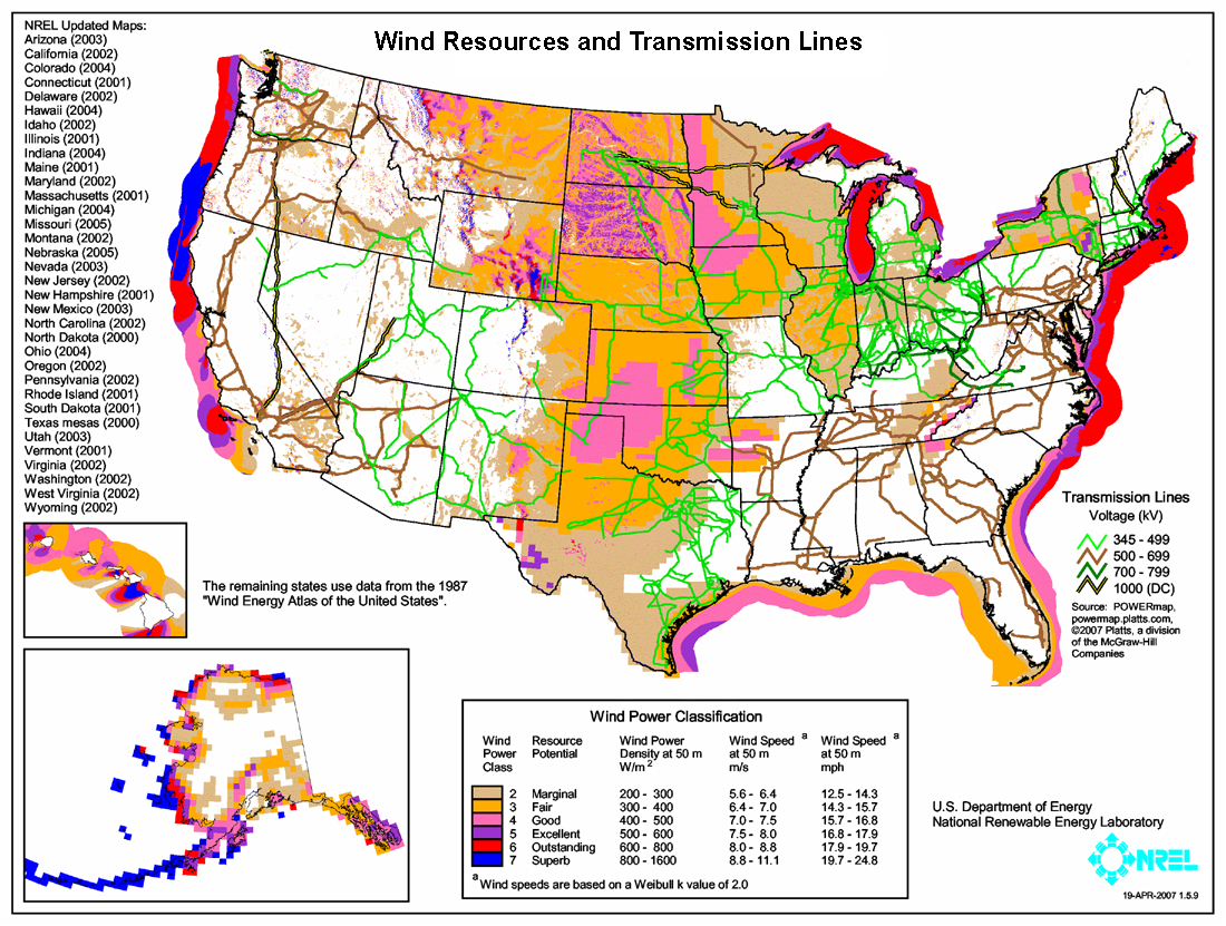
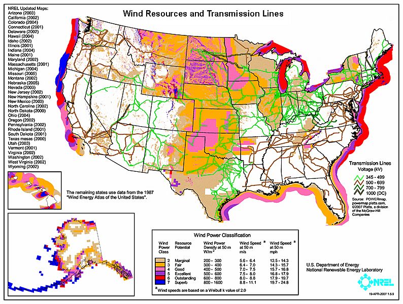
Image: United States Wind Resources and Transmission Lines map
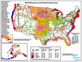
Size of this preview: 794 × 600 pixels. Other resolutions: 318 × 240 pixels | 1,100 × 831 pixels.
Original image (1,100 × 831 pixels, file size: 899 KB, MIME type: image/jpeg)
Description: Map showing estimated wind resources and existing power transmission lines for the United States.
Title: United States Wind Resources and Transmission Lines map
Credit: http://www.nrel.gov/gis/pdfs/windsmodel4pub1-1-9base200904enh.pdf
Author: National Renewable Energy Laboratory
Permission: EERE copyright policy says its works are public domain: http://www1.eere.energy.gov/webpolicies/#copyright
Usage Terms: Public domain
License: Public domain
Attribution Required?: No
Image usage
The following page links to this image:

All content from Kiddle encyclopedia articles (including the article images and facts) can be freely used under Attribution-ShareAlike license, unless stated otherwise.