
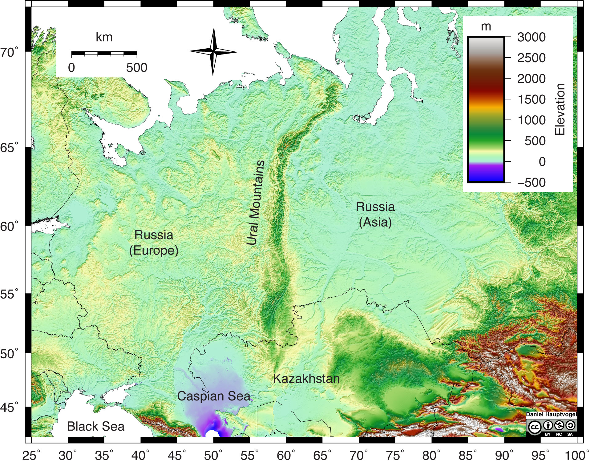
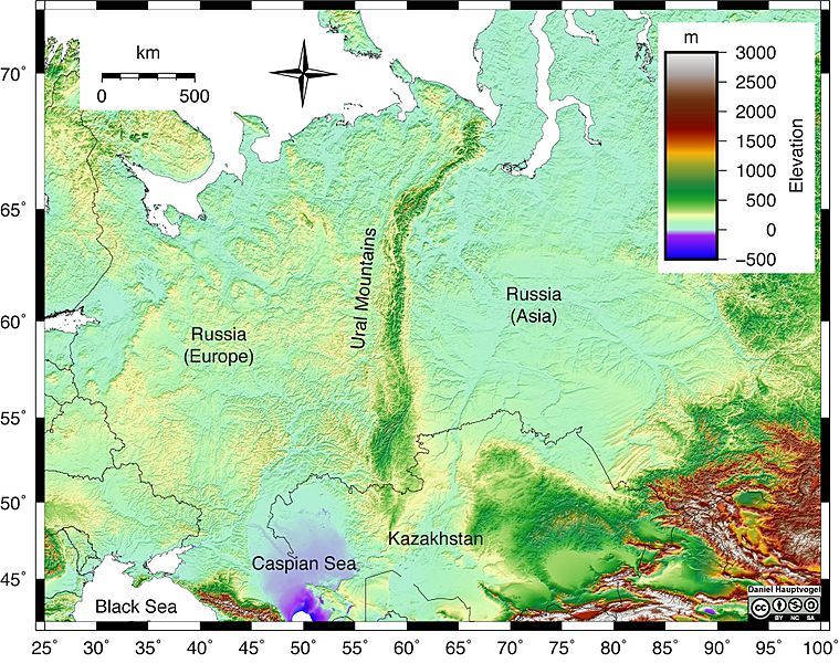
Image: Uraltopomap-1
Size of this preview: 759 × 600 pixels. Other resolutions: 304 × 240 pixels | 1,916 × 1,514 pixels.
Original image (1,916 × 1,514 pixels, file size: 946 KB, MIME type: image/jpeg)
Description: Shaded relief map of the Ural Mountains in Russia. Red and white colors represent high elevations, greens and yellow represent lower elevation, and purple and blue represent areas below sea level. The Ural Mountains are a narrow, linear chain of mountains that trend north-south through Russia. Map scale reference is 60° latitude.
Author: Daniel Hauptvogel and Virginia Sisson, CC BY-NC-SA
Usage Terms: Creative Commons Attribution-Share Alike 3.0
License: CC-BY-SA-3.0
License Link: http://creativecommons.org/licenses/by-sa/3.0/
Attribution Required?: Yes
Image usage
The following page links to this image:

All content from Kiddle encyclopedia articles (including the article images and facts) can be freely used under Attribution-ShareAlike license, unless stated otherwise.