
Ural Mountains facts for kids
Quick facts for kids Ural Mountains |
|
|---|---|
 |
|
| Highest point | |
| Peak | Mount Narodnaya |
| Geography | |
| Countries | Russia and Kazakhstan |
| Range coordinates | 60°N 59°E / 60°N 59°E |
| Geology | |
| Orogeny | Uralian orogeny |
| Age of rock | Carboniferous |
| Type of rock | Metamorphic, igneous, sedimentary |
The Ural Mountains, or simply the Urals, are a long mountain range in Eurasia. They stretch from the Arctic Ocean in the north to the Ural River and northwestern Kazakhstan in the south. Most of the mountains are in Russia.
These mountains help form the natural border between Europe and Asia. Islands like Vaygach Island and Novaya Zemlya continue the mountain chain into the Arctic Ocean. The Urals are usually between 3,300 and 4,300 feet (1,000–1,300 meters) high. The tallest point is Mount Narodnaya, which is 6,217 feet (1,895 meters) tall.
The Ural Mountains are full of valuable natural resources. These include metal ores, coal, and beautiful precious and semi-precious stones. These resources have been very important for the Russian economy.
Contents
- What's in a Name? The Ural Mountains' Meaning
- A Look Back: History of the Ural Mountains
- Exploring the Land: Geography of the Urals
- Earth's Riches: Geology of the Ural Mountains
- Waterways: Rivers and Lakes of the Urals
- Weather Patterns: Climate of the Urals
- Plant Life: Flora of the Urals
- Animal Life: Fauna of the Urals
- Protecting Nature: Ecology of the Urals
- Cultural Importance of the Urals
- Gallery
- See also
What's in a Name? The Ural Mountains' Meaning
There are many ideas about where the name "Ural" came from. Most people agree that the name comes from words that mean "stone" or "belt" or "chain." This makes sense, as the mountains look like a long chain of stones.
A Look Back: History of the Ural Mountains
The first written records about the Ural Mountains come from Middle Eastern travelers in the 900s. They wrote about merchants trading with the Bashkirs and other groups living on the western side of the mountains.
Russia first mentioned the Ural Mountains in 1096. This was when they described an expedition by people from Novgorod to the upper parts of the Pechora River. Over the next few centuries, Russia took control of more land along the Urals. In the 1600s, Russia found large amounts of iron and copper ores, mica, gemstones, and other minerals there.
In the early 1700s, Peter I of Russia ordered the first detailed study of the Ural Mountains. He asked Vasily Tatishchev, a Russian historian, to lead this work. Tatishchev also oversaw new factories that used heat to melt and purify metals, called smelting works.
Gold was discovered in the Urals in 1745, and gold mining began two years later in 1747. The first railway line across the Urals was finished in 1878. More railways have been built since then, making it easier to travel and transport goods.
Exploring the Land: Geography of the Urals

The Ural Mountains stretch for about 1,600 miles (2,500 kilometers). They go from the Kara Sea in the north to the Kazakh Steppe in the south, along the border of Kazakhstan. The mountains are usually between 3,300 and 3,600 feet (1,000–1,100 meters) high. The highest point is Mount Narodnaya, which is 6,217 feet (1,895 meters) tall.
The Urals are split into five main parts based on their shape and features. From north to south, these parts are:
- Polar (or Arctic) Urals: These mountains mostly have exposed rock and sharp, pointy peaks.
- Nether-Polar (or Sub-Arctic) Urals: These are the tallest parts of the range. They have jagged, sawtooth-shaped mountains.
- Northern Urals: This section mostly has mountains with flat tops.
- Central Urals: These are the lowest mountains in the range. They have smooth, rounded tops.
- Southern Urals: This part has many valleys and ridges that run side-by-side.
 |
 |
.jpg) |
 |
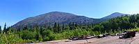
| A mountain formation near Saranpaul in the Nether-Polar Urals. | Rocks in a river in the Nether-Polar Urals. | The Ural Mountains in summer. | The entry to Ignateva Cave in the Southern Urals. |
Earth's Riches: Geology of the Ural Mountains

The Ural Mountains are home to about 48 different types of valuable ores and minerals. The eastern parts of the Urals are rich in metals like chalcopyrite, nickel oxide, gold, platinum, chromite, and magnetite ores. They also have coal (especially in Chelyabinsk Oblast), bauxite, talc, fireclay, and materials used for grinding.
The western parts of the Urals have deposits of coal, oil, natural gas, and potassium salts. The Urals are especially famous for their beautiful precious and semi-precious stones. These include emerald, amethyst, aquamarine, jasper, rhodonite, malachite, and even diamonds.
 |
 |
 |
 |
| Andradite | Beryl | Platinum | Quartz |
Waterways: Rivers and Lakes of the Urals

Many rivers start in the Ural Mountains. These rivers flow into either the Caspian Sea or the Arctic Ocean. A lot of these rivers are frozen for more than half of the year. In the Southern Urals, the rivers flow more slowly. This is because there is more evaporation and less snow in that area.
The mountains also have deep lakes, mostly on the eastern side of the Southern and Central Urals. Some of these lakes contain special muds that are used for medicine. Because of this, many Spas and medical centers have been built in the area.
Weather Patterns: Climate of the Urals
The Urals have a continental climate, which means there are big differences between summer and winter temperatures. The areas west of the Ural Mountains are warmer in winter. This is because they are warmed by winds coming from the Atlantic Ocean. The eastern regions are colder because of cold air masses from Siberia.
In January, the average temperatures are about -4°F (-20°C) in the Polar Urals. In the Southern Urals, they are around 5°F (-15°C). In July, the average temperatures are about 50°F (10°C) in the Polar Urals. In the Southern Urals, they average around 68°F (20°C).
The western parts of the Urals get more rainfall each year than the eastern parts. This happens because the mountains block clouds coming from the Atlantic Ocean. The Northern Urals receive the most snow. Summer is the wettest season, and winter is the driest.
Plant Life: Flora of the Urals

The landscapes of the Urals include tundra, forests, grassy meadows, and flat rocks. The Polar Urals have fewer trees than other parts because of the very cold climate. The Northern Urals mostly have coniferous trees. These include Siberian fir, Siberian pine, Scots pine, Siberian spruce, Norway spruce, Siberian larch, and silver and downy birches.
The low polar forests are mixed with swamps, lichens, bogs, and shrubs. Small plants like dwarf birch, mosses, and many berries are common. You can find blueberries, cloudberries, and black crowberries here. Further south, you will find deciduous trees like English oak, Norway maple, and elm.
Animal Life: Fauna of the Urals
Animals that like cold weather live in the northern parts of the Urals. Some of these animals include the snowy owl, elk, brown bear, Arctic fox, wolf, wolverine, lynx, squirrel, lemming, reindeer, and sable.
Reptiles and amphibians are mostly found in the Southern and Central Urals. In the Southern Urals, you can often see badgers, black polecats, and many birds of prey. Hares and small rodents like hamsters, susliks, and jerboas also live there. In summer, songbirds like nightingales and redstarts visit the Southern and Central Urals.
Protecting Nature: Ecology of the Urals
Because of factories and other human activities, the number of plants and animals has gone down near industrial areas. The region was also badly damaged by the Mayak facility. This plant made plutonium and, for its first ten years (starting in 1948), it dumped radioactive waste into the Techa River and Lake Karachay. Other accidents also caused pollution in lakes and rivers.
To help protect the plants and animals, Russia has created nine nature reserves in the Ural Mountains. These areas help keep the natural environment safe.
Cultural Importance of the Urals
Russians have always seen the Urals as a "treasure box" because of all its mineral resources. Just like people in other parts of Russia gather mushrooms or berries, people in the Urals often collect mineral samples and gems. Famous writers like Dmitry Mamin-Sibiryak (1852–1912) and Pavel Bazhov (1879–1950) have written stories about this special region.
The Urals were also important for military reasons. They served as a strong defense area during Peter the Great's Great Northern War with Sweden. They were also important during Stalin's time and the Cold War. Because of factories and military activities, the air and water became polluted with radiation and other harmful substances from World War II onwards. This caused many people to leave the area. After the Soviet Union ended, the region slowly started to rebuild its industries.
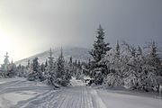
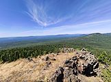
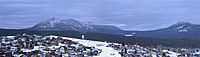
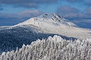
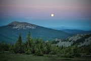
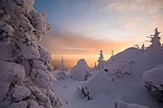
Gallery
-
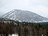
Mount Iremel
-
Mount Iremel
-
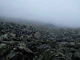
Mount Iremel peak
-
Mount Yamantau
-
View from mount Yamantau second peak (Bolshaya Yamantau)
-
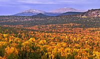
Forest around mount Yamantau
-
View of the two-peak mount Taganay
-
Mount Otkliknoy Greben
-
Taganay national park
-
Sunrise on Taganay


See also
 In Spanish: Montes Urales para niños
- Yugyd Va National Park
- Dyatlov Pass incident
- East Ural Radioactive Trace
- Idel-Ural State
- Pangea
- Research Range
- Ural Mountains in Nazi planning
