
Image: Urartu 715 713-en

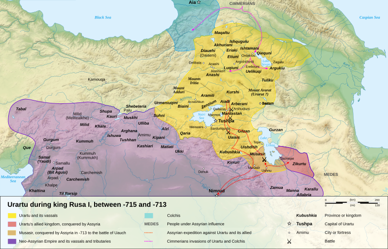
Description: Map of the kingdom of Urartu, between -715 and -713.
Title: Urartu 715 713-en
Credit: Own work. Sources : Topographic background : NASA Shuttle Radar Topography Mission (SRTM3 v.2) (public domain) Urartu map : Image:Urartu715-713.png by Jolle upload on Commons by Hardscarf under license « Public Domain », itself from the "Histoire d'Armenie" by Pierre Brosset. Rivers : Demis Scale : Image:Scale_kilometres_miles_svg.svg by Sémhur, under license « Public Domain »Software used : NASA data edited with 3DEM by Visualization Software LLC, and Global Mapper 9 (limited version), by the United States Geological Survey (USGS) Demis data edited with Demis Mapper Vectorized with Inkscape Cartographic tutorial (in french) by StingOther data : Cartographic projection : UTM Geodetic system : WGS84
Author: Sémhur
Usage Terms: Creative Commons Attribution-Share Alike 4.0
License: CC BY-SA 4.0
License Link: https://creativecommons.org/licenses/by-sa/4.0
Attribution Required?: Yes
Image usage
The following page links to this image:
