
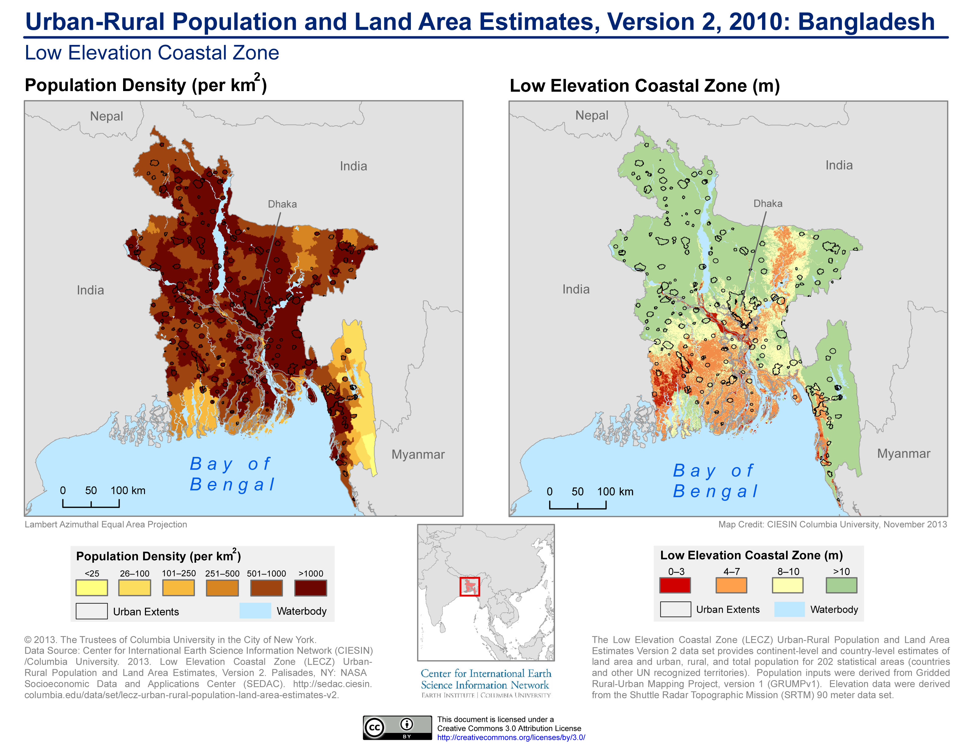
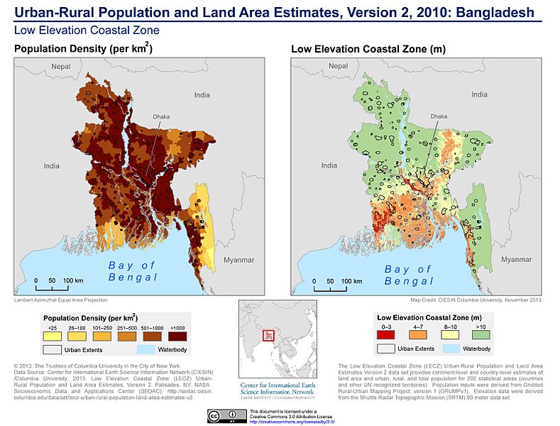
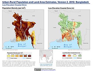
Image: Urban-Rural Population and Land Area Estimates, v2, 2010 Bangladesh (13873798283)
Description: The Low Elevation Coastal Zone (LECZ) Urban-Rural Population and Land Area Estimates Version 2 dataset provides continent-level and country-level estimates of land area and urban, rural, and total population for 202 statistical areas (countries and other UN recognized territories). Population inputs were derived from Gridded Rural-Urban Mapping Project, Version 1 (GRUMPv1). Elevation data were derived from the Shuttle Radar Topographic Mission (SRTM) 90 meter dataset.
Title: Urban-Rural Population and Land Area Estimates, v2, 2010 Bangladesh (13873798283)
Credit: Urban-Rural Population and Land Area Estimates, v2, 2010: Bangladesh
Author: SEDACMaps
Usage Terms: Creative Commons Attribution 2.0
License: CC BY 2.0
License Link: https://creativecommons.org/licenses/by/2.0
Attribution Required?: Yes
Image usage
The following page links to this image:

.jpg)