
Image: Urban-Rural Population and Land Area Estimates, v2, 2010 Greater Boston, U.S. (13873746295)
Size of this preview: 784 × 600 pixels. Other resolutions: 314 × 240 pixels | 3,158 × 2,415 pixels.
Original image (3,158 × 2,415 pixels, file size: 916 KB, MIME type: image/jpeg)
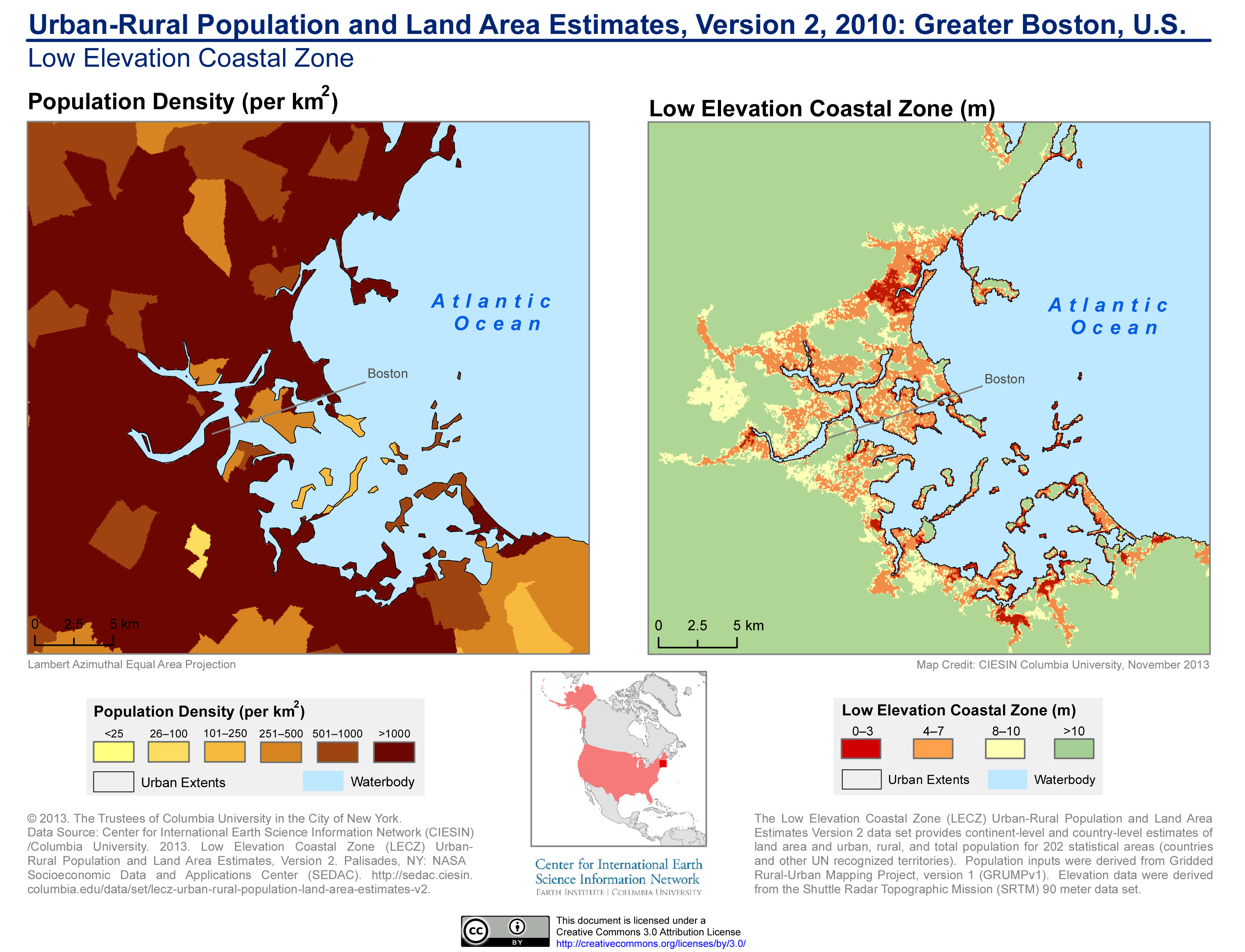
Description: الكثافة السكانية وارتفاع مستوى سطح البحر في بوسطن الكبرى (2010)
Title: Urban-Rural Population and Land Area Estimates, v2, 2010 Greater Boston, U.S. (13873746295)
Credit: Urban-Rural Population and Land Area Estimates, v2, 2010: Greater Boston, U.S.
Author: SEDACMaps
Usage Terms: Creative Commons Attribution 2.0
License: CC BY 2.0
License Link: https://creativecommons.org/licenses/by/2.0
Attribution Required?: Yes
Image usage
The following 3 pages link to this image:

All content from Kiddle encyclopedia articles (including the article images and facts) can be freely used under Attribution-ShareAlike license, unless stated otherwise.
.jpg)