Weymouth, Massachusetts facts for kids
Quick facts for kids
Town of Weymouth
|
||
|---|---|---|
|
City
|
||
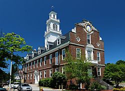
Town Hall, built in 1928 as a replica of Old State House in Boston
|
||
|
||
| Motto(s):
Latin: Laborare Est Vincere
("To Work Is to Conquer") |
||
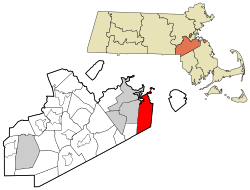
Location of Weymouth in Norfolk County, Massachusetts
|
||
| Country | ||
| State | ||
| County | Norfolk | |
| Settled | 1622 | |
| Incorporated | September 2, 1635 | |
| Government | ||
| • Type | Mayor-council | |
| Area | ||
| • Total | 21.57 sq mi (55.88 km2) | |
| • Land | 16.77 sq mi (43.42 km2) | |
| • Water | 4.81 sq mi (12.45 km2) | |
| Elevation | 200 ft (27 m) | |
| Population
(2020)
|
||
| • Total | 57,437 | |
| • Density | 3,426.01/sq mi (1,322.79/km2) | |
| Time zone | UTC−5 (Eastern) | |
| • Summer (DST) | UTC−4 (Eastern) | |
| ZIP Codes |
02188–02191
|
|
| Area code(s) | 339/781 | |
| FIPS code | 25-78865 | |
| GNIS feature ID | 0619462 | |
Weymouth is a city located in Norfolk County, Massachusetts, United States. It is one of the oldest settlements in Massachusetts, founded in 1622. Only Plymouth is older.
Weymouth is named after Weymouth, Dorset, a town on the coast of England. It is known for being an affordable place to live on the South Shore. It offers an easy trip into Boston and has public transportation like MBTA bus and train services. The city also has its own town beach.
In 2020, Weymouth had a total population of 57,437 people.
Contents
People and Population in Weymouth
| Historical population | ||
|---|---|---|
| Year | Pop. | ±% |
| 1840 | 3,738 | — |
| 1850 | 5,369 | +43.6% |
| 1860 | 7,742 | +44.2% |
| 1870 | 9,010 | +16.4% |
| 1880 | 10,570 | +17.3% |
| 1890 | 10,866 | +2.8% |
| 1900 | 11,324 | +4.2% |
| 1910 | 12,895 | +13.9% |
| 1920 | 15,057 | +16.8% |
| 1930 | 20,882 | +38.7% |
| 1940 | 23,868 | +14.3% |
| 1950 | 32,690 | +37.0% |
| 1960 | 48,177 | +47.4% |
| 1970 | 54,610 | +13.4% |
| 1980 | 55,601 | +1.8% |
| 1990 | 54,063 | −2.8% |
| 2000 | 53,988 | −0.1% |
| 2010 | 53,743 | −0.5% |
| 2020 | 57,437 | +6.9% |
| 2023* | 59,114 | +2.9% |
| * = population estimate. Source: United States Census records and Population Estimates Program data. Source: U.S. Decennial Census |
||
According to the 2010 census, Weymouth had 53,743 residents living in 22,435 households. About 64% of homes were owned by the people living in them, while 35% were rented.
Most of the people in Weymouth (82.7%) were White. Other groups included Black (5.2%), Asian (5.7%), and people of Hispanic or Latino background (3.1%).
About 27.3% of households had children under 18 living with them. The average household had 2.42 people, and the average family had 3.08 people.
The population's age was spread out. About 22% were under 18, and 15.4% were 65 or older. The average age was 38 years.
The average income for a household in Weymouth was $68,665. For families, the average income was $52,083. About 9.8% of the population lived below the poverty line.
Weymouth has a large Irish population, making up about 33% of its residents. Many people of Irish descent moved to Weymouth from Boston in the 1960s and 70s. This has given Weymouth a similar working-class culture to parts of Boston.
Geography and Environment

Weymouth is located at 42°12′23″N 70°56′45″W / 42.20639°N 70.94583°W. The city covers an area of 21.6 square miles (55.9 km2). About 17 square miles (44 km2) of this is land, and 4.6 square miles (11.9 km2) is water.
Weymouth has two important rivers: the Weymouth Back River and the Weymouth Fore River. Areas around these rivers, which used to be industrial, are now parks and natural spaces. One example is Webb Memorial State Park.
Weymouth's Districts
Weymouth is often divided into four main areas:
- North Weymouth: This area is north of Church Street, North Street, and Green Street. It includes places like Great Esker Park, George Lane Beach, and Webb State Park. You can also see views of the Boston skyline from here. Historically, it was a working-class area, but now many waterfront homes are being updated. It is the most crowded part of town.
- South Weymouth: This area is mostly south of Route 3. It is home to a former Naval Air base that is being turned into new homes and businesses. South Shore Hospital and Weymouth High School are also in South Weymouth. It has its own town center called Columbian Square.
- East Weymouth: This area is in the middle of Weymouth. It includes Whitman's Pond, Jackson Square, and Town Hall. East Weymouth has many beautiful old Victorian homes. Many long-time residents who work hard live here.
- Weymouth Landing: This area is about a mile around Weston Park. It is being redeveloped after some years of decline. Weymouth Landing is the border between Weymouth and Braintree. It is also where the Fore River splits into smaller streams.
Weymouth is bordered by Hingham Bay and Boston Harbor to the north. It includes Grape Island, Slate Island, and Sheep Island. These islands are part of the Boston Harbor Islands National Recreation Area. To the west, Weymouth borders Quincy, Braintree, and Holbrook. To the south, it borders Abington and Rockland. To the east, it borders Hingham.
Climate in Weymouth
Weymouth has a climate with hot, humid summers and mild to cool winters. This type of climate is called a humid subtropical climate.
| Climate data for Weymouth, Massachusetts | |||||||||||||
|---|---|---|---|---|---|---|---|---|---|---|---|---|---|
| Month | Jan | Feb | Mar | Apr | May | Jun | Jul | Aug | Sep | Oct | Nov | Dec | Year |
| Mean daily maximum °F (°C) | 39 (4) |
42 (6) |
49 (9) |
59 (15) |
70 (21) |
79 (26) |
85 (29) |
83 (28) |
75 (24) |
65 (18) |
54 (12) |
43 (6) |
61.9 (16.6) |
| Daily mean °F (°C) | 30 (−1) |
32 (0) |
40 (4) |
49 (9) |
59 (15) |
69 (21) |
74 (23) |
73 (23) |
65 (18) |
54 (12) |
45 (7) |
35 (2) |
52.1 (11.2) |
| Mean daily minimum °F (°C) | 21 (−6) |
23 (−5) |
30 (−1) |
39 (4) |
48 (9) |
58 (14) |
64 (18) |
63 (17) |
55 (13) |
44 (7) |
36 (2) |
26 (−3) |
42.2 (5.7) |
| Average precipitation inches (cm) | 4 (10) |
4 (10) |
4 (10) |
3.9 (9.9) |
3.2 (8.1) |
2.8 (7.1) |
2.8 (7.1) |
3.8 (9.7) |
3.3 (8.4) |
3.8 (9.7) |
4.5 (11) |
4.2 (11) |
44.3 (113) |
| Source: Weatherbase | |||||||||||||
Wildlife in Weymouth
Weymouth is home to many different kinds of animals. These animals have learned to live in the town's suburban areas and parks.
You can often find small mammals like Red and Gray foxes, Striped Skunks, Raccoons, and Eastern Gray Squirrels. Larger mammals, such as Coyotes and White-tailed Deer, live in more forested areas like Great Esker Park. Sometimes, they even wander into neighborhoods.
Many types of birds also live in Weymouth. Common backyard birds include Wild Turkeys, American Robins, Blue Jays, and Northern Cardinals. Other birds like Red-tailed Hawks, Ospreys, and Great Blue Herons can be found in different habitats. There are also many waterfowl, seagulls, and shorebirds.
The Herring Run flows through Weymouth, connecting the Back River to Whitman's Pond. Every spring, hundreds of thousands of Alewife Herring swim up this brook to lay their eggs. This Herring Run was very important for the early colonists and the Native Massachusett people.
Transportation
Weymouth has several MBTA bus routes. It also has three MBTA Commuter Rail train stations. Two stations are on the Greenbush Line: Weymouth Landing and East Weymouth. One station is on the Kingston Line at South Weymouth. Major roads that go through Weymouth include Massachusetts Routes 3, 3A, 18, 53, 58, and 139.
Education
Weymouth High School is the only public high school in Weymouth. It houses students from ninth to twelfth grade. More than 2,000 students attend the high school. In 2005, a new athletic field with artificial turf and a track was built.
Weymouth has two middle schools, named after important local women: abolitionist Maria Weston Chapman and First Lady Abigail Adams.
The Maria Weston Chapman Middle School, also known as "The New Chapman," opened in September 2022. The old Abigail Adams Middle School is currently being renovated, and its future use is still being decided.
There are eight primary schools and one early childhood center. Five of these schools are named after Weymouth residents who received the Congressional Medal of Honor.
- Academy Avenue Primary School
- Frederick C. Murphy Primary School
- Thomas V. Nash Jr. Primary School
- Lawrence W. Pingree Primary School
- William Seach Primary School
- Ralph Talbot Primary School
- Thomas W. Hamilton School
- Wessagusset Primary School
- Elden H. Johnson Early Childhood Center
In June 2021, Weymouth High School joined a state program to help schools improve their student support and discipline practices. The New Maria Weston Chapman Middle School has also been working with officials to address student behavior and create a positive learning environment.
Weymouth is also connected to one Public Charter School:
- South Shore Charter Public School (located in Norwell Massachusetts)
In addition, Weymouth has four private schools:
- South Shore Christian Academy: A Christian school for students in grades K–12, also offering a pre-school program.
- Sacred Heart Elementary School: A Catholic elementary school for grades Pre-K–4, connected to St. Francis Xavier.
- First Baptist Christian: An elementary school for grades Pre-K–8, run by the First Baptist Church of Weymouth.
- St. Francis Xavier: A Catholic elementary school for grades 5–8, connected to Sacred Heart Elementary School.
History of Weymouth
The First Colony: Wessagusset
Weymouth was first settled in 1622. It was called Wessagusset Colony. This colony was started by Thomas Weston, who had helped pay for Plymouth Colony. The settlement was likely named after English explorer George Weymouth.
The Wessagusset Colony did not succeed. The 60 men who came from London were not ready for the hard life needed to survive. They were focused only on making money and did not bring their families.
By winter, they ran out of supplies. The people from Plymouth Colony had little to share. The situation became very difficult. The Wessagusset men started selling their clothes and even stealing from the local Massachusett Native Americans. The Native Americans began to tease them and steal their food. Many colonists became sick or starved, and there was no law and order.
In April 1623, there were rumors of conflict between Native Americans and colonists in Virginia. This made things tense between the Wessagusset colonists and the local tribes. The Massachusett and other tribes planned to attack the struggling Wessagusset Colony and the more successful Plymouth Colony.
Wampanoag Chief Massasoit heard about this plan. He became very sick but was nursed back to health by a group from Plymouth Colony. He then warned them of the attack. Governor William Bradford of Plymouth decided to act first. He sent Myles Standish to Weymouth with the Plymouth militia and their guide, Hobbamock.
Standish tricked five of the more aggressive Massachusett leaders into the fort by promising them a meal. Once inside, a fight broke out, and the Native American leaders were killed.
Ten of the original 60 colonists died from starvation. Two others were killed in fights with Native Americans. Forty-five colonists either joined Plymouth or went north to Maine, with most eventually returning to England. Three men who had left the colony to live with the Native Americans were killed by them later.
Later that year, Robert Gorges tried to start another colony in the same spot. He wanted a more royalist and Anglican government for New England. But the New England winter made Gorges leave with most of his settlers. The few who stayed formed the beginning of the permanent settlement.
In 1630, the area officially became part of the Massachusetts Bay Colony. Its name was changed to Weymouth in 1635. About 100 new families, led by Joseph Hull, joined the town. These new groups had some trouble getting along. They also faced pressure from the Puritans in Boston and the Pilgrims in Plymouth. However, by 1635, Weymouth was a stable and important town with its current borders. It became part of Suffolk County in 1643. The oldest house still standing in Weymouth is the Bickman House, built around 1650, at 84 Sea Street.
After the First Settlements
Weymouth was very involved in making shoes. This industry lasted from the early 1700s until 1973, when the Stetson Shoe Company closed. That building is now used for medical offices.
The original town hall burned down in 1914. A new town hall was built in 1928. It looks like a smaller version of the old Massachusetts State House in Boston.
Points of Interest in Weymouth
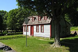
- The house where Abigail Adams was born is in Weymouth. She was the wife of President John Adams and the mother of President John Quincy Adams.
- Part of the former South Weymouth Naval Air Station is in Weymouth. This base closed in 1996. The land is now being developed into a new area called Union Point. Plans include a parkway, homes, a sports facility, and a movie studio. Several movies, like Don't Look Up and Free Guy, have filmed scenes there.
- Union Point Sports Complex is a 25-acre (10 ha) sports complex.
Parks and Green Spaces
Weymouth has 700 acres (283 ha) of parks and conservation land. This includes 46 playgrounds, nature preserves, and recreation areas.
Notable People from Weymouth
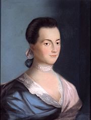
- Abigail Adams: Wife of President John Adams.
- Tobin Bell: Actor, known for playing Jigsaw in the Saw movies.
- Jim Carey: NHL hockey goalie who won the Vezina Trophy in 1996.
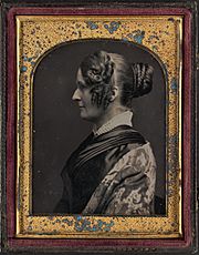
- Maria Weston Chapman: An important leader in the movement to end slavery.
- Rob and Nate Corddry: Comedians and actors, known for The Daily Show.
- Charlie Coyle: Professional hockey player for the Boston Bruins.
- Hal Holbrook: An actor nominated for an Academy Award.
- Elden H. Johnson: US Army soldier who received the Medal of Honor in World War II.
- Kristie Mewis: Soccer player for NJ/NY Gotham FC and the U.S. national team.
- Ralph Talbot: The first US Marine Corps aviator to receive the Medal of Honor.
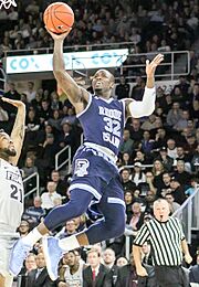
- Jared Terrell: Basketball player in the Israeli Basketball Premier League.
- Booker T. Washington: A famous African-American educator and leader. He owned a vacation home in Weymouth.
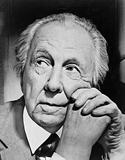
- Frank Lloyd Wright: A famous architect. He lived in Weymouth briefly as a child.
See also
 In Spanish: Weymouth (Massachusetts) para niños
 | Selma Burke |
 | Pauline Powell Burns |
 | Frederick J. Brown |
 | Robert Blackburn |


