
Image: Urban sprawl per country
Size of this preview: 523 × 599 pixels. Other resolutions: 209 × 240 pixels | 4,211 × 4,824 pixels.
Original image (4,211 × 4,824 pixels, file size: 2.75 MB, MIME type: image/png)
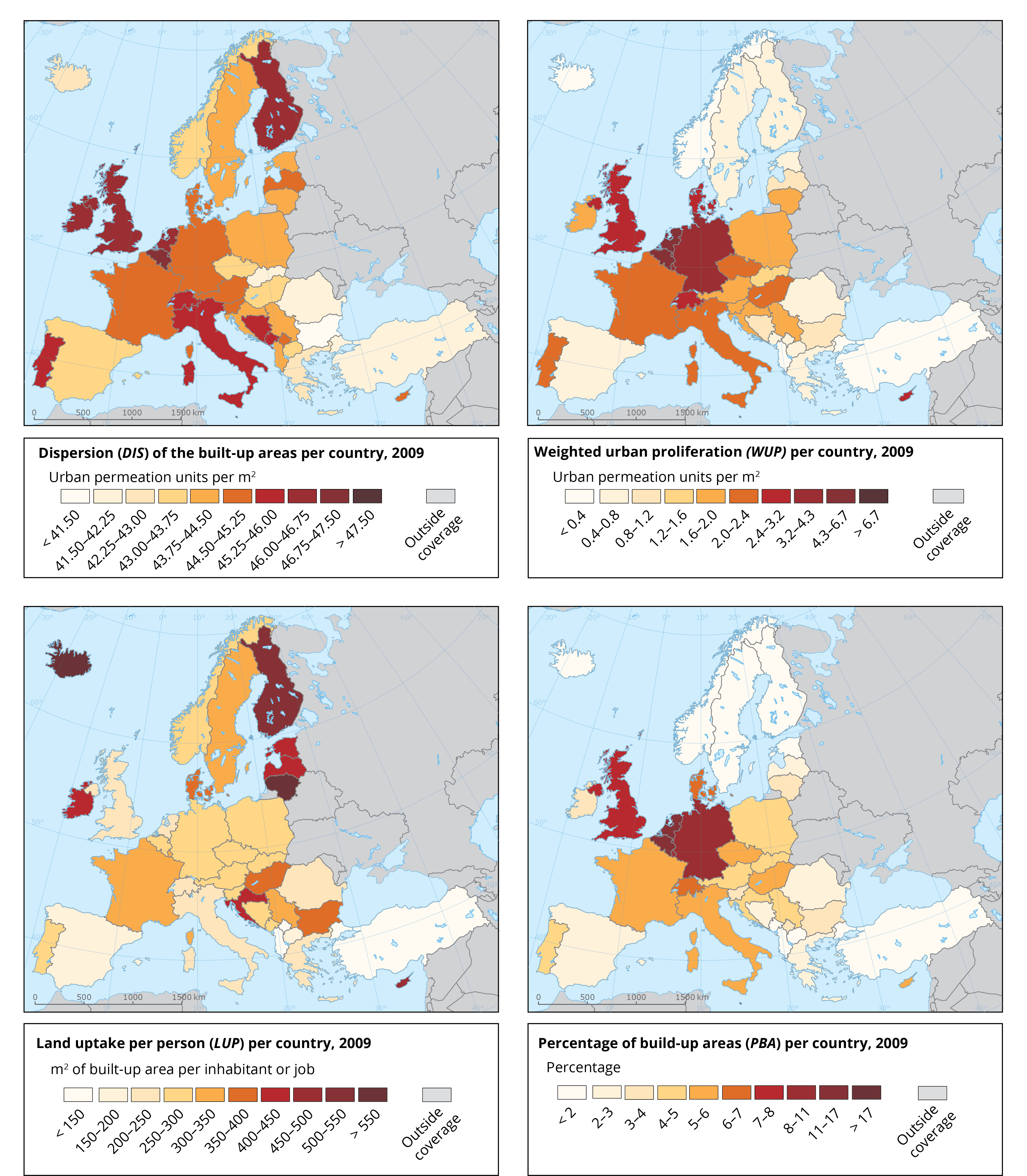
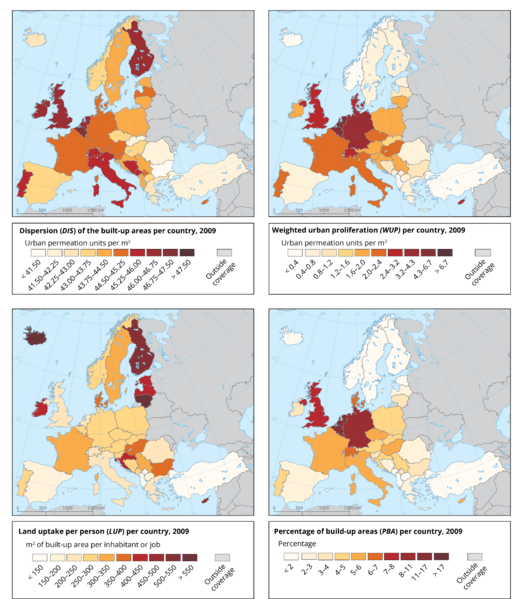
Description: The maps shows urban sprawl per country for the four metrics WUP (Weighted Urban Proliferation), Urban Permeation (UP), Dispersion (DIS), and Land Uptake per Person (LUP) at the country level for Europe in the year 2009.
Title: Urban sprawl per country
Credit: https://www.eea.europa.eu/data-and-maps/figures/maps-of-urban-sprawl-per#tab-metadata
Author: European Environment Agency (EEA)
License: Attribution
Image usage
The following page links to this image:

All content from Kiddle encyclopedia articles (including the article images and facts) can be freely used under Attribution-ShareAlike license, unless stated otherwise.