
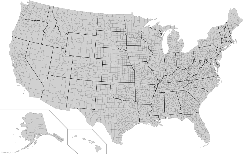
Image: Usa counties large

Description: This is a map of the United States showing the borders of states and counties in high detail. Every county's object in this SVG has its FIPS code (preceded by a "c") in the object id field , with the county name and 2-letter postal state abbreviation in the title tag. In cases where there is a county in a state that also has a county-equivalent city of the same name, the word "Co." is appended to the county name. In all other cases, "County", "Parish", "Borough", or other county equivalent is omitted from the name. FIPS county codes can be found at this page.
Title: Usa counties large
Credit: File:USA Counties.svg
Author: File:USA Counties.svg: U.S. Census Bureau derivative work Abe.suleiman
Usage Terms: Public domain
License: Public domain
Attribution Required?: No
Image usage
The following page links to this image:
