
Image: Utah Valley dasymetric map
Size of this preview: 800 × 396 pixels. Other resolutions: 320 × 159 pixels | 3,167 × 1,569 pixels.
Original image (3,167 × 1,569 pixels, file size: 1.46 MB, MIME type: image/png)
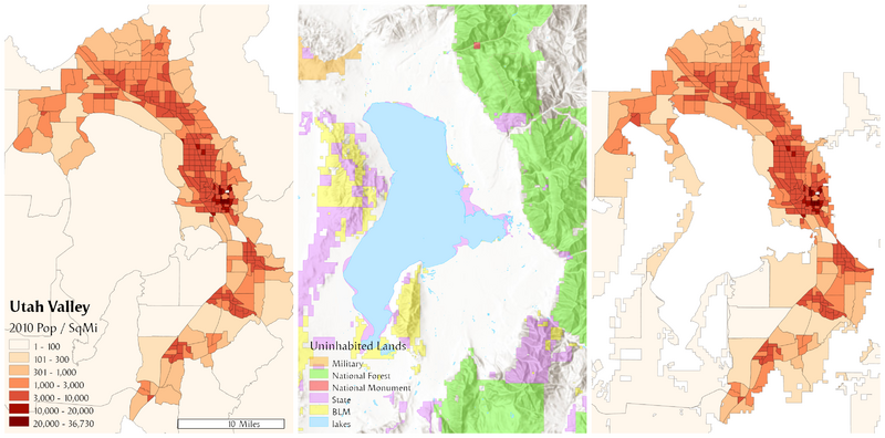
Description: This illustrates the steps in using the binary method to create a dasymetric map of population density in Utah County. The panel on the left is the original census block groups. The middle panel are areas known to be uninhabited (water and public lands). The third panel is the result of removing the uninhabited areas from the block groups and recalculating density over the remaining areas.
Author: Bplewe
Usage Terms: Creative Commons Attribution-Share Alike 3.0
License: CC-BY-SA-3.0
License Link: http://creativecommons.org/licenses/by-sa/3.0/
Attribution Required?: Yes
Image usage
The following page links to this image:

All content from Kiddle encyclopedia articles (including the article images and facts) can be freely used under Attribution-ShareAlike license, unless stated otherwise.