
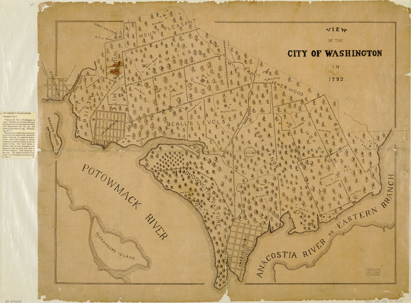
Image: View of the city of Washington in 1792
Description: - Cadastral map showing named land tracts with owners' names. - Selected buildings and trees shown pictorially. - Planimetric map--not bird's-eye view. - Also shows townsites of Georgetown, Hamburgh, and Carrollsburg. - Available also through the Library of Congress Web site as a raster image. - LC copy accompanied by D.C. Sesquicentennial exhibition caption, Apr. 1950-Apr. 1951: 9. Pre-District plantations. - LC copy darkened, fold-lined, lacking small sections along edges, and mounted on cloth backing. - Phillips. Washington 1285 - Vault - DCP
Title: View of the city of Washington in 1792
Credit: Library of Congress Geography and Map Division, Washington, DC: https://www.loc.gov/item/87694269/
Author: Unknown authorUnknown author
Usage Terms: Public domain
License: Public domain
Attribution Required?: No
Image usage
The following 3 pages link to this image:
