
Image: Views of Brighton and Hove - Lewes Road, Hollingdean and Prestonville from Tenantry Down Road (August 2013)

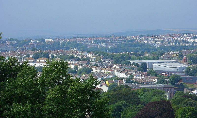
Description: Views of Brighton and Hove #14. This view looks slightly north of westwards from Tenantry Down Road (which connects Elm Grove and Bear Road), high above the east side of Brighton. Features (click to enlarge): Across the background runs the Prestonville suburb. Just right of centre is the tower of the Church of the Good Shepherd on Dyke Road, which serves the north part of Prestonville. The houses in the left foreground are those of the Round Hill suburb. The large futuristic-looking structure is the Veolia refuse disposal facility on Hollingdean Lane. To its right, the small conical-domed red building is the chapel of the old Jewish Cemetery. The blue building is on the Hughes Industrial Estate, and the wide brick building with the clock is the Lewes Road Sainsbury's. Both were built on the site of the viaduct which tool the Kemp Town branch line across the Lewes Road valley. Camera location 50° 50′ 07.48″ N, 0° 06′ 35.28″ W View this and other nearby images on: OpenStreetMap - Google Earth 50.835412; -0.109801
Title: Views of Brighton and Hove - Lewes Road, Hollingdean and Prestonville from Tenantry Down Road (August 2013)
Credit: Own work
Author: Hassocks5489
Usage Terms: Creative Commons Zero, Public Domain Dedication
License: CC0
License Link: http://creativecommons.org/publicdomain/zero/1.0/deed.en
Attribution Required?: No
Image usage
The following page links to this image:

.JPG)