
Image: Virginia District 1 pre-1928

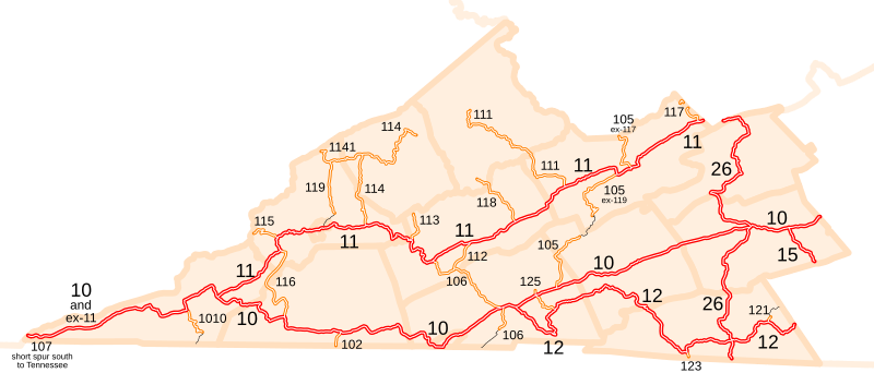
Description: This is a map of the state routes in Virginia's District 1 just before the 1928 renumbering. I made this from scratch, by tracing the roads on USGS topographic maps. The county and state boundaries are from 2001 U.S. government data. Black lines are routes that were added in 1928 or soon after and formed natural extensions of the pre-1928 routes.
Title: Virginia District 1 pre-1928
Credit: No machine-readable source provided. Own work assumed (based on copyright claims).
Author: No machine-readable author provided. NE2 assumed (based on copyright claims).
Usage Terms: Creative Commons Attribution 2.5
License: CC BY 2.5
License Link: http://creativecommons.org/licenses/by/2.5
Attribution Required?: Yes
Image usage
The following page links to this image:
