
Image: Volcanoes of Western Isabela
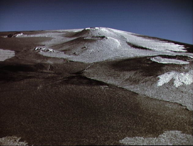
Description: This is a three dimensional perspective view of Isla Isabela in the western Galapagos Islands. It was taken by the L-band radar in HH polarization from the Spaceborne Imaging Radar-C/X-Band Synthetic Aperature Radar on the 40th orbit of the Shuttle Endeavour. This view was constructed by overlaying a SIR-C radar image on a U.S. Geological Survey digital elevation map. The image is centered at about .5 degrees south latitude and 91 degrees West longitude and covers an area of 75 km by 60 km. This SIR-C/X-SAR image of Alcedo and Sierra Negra volcanoes shows the rougher lava flows as bright features, while ash deposits and smooth Pahoehoe lava flows dark. The Jet Propulsion Laboratory alternative photo number is P-43938.
Title: Volcanoes of Western Isabela
Credit: www.nasaimages.org
Author: NASA (Space Shuttle Endeavour)
Usage Terms: Public domain
License: Public domain
Attribution Required?: No
Image usage
The following page links to this image:
