
Image: Waghenaer1583

Size of this preview: 800 × 506 pixels. Other resolutions: 320 × 202 pixels | 946 × 598 pixels.
Original image (946 × 598 pixels, file size: 201 KB, MIME type: image/jpeg)
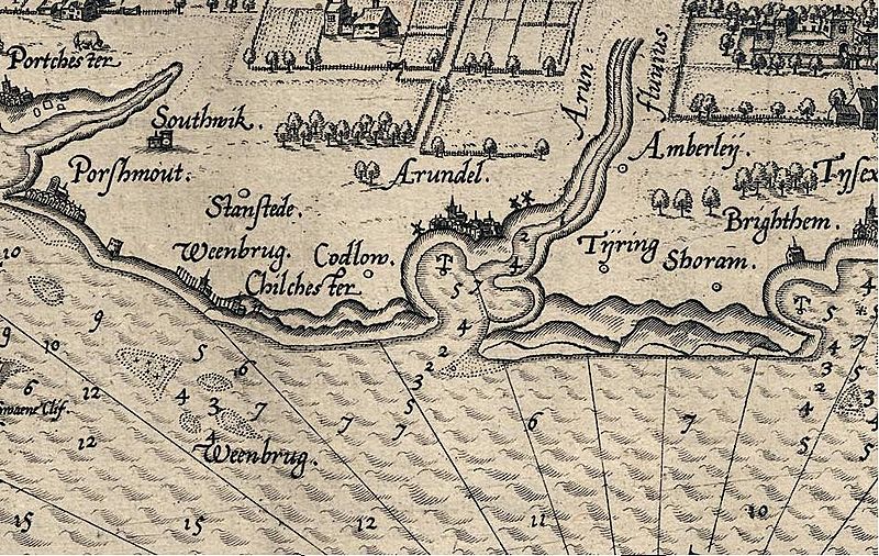
Description: Section of Map of the Sea Coast of England between Wight and Dover, scale roughly 7.5 miles to 1 inch, engraved by , Johannes van Doetecum 1583, showing part of the Sussex coast surrounding the Manhood Peninsula.
Title: Waghenaer1583
Credit: Scan of Print in Public Domain
Author: Waghenaer, Scanned by Michael Jones
Permission: see below
Usage Terms: Public domain
License: Public domain
License Link: //en.wikipedia.org/wiki/File:Waghenaer1583.JPG
Image usage
The following 2 pages link to this image:

All content from Kiddle encyclopedia articles (including the article images and facts) can be freely used under Attribution-ShareAlike license, unless stated otherwise.